Why Take this Hike
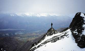
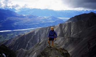
Beginning almost 120 miles northeast of Anchorage on the Glenn Highway, the trail to the summit of Gunsight Mountain takes a while to reach. After all, it involves a 3.5-mile, 3,300-foot climb through some very big country. But the view from the top makes for an all-day excursion that you won’t easily forget.
The Details
The landscape you drive through on the Glenn Highway north of Palmer will give you some idea of the climb ahead. As you follow the Matanuska River back toward its source, your drive will wind between the Talkeetna Mountains on the left and the Chugach Mountains on the right—many of which tower 6,000 to 10,000 feet high. When you reach the Alascom tower, in the center of broad Tahneta Pass (the headwaters of Matanuska River), you will already have seen plenty of mountains. Turn left into the parking area and get ready to climb one.
The trail starts at the back of the parking lot and crosses a confusion of ATV trails. Turn left at the first trail junction and right at the second. As you begin contouring across the front of the mountain, you should have passed the most confusing section of the climb. Just keep in mind that you want to reach the highly visible big broad ridge that drops off the summit above you to the left. If you keep that goal in sight and mind, you should find your way.
Once above this confusion of trails, continue bearing left until you reach a large, level patch of tundra below the lower end of this ridge. Then turn left and follow this broad, open meadow above tree line. At its uppermost end, the meadow narrows to a broad ridge for the final 1.25-mile, 1,400-foot climb to the summit ridge. Most of this section continues along the left rim of the great cirque that forms a huge hollow bowl in the mountain’s eastern face. Looking up the cirque, you can now plainly see the “gun sight”—the deep notch that gives the mountain its name—outlined by the sky at the cirque’s uppermost end.
Just after climbing past that end, you come to an intersection with the summit ridge. Turn left onto the narrow and dramatic ridge top; in less than 100 feet you’ll have arrived at the south summit (6,641 feet).
For a real novelty, consider backtracking the 100 feet to where you first climbed onto the summit ridge, turn left, and follow the sheep trail down the backside of the mountain and over to the “gun sight.”
Standing on that flat notch with 200-foot ledges towering above either side, you can look east out over Tahneta Pass and to the great summits of the Saint Elias Range appearing and disappearing through the clouds on the very distant horizon.
(For more, see Walk-About Guide to Alaska, Volume Four by Shawn R. Lyons)


