Why Take This Hike
Just 90 minutes north of Anchorage, this 2-mile trail climbs some 2,000 feet to the summit of Marmot Mountain. From the summit you can enjoy a great view of the entire upper Fishhook Creek Valley, including the remains of Independence Mine that sprawl across its upper end.
The Details
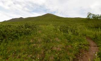
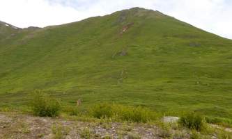
After getting out of the car at the marked "Fishhook Trailhead," you begin this hike through an embankment at the back of the parking area. Climbing gently at first, the trail soon slopes with more determination before turning directly up the spine of the ridge. This section of the trail will require some effort. Possibly as a result, most people climb only as far as the small porch of tundra halfway up the ridge—a vantage point from which they can look south down the Little Susitna River to the broad Palmer-Wasilla flats.
But keep going; even better views await. Continue up the ridge to the rock outcrop plainly visible 1,000 feet higher. Here you’ll find the climbing much easier, as the trail winds up the ridge for another 0.5 miles to the weather tripod that marks the summit of Marmot Mountain (4,600-plus feet).
Look off the far side of the summit and you’ll realize why finishing the hike is the right decision. The entire Independence Mine Valley extends out below you, while spired mountains rise around it in a great circle. Look up over Hatcher Pass to the west; shift to the north and northeast to see snow-covered peaks rising in the heart of the Talkeetna Mountains.
You don’t have to go back the way you came. If you’re feeling adventurous, continue down the ridge and eventually you’ll come to a zigzagging mining trail. This takes you down off the ridge and into the Fishhook Creek Valley, on the far side of which lies Independence Mine.
On this short ridge walk you’ll have a unique opportunity—to look out at the endless waves of peaks that extend north and east into the deep and wild Talkeetna Mountains.
(For more, see Walk-About Guide to Alaska, Volume Three by Shawn R. Lyons)


