Western Alaska Float Trips
Its Boundaries
This refers to the rivers flowing west towards the Bering Sea, into Kotzebue and Norton Sound. Beginning south of the Brooks Range, this region also includes the Noatak and Kobuk watersheds, the Seward Peninsula, and a region of the Yukon Delta, spanning from west of the Nulato Hills to approximately Nunivak Island.
What It’s Like
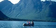
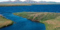
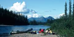
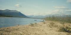
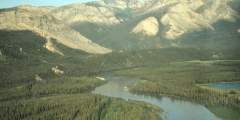
Many of the Western Alaska rivers begin in the majestic Gates of the Arctic National Park, where granitic peaks reach to the sky and the countryside offers vast moments of solitude. These rivers tend to be heavily forested, providing habitat for moose, caribou and bear.
Some of the rivers are sport-fishing destinations, too—namely, for the famed Sheefish, which run up the rivers to spawn each year. Some other interesting facts about the area:
- Many of the rivers flowing into Kotzebue Sound are arctic-like, with permafrost features and vast wilderness areas, but they flow west instead of north.
- The Noatak is known as the largest wilderness biosphere in the country.
- The rivers of the Kobuk drainage have long attracted river villages, and still offer great opportunities to meet local subsistence people.
Show Map
Float Trips
Western Alaska Float Trips
The Wild River is a 63-mile, Class I family-friendly float trip through remote wilderness. It flows from a forested lake to the Koyukuk River, passing Bettles. Easily floated in 6 days, it starts as a swift, crystal-clear stream before slowing near the Koyukuk. With only a few lineable Class II riffles, it offers a scenic and accessible adventure far from civilization.
The Squirrel River is a clear Arctic river flowing from the Baird Mountains to the Kobuk River at Kiana. It’s an easy float, ideal for families and beginners with good fishing and hiking. After August, only folding canoes and kayaks can navigate the upper stretch, while the lower 56 miles suit rafts. A historic route between the Kobuk and Noatak watersheds, it offers 80 or 56-mile Class I trips lasting 5 – 7 days.
The Salmon River, a National Wild and Scenic River in Kobuk River National Park, flows 100 miles from the Baird Mountains to Kiana. A Class I waterway, it passes through tundra, forests, and rolling hills. While its upper reaches may be too shallow, it’s ideal for campers and fishermen seeking remote wilderness. The trip, taking 6 – 10 days, offers stunning scenery and opportunities to meet local native families.
The Nowitna River (Novi) is a remote, tea-colored Class I‑II river in Alaska, flowing 300+ miles through the Nowitna National Wildlife Refuge. Originating in the Susulatna Hills and Sunshine Mountains, it meanders through wooded terrain to the Yukon River near Ruby. A stretch of whitewater exists in Nowitna Canyon. The lower river is slow and winding. A 245-mile float takes 10 – 14 days.
Overview Within the Brooks Range lies the Endicott Mountains and in the heart of these mountains is the Gates of The Arctic National Park and Preserve. Where the mountains rise to meet the sky the beginnings of the North Fork of the Koyukuk River lie. This is a river that begins in these mountains and eventually flows into the giant Yukon-Kusko delta region. But at its start are the 7000-foot high mountains of the Gates, with Mt Doonerak the… ...more
The Nigu and Etivluk Rivers, in Gates of the Arctic National Park, flow north from the Brooks Range through tundra to the Colville River. Shallow waters favor kayaks and folding canoes, though small rafts can navigate with effort. The Class I‑II rivers offer scenic views, fishing, and archaeological sites. Trips span 6 – 10 days, covering up to 100 miles with boulder gardens and riffles along the way.
The upper Kobuk River flows through a scenic, forested valley from Walker Lake, featuring Class I – IV rapids. It transitions from wilderness to a travel corridor with fish camps and rich archaeological sites like Onion Portage. The journey to Kobuk village is 115 miles (5 – 8 days), while reaching Noorvik takes 16 – 20 days (285 miles). This route is ideal for kayaks and rafts.
The Killik River flows 135 miles through Gates of the Arctic National Park, offering a 7 – 10 day rafting trip with Class I – III rapids. It begins in the Endicott Mountains, winding through tundra and permafrost country before joining the Colville River. The route passes archaeological sites and evidence of early Native American habitation. Rafters can start at Easter Creek or upriver near April Creek.
The John River flows south from the Arctic through Anaktuvuk Pass into the Endicott Mountains, linking Inuit and Athabaskan cultures. It offers clear waters, great fishing, hiking, and abundant wildlife. The headwaters require dragging boats before a swift Class III run, while the middle and lower sections are easier. The 100-mile stretch is the most popular, taking about 7 days to complete.
The Aniuk River flows 80 miles from Howard Pass to the Noatak River, offering a remote, scenic route with rocky rapids and rich wildlife. It traverses alpine tundra, marshy valleys, and upland habitats in the Noatak National Preserve. The river is above the tree line and follows a historic migratory path. A trip takes 4 – 6 days, with Cutler River as the first exit. Inflatable kayaks and canoes are ideal.
The Ambler River is an 80-mile clear water route from the Schwatka Mountains to the Kobuk River, featuring rocky rapids, braided channels, and a challenging 3‑mile canyon. Its diverse habitat supports Sheefish, making it great for fishing. The journey, ideal for kayaks and canoes, takes 6 – 8 days, allowing for a mix of adventure and relaxation through forested and open landscapes.
The Alatna River, a wild and scenic river in Alaska, flows 184 miles from the Brooks Range to Allakaket. It passes Circle Lake, the Arrigetch Peaks, and Helpmejack Hills, offering stunning views. The upper section is rocky with Class II+ rapids, while the lower section mellows into meandering boreal forest. A popular float trip destination, it takes 4 – 14 days, best navigated by inflatable kayak or small raft.

