The Best Birding Locations in Alaska
Alaska is one of the world’s great birding destinations. Perched at the top of the Pacific Rim, the state forms a peninsula that reaches from North America toward Asia, at times drawing birds from both hemispheres. Its northern and western zones overlap arctic habitat used by tens of millions of migratory birds during summer nesting. Its coastal wetlands concentrate immense flocks of ducks, geese and shorebirds. At the same time, the state has healthy populations of interesting year-round residents such as bald eagles and ravens, as well as charismatic seabirds like puffins and murres. Regardless of season or locale, Alaska has the potential to delight anybody attuned to avian life.
Jump to: MAP | Potter Marsh | Resurrection Bay | Tern Lake | Kenai Peninsula | Rookery Falls | Denali National Park | Nome | Unalaska | Guaranteed Viewing at Treatment Centers | Birding Festivals | Birding Seasons | Birding Tips
Get Started
Find an Alaska wetland, seashore or water body during spring and summer, and chances are you’ll immediately find interesting and even exotic birds to admire. You can find birds to watch just about everywhere in the state in every season.
Alaska’s Top Ten Bird Hotspots
This online guide was compiled by state biologists. The list describes the specific places that draw avid birding enthusiasts to Alaska from across the world. They span from the remote Aleutian Islands to Southeast Alaska, from the north slope of the Alaska Range to the vast Copper River Delta.
Alaska.org Recommended Spots
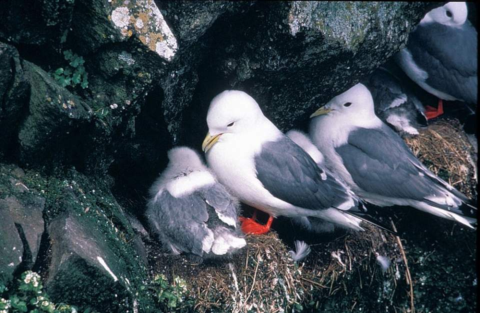
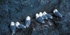
Nesting Kittiwakes
Potter Marsh
20 minutes south of downtown Anchorage
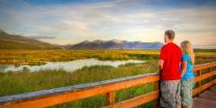
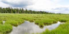
Part of the Anchorage Coastal Wildlife Refuge, Potter Marsh and its extensive boardwalks are famous for providing intimate views of waterfowl and nesting birds, including trumpeter swans, Arctic terns and 130 other species. Located in a dramatic setting where the Seward Highway enters Turnagain Arm at the south end of the Anchorage urban area, this 564-acre wetland may be the most accessible wildlife viewing destination in the state. Anchorage has many other excellent birding venues, too, including Westchester Lagoon and the Campbell Creek Estuary, both easy drives from the Ted Stevens Anchorage International Airport. Checking into the city’s bird action can anchor a quick adventure for the last or first day of your Alaska trip.
Resurrection Bay, Seward
2.5 hours by car or 4 hours by train south of Anchorage
Extending south from Seward, the rugged cliff faces and nutrient-rich waters of this big fiord create a bona-fide seabird paradise, with most of Alaska’s iconic marine birds putting on a daily show. Take one of the many marine tours from the Seward harbor, and you will see puffins, kittiwakes, murres, bald eagles and a myriad of crying gulls. The plankton bloom of May-June may be the most exciting time to visit, but birds remain in large numbers throughout the summer. Much of the area lies within Kenai Fjords National Park and is also known for remarkable viewing of marine mammals.
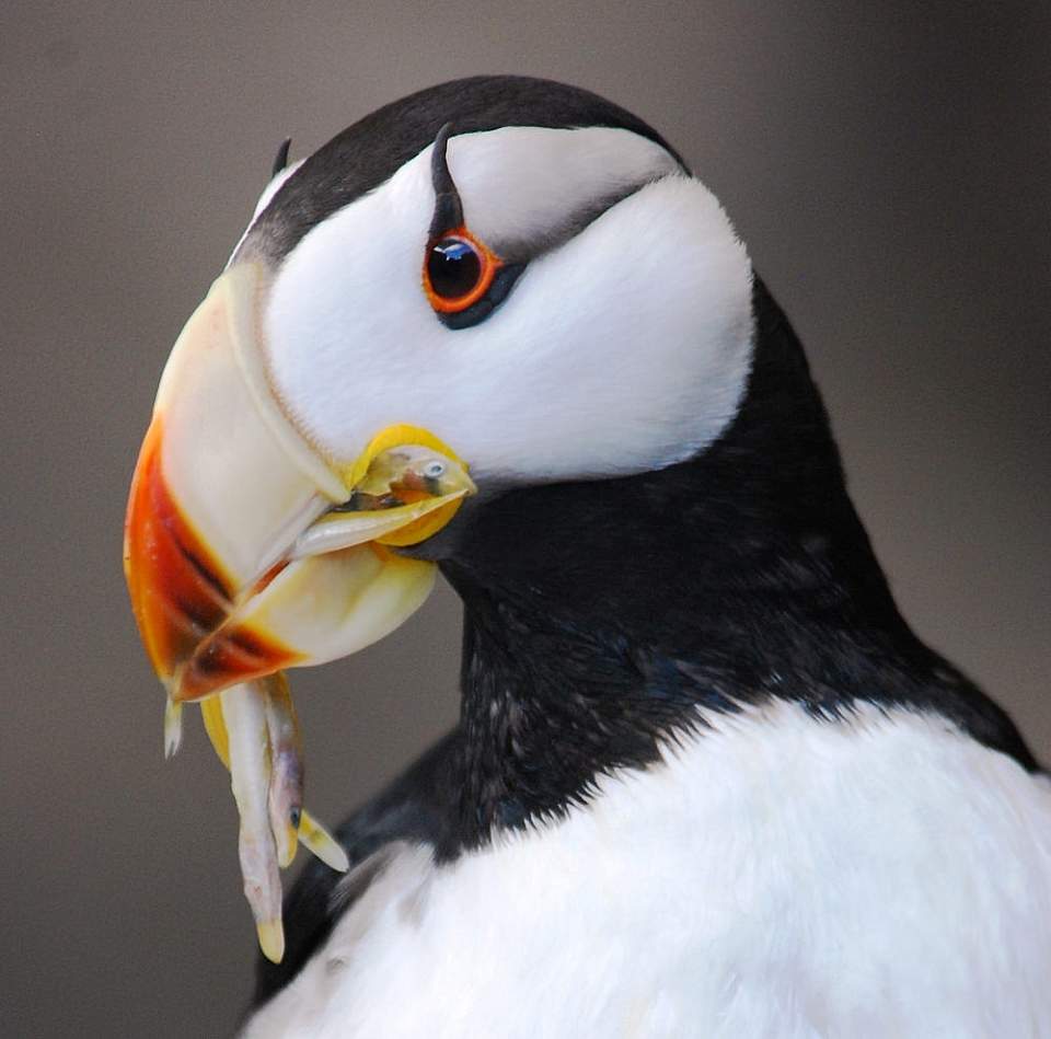
An Atlantic puffin carrying freshly caught sand eels
Tern Lake
About 2 hours south of Anchorage or half hour east of Seward
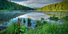
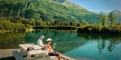
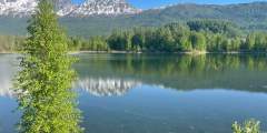
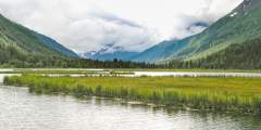
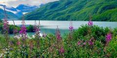
This large, productive lake at the junction of the Seward and Sterling Highways about 90 miles south of Anchorage hosts nesting pairs of Arctic terns as well as trumpeter swans, mew gulls and other waterfowl. You’ll find sweeping views of the lake and surrounding mountains from a pullout on the highway and a picnic area (with bathrooms.) Watch for spawning salmon, bears, beavers, moose and Dall sheep too! Tern Lake is known as one of the best overall wildlife viewing spots in the region.
Kenai Peninsula Beaches
Kenai to Homer
From the sandy mouth of Kenai River to Deep Creek’s dramatic front to the Homer Spit, the east coast of Cook Inlet—northwest and southwest—opens one dramatic window after another on Alaska’s bird world. For someone taking a road trip down the Sterling Highway, every state park and beach access offers a potential birding highlight. Depending upon the season, you’ll find estuary overlooks with migrating flocks or breaking surf where shorebirds dart up and back. Once salmon start running, bald eagles and gulls converge on river mouths. For a treat, take a boat tour to Gull Island three miles off the Homer Spit, with 20,000 nesting seabirds and marauding bald eagles.
Rookery Falls, Prince William Sound
A 90-minute trip from Anchorage in Whittier
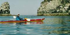
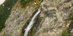
If you seek the intense sensory overload and teeming chaos of a bird colony in all its guano-scented glory, take a day cruise or kayak paddle to Rookery Falls just across Passage Canal from the port of Whittier, located beyond the head of Turnagain Arm via the Anton Anderson Memorial Tunnel. This cliff face may be the most accessible seabird rookery in the state, with more than 8,000 black-legged kittiwakes crowding the crannies amid a dramatic waterfall. Pigeon guillemots, sea gulls and bald eagles also make appearances. A natural wonder only minutes from Whittier Harbor.
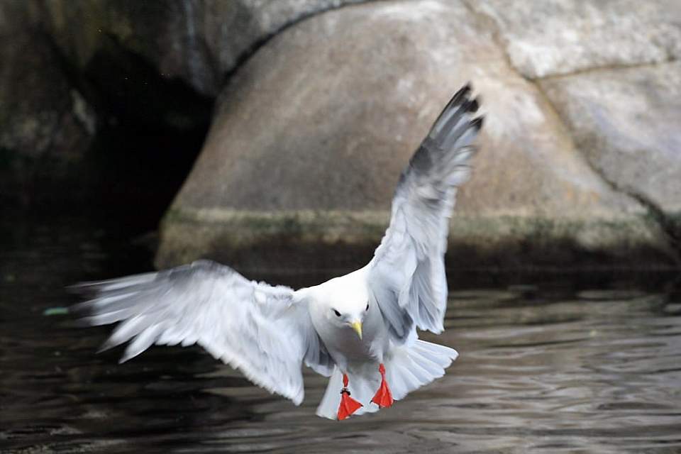
Kittiwake in flight
Denali National Park
4 hours from Anchorage or 2.5 hours from Fairbanks
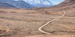
The 90-mile road across the northern slopes of Alaska’s most-visited national park traverses remarkable summer habitat for migratory species and winter-hardened residents. More than 160 species have been recorded in the park, with most of them nesting and raising young during the brief but intense snow-free season. Visitors can easily scan the panoramic views of tundra and mountain slopes to find nesting and feeding birds, with flocks staging for migratory moves. Take a bus tour on the park road or the national park shuttle, and look for birds at Tattler Creek (mi 37.5), hike the Sable Mountain Trail (mi 37.5), or in the fall months of August and September, look above at the Stoney Hill Overlook (mi 61.9) for migrating sandhill cranes.
Nome
A 90-minute flight from Anchorage
Located on the Bering Sea relatively close to Asia—and surrounded by the tundra of the Seward Peninsula—the community of Nome offers unique birding opportunities for travelers. Between May and October, visitors can rent vehicles and drive into the backcountry on more than 350 miles of gravel roads, gaining economical access to habitats that would have ordinarily been very expensive or impossible to reach. Prime time may be spring, May 15 to June 15, when more than 200 species migrate through or stop for the season. Fall has thousands of birds—swans, cranes and geese—staging for their annual return to the south.
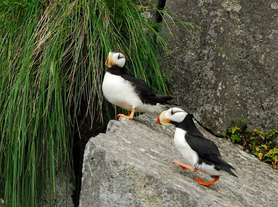
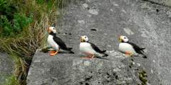
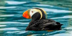
Puffins are nicknamed “sea parrots” – and sometimes “clowns of the sea“!
Unalaska Island
A 3.5-hour flight from Anchorage
Reaching into the Eastern Hemisphere, the far-flung outposts of the Aleutian Chain have always been a mecca for world-class birding. But many islands have no regular access, making them extremely expensive or impossible to visit. Not true for Unalaska, home to historic Dutch Harbor and America’s busiest fishing port. Most of the time, the island and its community of 4,500 year-round residents enjoy daily airline service from Anchorage, and sometimes be reached by a ferry via the Alaska Marine Highway System. Depending upon the season, you might find migrants from across the Pacific, seabirds and shorebirds of the Bering Sea, and hardy residents.
Guaranteed Viewing
Alaska Zoo
In South Anchorage on O’Malley Road
If you don’t mind viewing birds under human care, dozens of birds—many rescued from the wild after being orphaned or injured—can be seen on display at the Alaska Zoo on O’Malley Road in South Anchorage.
Bird Learning and Treatment Center
In South Anchorage near Potter Marsh
This avian rehabilitation clinic often puts on programs with the chance to see one of their recovered patients up close. The BTLC is located near Potter Marsh on the Old Seward Highway.
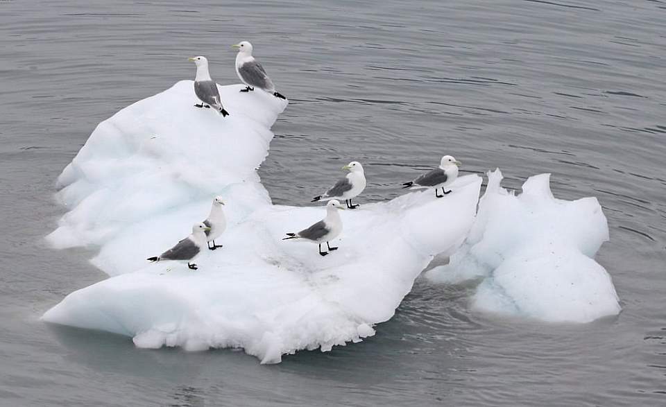
Black-legged Kittiwakes resting on ice floe
Alaska Sealife Center
2.5 hours by car or 4 hours by train south of Anchorage
This popular public aquarium and research center in Seward features a multistory habitat for diving seabirds, with both above-water and below-the-surface viewing. Watching puffins “fly” underwater to snatch submerged snacks can be astounding.
Attend a Bird-Watching Festival
Alaskans love bird watching festivals. They combine fun events, education and science with great opportunities to watch wild and exotic birds doing their thing. It’s a terrific way to meet locals too! Here’s a 2019 listing for these annual events, generally held about the same time every year.
The big three:
- Copper River Delta Shorebird Festival (early May)
- Kachemak Bay Shorebird Festival (early May)
- Alaska Bald Eagle Festival (early November)
Alaska’s Birding Seasons
Spring Arrival
(May-June.) Epic migratory flocks converge on wetlands and coasts. Upland habitat—forests, mountain slopes, meadows—fill with nesting birds singing for mates and claiming territory. This very active and noisy period is when you will have a chance to view most of the state’s annual visitors and residents.
Summer Peak
(June-August.) Birds are nesting and raising offspring. Migrants have dispersed, so finding nest sites of exotic species (like sandhill cranes) can require patience. The forest and wetland grows more silent as birds raise their young. Lakes and streams will host menageries of growing offspring.
Fall Migration
(August-October.) As foliage turns and frost approaches, migratory birds begin to stage and/or simply leave for parts south. Skeins of geese crisscross the sky. Local residents become active, while their offspring actively feed. Serious birders relish this season for the chance to see unexpected and exotic travelers.
Winter Residents
(October to April.) Between freeze-up in the fall until break-up in the spring, Alaska’s bird population becomes more limited. Many birds shift to coastal areas, while many inland locales seem dominated by ravens, with flocks of chickadees and redpolls flitting among the trees. In some ways, the austere winter landscape makes it easier to watch these tough locals make a living in a harsh world.
General Advice:
- If you can, use binoculars or spotting scopes. Good glass always enhances birding and may be necessary to see details and study behavior. Still, with extensive wild habitat adjacent to trails, decks and roads, it’s relative easy to view active birds even without visual tools.
- Connect to birding social groups and websites for real-time reports. It’s a great way to find out about rare bird sightings.
- You’ll find a trove of field-tested birding tidbits and advice in a series of wildlife viewing guides published in paper and online by Alaska Dept. of Fish & Game. They’re organized by geographic area.
- Come during the shoulder seasons! Alaska’s vast wetlands and 40,000 miles of coastline draw huge flocks during spring migration and fall dispersals. These long-distance travelers include a remarkable collection of geese, ducks, swans, shorebirds and waterfowl, including species like Arctic terns, the world’s grand champion travelers, known for winging 10,000 miles from their wintering grounds.
For More Information:
Show Map
Points of Interest
Jump to:
Anchorage
Portage (Near Anchorage)
Whittier
Cordova
Mat-Su Valley
Denali National Park
Fairbanks & Interior
Wrangell St. Elias National Park
Homer Area
Sterling Highway, Kenai & Soldotna Area
Seward & Kenai Fjords National Park
Juneau
Sitka Area
Glacier Bay National Park
Kodiak
Nome
Unalaska
Anchorage
Here you’ll find one of the most accessible wildlife viewing areas in Alaska. The marsh is a rest area for migratory birds including trumpeter swans, rednecked grebes, golden eyes, and pintails. Also watch for beavers, moose and bald eagles. You may even spot salmon spawning in the deeper water.
If you’re looking for a wild oasis that’s just a 15-minute walk from downtown Anchorage, look no further than Westchester Lagoon (also known as Margaret Eagan Sullivan Park). One of the city’s most popular places, this is where locals come to play, as it has something for everyone. You’ll find access to great trails and wildlife, as well as year-round activities and events for the entire family.
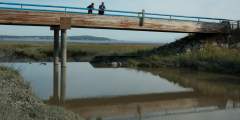
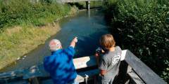
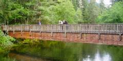
This short wooden bridge crosses a popular salmon fishing creek. Downriver you’ll see deep channels that the creek has carved into the mud flats. In late summer, salmon migrate up to the estuary to spawn.
Goose Lake is located in central Anchorage, near the university district. You’d never know you’re in the heart of Anchorage as you view Pacific loons nesting at the far end of the lake from mid-May to mid-September.
This is a great pocket of wilderness right in Anchorage: easy to get to, quiet and pretty idyllic. Set in the northeastern section of Kincaid Park, Little Campbell Lake is packed with lily pads and surrounded by a thick forest lined with trails. Spend the afternoon hiking, swimming, fishing, or paddling around the lake.
A short drive from 5th Ave, you’ll find this great display of Anchorage’s natural environment, which coexists alongside the industrial port and rail areas that supply much of southcentral Alaska. There are hardly ever any people here, making this a great place, close to downtown, to get a moment of solitude.
Portage (Near Anchorage)
Crystal-clear Williwaw Creek and its bank-side trail system in Portage Valley at the head of Turnagain Arm offers exceptionally good conditions for watching spawning in action. Coho, sockeye and chum salmon converge on the creek as it winds through the brushy flats beginning in mid-August, with some late-arriving fish still present after first frost in the fall.
Located at Mile 1.0 of the Portage Highway, this site has a short boardwalk trail along several ponds. It is a good site for observing waterfowl that nest and rear their young in the ponds and river channels.
Whittier
Cordova
Considered one of Alaska’s top birding events, this annual festival during early May celebrates the arrival of more than 5 million migratory birds on the Copper River Delta east of Cordova.
Every year, millions of shorebirds migrate from South America into Alaska where they stop to rest and feed on the Copper River Delta mud flats at Hartney Bay. Located about 5 miles south of Cordova near the end of Whitshed Road, the mudflats are host to thousands of Western Sandpiper during high tide during the first several days of May each year. Additionally, the Copper River Delta near Alaganik Slough is an excellent location to find… ...more
Located at Mile 17 of the Copper River Highway. An accessible boardwalk leads visitors to stunning views of both the expansive wetlands of the Copper River Delta and the surrounding mountains. A wide variety of wetland animals including trumpeter swans, moose, brown bear, and shorebirds can be seen in the area, especially during the spring and fall. The first half of this trail is paved with geoblock, so that it does not have a negative… ...more
Mat-Su Valley
Visible outside the windows of the Mat-Su Convention and Visitors Bureau, this state wildlife refuge is the result of the 1964 earthquake. Literally overnight, the land dropped by 6 to 20 feet; hay fields and pastureland became salt flats and marshland. Once home to cows and grains, the land is now prime habitat for moose, birds, and fish. Some 20,000 acres are protected in the refuge, which is a popular recreation and wildlife-viewing… ...more
This short, paved trail is an hour’s drive north of Anchorage in southern Wasilla. It leads out to a bluff on Palmer Hay Flats — a large stretch of wetlands with all kinds of wildlife. There, a viewing platform overlooks the flats and the Chugach Mountains beyond.
This is a mellow, 1.1‑mile-long, family-friendly loop trail, easily accessible from the Glenn Highway. The highlight is the built-up viewing deck, where visitors can get a breathtaking view of the Knik Arm, the surrounding mountain ranges, and the Palmer Hay Flats. Bring binoculars.
Part of the Palmer Hay Flats State Game Refuge, this trail meanders through tidal flats and wetlands. Highlights are great views of the mountains surrounding Palmer (Pioneer Peak, the Chugach and Talkeetna ranges) and excellent bird watching.
This big pullout doesn’t look like much, but each spring bird watchers from around the world gather here to look for elusive species of raptors and falcons. Migrating north for summer, red tail hawks, sharp-shinned hawks, gyre falcons and other birds of prey gather in large numbers here, playing on the uplifts along the windy cliffs. In addition to seeing impressive numbers of hawks and rare species, birders are drawn by the good light, with… ...more
Denali National Park
Pick up the trail right after you cross over Tatter Creek. Follow Tattler Creek upstream for 1⁄4 mile to a steep ravine that comes in from the left. Follow this ravine up until you reach a ridge that overlooks the Sable Pass restricted area. If you only plan to spend time on the ridge without going farther afield you may want to stock up on water in the ravine because there are no sources on the ridgeline. From the ridge you can choose to… ...more
Tattler Creek is named for the Wandering Tattler, a large shorebird that you may be lucky enough to spot. The first Wandering Tattler nest known to science was found at Denali National Park. The first nests of the Arctic Warbler and Surfbird were also found here.
The grizzly bears of Denali can be found feeding in almost every corner of Denali National Park. Early to mid summer, these bears can be often observed from Thorofare Pass. What draws these adaptable and persistent omnivores to this high alpine environment? Audio tour by Camp Denali Wilderness Lodge.
This is the most photographed view of Denali (Mt. McKinley) from the road. You’re up high, at the edge of a mountain pass, and there’s alpine tundra all around, with the road snaking towards the mountain in the foreground. And this is the first spot where you can see the whole mountain from base to summit. On clear days, Tundra Wilderness Tours will extend their trip several miles just to reach this spot. Stony Hill is also a great place to… ...more
This is an unmarked, unmaintained trail and can be difficult to follow, but is a good example of the real outdoors in Denali National Park.
Fairbanks & Interior
Come visit and you might see up to 15 different kinds of mammals — from beavers to red foxes, flying squirrels, snowshoe hares, and even moose — and several species of birds. Throughout the Sanctuary’s trail system there are 14 interpretive signs, so you can learn how the birds, fish, frogs, and mammals survive in interior Alaska’s tough climate.
Accessed via the 1.5‑mile long Lost Lake Trail, Moose Lake is an excellent place to visit with a camera or binoculars. Knock-kneed moose are a frequent visitors to the area and you’re most likely to see them if you arrive early in the morning or about an hour before sunset.
This string of lakes along the highway serves as a summer home for a great variety of waterfowl. Some, like the trumpeter swan, stay until the lake is freezing up. Several pull outs and wide spots along the shoulder allow safe parking, with many trails leading down to lakeshores. Watch for caribou crossing the highway in stretches with gaps between lakes.
When you’re driving Chena Hot Springs Road, keep in mind that it’s best not to rush. This journey defines “scenic route” as a one-day road trip primed for spotting wildlife, exploring a new trailhead, and pulling over to cast a line.
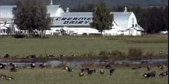
Once a small dairy owned by a couple named Creamer, this land is now an extraordinary wildlife refuge. More than 100 species of birds and mammals call this wilderness home (sandhill cranes and mallards show up all summer), and there are miles of trails that meander through a variety of habitats.
Wrangell St. Elias National Park
This river originates from the Lakina Glacier and the southern flanks of Mt. Blackburn, spilling into the Chitina River several miles downstream. Pulling over to the side of the road just after the bridge at milepost 44, one can explore upstream for around a half-mile before getting boxed out by the forest and a narrowing of the river.
This is a great site to take a break for some wildlife viewing or bird watching. There are views of wetlands, a small lake, and boreal forest. Moose are often seen here and caribou migrate through this area in the spring and fall. During spring and summer, look for nesting ducks and trumpeter swans. Vault toilets.
Homer Area
From the base of the Homer Spit, take this 4‑mile paved trail to the Nick Dudiak Fishing Lagoon. The trail is in excellent condition and is flat as a pancake for most of its length. The first mile of trail is along a broad estuary that is great for birding. Once you pass the one-mile mark you’ll be riding past fishing boats that are out of the water being worked on as well as a few shops.
Sounds Wild: Ravens HotWherever there is food, you will find ravens and northwest crows. In fact crows love people and their food. At the Homer Small Boat Harbor you can find these birds feeding along the shore, in the campgrounds and perched on the surrounding telephone poles and buildings.More Information
To all the other great reasons to visit Homer, add plentiful shorebirds, seabirds, marine mammals, and a ring of stunning mountain peaks surrounding Kachemak Bay. The Islands and Ocean Visitors Center puts the icing on this cake.
More than 20,000 birds often nest on the cliff faces of this craggy island in Kachemak Bay about three miles south of the Homer Spit. See thousands of screaming kittiwakes, babies crying from nests, murres and puffins and other seabirds diving offshore for fish, lone bald eagles on the hunt for a meal.
Sounds Wild: Underground SeabirdsA great spot on the Kenai Peninsula to see a large group of seabirds nesting is Gull Island out of Homer. This short three-mile boat ride across Kachemak Bay is great for families. You’ll also find red-faced cormorants, common murres, puffins, eagles, murrelets, sea otters, harbor seals, sea lions and even whales.More Information ...more
Sounds Wild: PhalaropesHundreds of red-necked phalaropes can be seen from the end of the Homer Spit during their spring and fall migrations. Look for these small birds spinning in circles on the water. They do this to concentrate food. These whirling living tops are a joy to watch. They tend to be in small flocks, which can make spotting them easier.More Information ...more
Everyone wants to explore a tidepool, don’t they? This is a must for the kids — even that little kid in those slightly more mature visitors. Here’s the perfect spot. Bring a towel and let’s have an intertidal adventure.
At Homer’s main traffic light, at Lake Street and the Sterling Highway, be sure to stop on the south side of the road and look up — way up. You’ll likely get a glimpse of a big, messy eagle’s nest at the top of a dead spruce there, where in late summer you might even see fluffy, rumpled baby eagles peeping over the top. Look one tree over, too, to see if you can spot one of the parents standing guard.If you don’t see the nest on the day you’re… ...more
Above Homer, up East Hill and right on Skyline Drive a mile and a half (a beautiful drive along the bluffs overlooking Homer), watch for the Wynn Nature Center, managed by the Center for Alaskan Coastal Studies. You can stroll in the wilderness among the beautiful flora and watch for wildlife or take a tour guided by a well-informed naturalist.
As you drive out East End Road about 4 miles you will see open fields, and likely the sandhill cranes that frequent them.
Witness giant tractors towing the Kenai Peninsula’s fleet out to water’s edge and launching them into the tide on their quest for fish. You can camp here, scout for wildlife, fish for steelhead, and enjoy some of the best puffin viewing on the Kenai.
Sterling Highway, Kenai & Soldotna Area
Sounds Wild: LoonsAs you approach Summit Lakes, look for common loons. Most of the time they are found at the southern end of the lakes near the shore but can be anywhere, so stop at the lodge and road pullouts to look at the lake surface. Moose can sometimes be seen in the marsh areas at the end of the lakes.More Information
Sounds Wild: Birds SmellTern Lake has lots to offer but few people use the old Sterling highway to access the boreal forest near this lake. Drive into the recreational area and as you turn left toward the restrooms you will see an old road to your right. You can walk for miles down this road and enjoy the smell of the woods and the sound of the birds.More Information ...more
Located at the intersection of the Seward and Sterling highways at Milepost 37. This area hosts a myriad of animals, birds, fish, and unique plants. Common loons, bald eagles, and arctic terns share the area with a variety of songbirds and shorebirds like the northern water thrush, golden-crowned sparrow, and the greater yellowlegs. Beavers, river otters, muskrats, and salmon ply the cold, clear waters of Tern Lake. Moose, Dall sheep, and… ...more
You’ll either enjoy a peaceful walk through a secluded and beautiful estuary ripe with birdlife — or have a ringside seat at the annual salmon dipnetting extravaganza, featuring hordes of crazed locals armed with 10-foot poles. The beach road emerges from the forest at a river-mouth lined by dunes, tidally influenced beach, an estuary and broad salt marsh.
Definitely keep your eyes open here, there’s volcanoes, beluga whales, harbor seals, and tons of birdlife to be seen — depending on the season and weather, of course. Extra credit if you spot an owl!
Sounds Wild: Porky BabiesPorcupines are not often seen along the main paved roads of the Kenai Peninsula. You have to get off on the gravel side roads that pass through their habitat. Tustumena Lake road travels through the Kenai Wildlife Refuge and ends at the Kasilof River campground. This road is great for viewing various birds including spruce grouse, thrushes and chickadees. Moose are found along this road and if you are really lucky, a… ...more
Stretch your legs here and check out one of the favorite rest stops for thousands of Kenai River salmon on their journey home. We’ll also seek out giant trumpeter swans, red-necked grebes, and of course, fishers of another species — humans. Here at the confluence, the two rivers reveal their source waters in a very clear visual demonstration.
Not Steinbeck’s classic novel, but a fantastic adventure, communing with a 30,000-member herring gull colony. It’s a one-of-a-kind experience you won’t want to miss.
Let’s go caribou-spotting on the wide open spaces at the mouth of the world-famous river system. This spot is one of your best bets for viewing these beautiful, stately beasts.
Walk out to the boardwalks along the Kenai River, learn about riverine habitat and the salmon lifecycle, and witness the timeless dance of hunter and hunted, of fish and fisher. One year-round resident here will impress you with their winter survival skills.
Sounds Wild: Alaska’s DragonsWatson Lake is a shallow lake that is full of vegetation – just the right spot for dragonflies and other critters. Standing at the boat launch and camping area, look out across the lake for these large flying insects. Red-necked grebes, rusty blackbirds and loons are also found on the lake. Most lakes on the Kenai Peninsula can be a good spot for dragonflies.More Information ...more
Sounds Wild: Mother BatsThis recreational site has a series of loop trails that pass two small lakes. Park in the parking lot and take the path to your left as you face the buildings; this will lead you to the trailhead. The trail is great for viewing woodland birds and loons on the lake. As evening approaches, look for bats flying over the lake feeding on insects. Bats are hard to see because they are very secretive and do not become active… ...more
Sounds Wild: SparrowsSavannah sparrows love to sing and hide in the grass. However, sometimes they will perch on a fence, small trees or brush piles in this estuarine area. Walk along the beach toward the Kasilof River and look at the large flats to your right. In addition to sparrows you will see arctic terns, numerous herring, mew gulls and migrating shorebirds in the spring and fall.More Information ...more
Seward & Kenai Fjords National Park
Just south of Seward you could spot humpback whales, sea lions, bird life and old growth forest habitat. There’s a great sand beach at the end that will reward your exploration, so let’s go!
As the boat pulls away from the nesting areas of the horned puffins it will turn left and again stay right next to the cliff face. You’ll notice some pelagic and possibly red-faced cormorants nesting high on the cliff just after the boat turns to the left for the final stretch of Cape Resurrection.
Here is the local favorite area of our Horned and Tufted puffins. You can tell the two species apart if you remember that “Tough Guys Wear Black.” The tufted puffin’s body is entirely black with distinctive long yellow “tufts” of feathers on either side of their head. Horned puffins have a white belly and black back. These puffins come to land only to lay their eggs and raise their young. Puffins spend most of their lives about 400 miles away… ...more
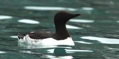
Some of the little caves on the tip of the cape contain nesting Common murres. You may also be seeing many of these murres on the water. They have black heads, black backs and white bellies. They are Alcids, like the puffins, so they are diving birds that use their wings for propulsion under water. Of all the alcids, common murres can dive the deepest, plunging to record depths of at least 600 feet.In addition to the cave nesters on the Cape,… ...more
Up ahead the noise and odor of the Black legged Kittiwakes will soon become apparent. These birds take advantage of the slight depressions in the rocks to build their nests. Their nest is simply some grass and mud glued to the rock wall with their own guano. These birds nest in dense aggregations as a means of protection against birds of prey.If a Bald eagle or Peregrine falcon flies into the area every bird will leave the rocks in one… ...more
Just up ahead on the right is a small rock that sticks above the water and almost always has a mixed group of cormorants standing atop it drying out their feathers. This long necked black bird dives in the water and uses its feet to swim but unlike the puffins and other alcids has no oil in its feathers to aid in drying off. So they stand out on rocks to get dry.Just up ahead on the left you will see a rock with many gulls on top of it and… ...more
Juneau
Aside from rivers where salmon are spawning, this is one of the best spots to watch bald eagles. They perch in trees and on rocks here, hunting for washed-up salmon and other food. It’s also a great place for a picnic, or to go beachcombing.
Adjacent to the Airport and accessible off Ratcliffe Road, this trail runs through the wetlands between the mainland and Douglas Island. It’s a great walk for families, birdwatchers, and exercisers.
This flat trail — a must for birders — takes you past the Juneau International Airport runway and into the famed Mendenhall Wetlands. You’ll start by following the Mendenhall River until you get past the runway. Then the trail veers left, but a smaller footpath follows the embankment above the Mendenhall out to where it empties into Lynn Canal. Follow the main trail for about another 1.5 miles, past a small covered shelter and the largest tree… ...more
Just before Echo Cove is Bridget Point State Park, where you’ll find this well-maintained trail. It meanders through muskeg, mature forest, and grassland until it reaches a beaver dam and views of the Lynn Canal. Bears often visit the meadow, but leave it to fish the stream.
Sitka Area
Overlooking the Eastern Channel, this park is designed for whale watching, with 3 covered viewing shelters, public-use binoculars, and 11 interpretive signs. Learn about whales’ feeding habits, migrations, and biology while walking the boardwalk.
This is a great, easy walk that can be linked to the Forest and Muskeg Trail and Mosquito Cove Trail. The boardwalk trail travels through a rich tidelands ecosystem, where you’ll find good bird watching for shore and seabirds. You may even spot bears, who show up here to feed on young grasses in early summer and return in mid-July to the end of September for the pink and silver salmon runs. The U.S. Forest Service manages the area, and the… ...more
A clump of volcanic rock in the middle of the ocean, this 60-acre island is home to nesting puffins, murres, cormorants, and peregrine falcons from May to September. Thousands of birds show up, making it a loud, raucous place. They come because of the island’s location in the middle of food-rich ocean currents and its lack of predators.You’ll have to get here by boat; as you drift along, look for tufted puffins building nests in the grassy… ...more
This protected bay roughly 15 miles south of Sitka is a great destination by boat or floatplane to see birds and bears. Thousands of salmon run up numerous watersheds to a lake just inland from the coast and the bears congregate here from July to September. The area is heavily forested and numerous waterfalls add an ethereal feel to the trip.
Glacier Bay National Park
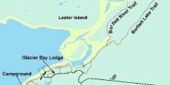
This trail passes along an intertidal lagoon and through a forest of spruce and hemlock before ending at the Bartlett estuary. You may see coyotes, moose, bear, and river otter along the beach. Ducks, geese and other water birds concentrate in the intertidal area during migrations and molting. Salmon run up the river later in the summer that draws in hungry harbor seals. To reach the trailhead, park at the Glacier Bay Lodge/Visitor Center and… ...more
The Beach Trail departs from Glacier Bay Lodge in Gustavus and follows the shore for one mile, traversing beach meadows and forest habitats, home to porcupines, bears and moose.
A stunning 200-foot waterfall cascades from mountain cliffs into the waters of Passage Canal just across from Whittier. The falls — a stop on most marine tours and a popular destination for kayakers — pours right through one of the largest bird rookeries in Prince William Sound.
Humpback whales, sea otters and harbor seals are scattered throughout the Beardslees, with whales and otters most likely to be seen on the western side of the islands — nearest to open water. Watch the shore for black bears and moose. Black oystercatchers – black shorebirds with bright red-orange bills – nest on the islands. Look for harlequin ducks, pigeon guillemots, pelagic cormorants, arctic terns, marbled murrelets and large flocks of ...more
Kodiak
Look for salmon and bald eagles here.
The trail parallels Island Lake Creek, which tumbles steeply through the woods over falls and boulders. This is a good place to see dippers, as well as forest birds such as winter wrens, varied thrush, chickadees, nuthatches and creepers.
This is a very scenic and easy hike with great birding and flower viewing. During April and early May this is a prime location to view migrating gray whales. Check out all of the rocky outcrops, beaches and offshore waters for birds. Look for bank swallows nesting in the sea cliffs and harbor seals lounging on the rocks.
A popular place for viewing wintering Emperor Geese.
During summer the meadows are full of wildflowers and the views of Chiniak Bay are spectacular. The south cape is a good place to look for Horned and Tufted Puffins, Balck-legged Kittiwakes, Pelagic and Double-crested Cormorants, Black Oystercatchers and various ducks including Harlequins, scoters and Long-tailed Ducks.
Buskin River State Recreation Site near Kodiak offers 15 wooded campsites along a top salmon fishery. Surrounded by spruce forest and coastal beaches, it features vault toilets, picnic shelters, and a wheelchair-accessible fishing platform. Ideal for fishing sockeye, coho, and pink salmon, beachcombing, wildlife watching, or exploring Kodiak’s wild charm, with the town minutes away.
Pasagshak State Recreation Site on Kodiak Island offers a few waterfront campsites near the mouth of Pasagshak Bay. Surrounded by beaches and wetlands, it features vault toilets and a boat launch with sweeping ocean views. This scenic spot is ideal for fishing, beachcombing, whale and bear watching, or exploring the island’s wild coast, with the town of Kodiak just a drive away.
One of the easiest beaches to access from town, this park has a nice overlook and excellent waterfront with picnic sites. In late July through September, you can fish from the beach for silver and pink salmon. Birding is good year round, but it’s especially great during the winter.
A six-mile round-trip hike that climbs to just over 2,000 feet, this climb will get you great views of Women’s Bay and the rolling mountains of the island. Look for ptarmigan up here…this is a hike the Audubon Society does annually.
This trail can be hard to follow as it meanders through wet areas, thick vegetaion and up salmonberry slopes before it reaches the rich subalpine meadows and eventually leads into a bowl-shaped glacial cirque at the base of the mountain. There is plenty of great bird habitat along the trail so watch for pipits and ptarmigan up high and songbird and snipe in the lower elevations.
This is the highest mountain close to town. If you tackle this hike, you’re in for a climb, but a large portion of the trail is in the alpine, with beautiful flowers and tundra. You’ll be climbing 2,400 feet in elevation in just two miles. Watch for upland birds including Willow and Rock Ptarmigan, and American Pipits.
Nome
Glacier Creek Road runs approximately 30 miles up the east side of the Snake River. It becomes a rough four-wheel-drive road after it passes the Rock Creek Mine site three miles in and is not maintained in winter. If you look north up the valley from Teller Road, you will see the pyramid-shaped peak of Mount Osborn, the tallest peak on the Seward Peninsula. Look for birds nesting in the small lakes on either side of the road.
The Snake River has a relatively short drainage that flows out of the south side of the Kigluaik Mountains. Prime moose, birding, and salmon viewing habitat.
The bridge crossing gives a good view of birdlife, spawning salmon, and moose. Red-breasted merganser and harlequin duck like the swift-flowing water.
Driving north, the rocky outcrop on your right may host a nesting or perching site for rough-legged hawk, gyrfalcon, and common raven. Look to your left into the creek bottom to see an active beaver lodge with several dams and ponds.
House Rock and Cabin Rock are local names for the obvious rock formation on the right. Look for Arctic ground squirrel on the dry, upper slopes and for Musk ox on the windblown summits. This is also a great birding area.
The steep road grade on either side of Cripple River gives a good overview of the thin thread-like river that runs through the valley. Gold mining activities occurred in the upper tributaries, as evidenced by the road and horizontal ditch lines. Look for harlequin ducks paddling swift river currents in late August or September, and Pink Salmon swimming upstream to spawn.
The Sinuk River is the largest river crossing on the Teller Road, and the magnitude of the valley, river channels, craggy mountains, and rolling tundra — all in one panoramic vista — is an impressive sight. The bridge is a reliable spot to see salmon on their return upriver. Birdlife tends to be those species attracted to flowing water and gravel bars, islands, and thick vegetation clustered in some sections of the river.
This 100-foot-wide road is a public right-of-way that traverses lands privately owned by the King Island Native Corporation. It runs eight miles to traditional summer fishing camps at Woolley Lagoon. Please stay within 50 feet of either side of the road. Do not photograph or travel close to lagoon or camps. A pull-off to the right offers views of Moon Mountains, a wintering spot for muskox. Also watch for red fox and black-bellied plovers. ...more
As you approach the Tisuk River, scan downstream and across the river for a large nest of sticks on an orange lichen-covered rock outcrop. Built by golden eagles, it may be used by gyrfalcon when not occupied by eagles.
The road parallels a somewhat narrow creek valley, making it easy to see water and shorebirds associated with flowing water as well as the wide variety of songbirds, such as thrushes, warblers, and sparrows that hang out in dense shrubs clustered at creek’s edge. Arctic grayling, and sometimes pink salmon, are found here.
The Bluestone River is unlike other river crossings along the Teller Road because it flows northward to Imuruk Basin rather than south to Norton Sound. The river is deeply incised as it cuts through steep mountains, creating steep, rocky slopes and cliffs. Rough-legged hawk, golden eagle, gyrfalcon, and common raven may nest on nearby rock cliffs
At Teller the road returns to sea-level where the environment is dominated by marine waters. Look for spotted seals on calm days, their heads popping up inquisitively at the tip of the spit. Pelagic cormorant, pigeon guillemot, horned puffin, common eider, and black scoters are seen here.
Spring provides some of the best opportunities to see semi-domestic reindeer along this section of road. In summer the drive provides good bird watching for waterfowl, gulls, terns, and tundra species.
The landfill draws many scavengers. Common raven is abundant year round. Glaucous, glaucous-winged, herring, mew, and — occasionally in summer — slaty-backed gulls show up as well. Red fox is also a frequent visitor to the facility.
A gravel pit pond may contain local nesting waterfowl, mew gull, Bonaparte’s gull, and semipalmated plover. The edges with the tallest willows are a good place to find blackpoll warbler. A large beaver lodge on the banks has helped to fertilize this once sterile gravel pit, which now supports juvenile coho salmon, Dolly Varden, and Arctic grayling.
The Nome River is a good place to see salmon. Pink and chum salmon spawn in August, coho are usually present in August and September. Sockeye salmon, Arctic grayling, and Dolly Varden may be present. Look for Arctic terns fishing, harlequin duck and red-breasted merganser riding swift water, spotted sandpiper or wandering tattler at waterline, and northern shrike in the willowed river edges.
This high point in the road gives you an excellent view across the valley. Three ditch lines from earlier mining activities are apparent on the far side of the valley, especially where they cross the exposed rock face of Cape Horn. The ditches originate near Hudson Creek about 12 miles upstream. Today these deep, wide gashes on the hillside offer cover and easier movement for wildlife — especially moose and grizzly bears.
There are two turn-offs to see raptors as you are heading down Kougarok rd. The first is a raptor nest, and the second give you a chance to see hawks
Sockeye salmon migrate up Pilgrim River to Salmon Lake between late July and mid-August, and some continue up the Grand Central River as far as the bridge. Grizzlies are fairly common in late summer when spawned-out salmon and ripe berries are abundant. Birders watch for harlequin duck, red-breasted merganser, American dipper, Bluethroat, yellow warbler, Wilson’s warbler, and Arctic warbler.
Golden Gate Pass divides the gold-laden creeks and rivers to the south from Pilgrim and Kuzitrin Rivers. This pass is a migration corridor into the Pilgrim River drainage for the Western Arctic caribou herd in years when they winter on the central Seward Peninsula. American golden-plover, northern wheatear, American pipit, and Lapland longspur are common in the tundra areas.
The Pilgrim River crossing brings you close to groves of cottonwood that are abundant in this section of the valley. Look for spawning salmon, moose, and a variety of birds.
The northernmost lake is called Swan Lake but several lakes in this area may hold a wide variety of birds. Tundra swan with cygnets, Canada goose, sandhill crane, northern shoveler, black scoter, long-tailed duck, greater and lesser scaup, and canvasback frequent the ponds. Red-necked grebe build floating nest platforms. The perimeter of meadow habitat with threads of water drainages are good places to find Pacific golden-plover. Look for signs ...more
Several small lakes and ponds sprinkle the landscape on either side of the road. Look for a small hillock just beyond the first lake. This lone pingo rises above the surrounding flat tundra meadow and serves as a convenient lookout for hunters such as foxes, wolves, hawks, owls, and jaegers. The soil on the tops of pingos is fertilized by predator feces and prey remains and generally supports lush and diverse vegetation.
Though built to accommodate the road from Bunker Hill to Taylor in the early 1900s, the bridge is as far as you can go by highway vehicle. From here a rough, unmarked, and sometimes impassable ATV trail leads to Taylor where family-owned mines still operate. Look for canada goose and white- fronted goose. Bluethroat can be found on shrubby river banks. Arctic grayling are the most likely fish to be seen from the bridge.
The bridge marks a mixing zone where fresh river water meets tidal salt water and turns brackish. This creates a blend of water types and habitats and attracts many different birds to areas of open water or the mud-bar edges of islands. Look for geese, cranes, shorebirds, and gulls in good numbers, even unusual species like Arctic loon, red knot, black-tailed godwit, red-necked stint, ivory gull, and white wagtail. Also spot spawning salmon. ...more
Safety Lagoon slowly narrows and mixes with wetlands, ponds, and the Bonanza River estuary. Thousands of tundra swan move through this area on their spring migration. Breeding swans move on to upland ponds to nest and raise their young, while non-breeding birds may remain all summer. In the fall, parts of the lagoon and Solomon River wetlands turn white with huge groups of swans preparing for fall migration.
In the fall, people fish for tomcod from the bridge. Deep diving ducks feed in the channel depths of the Bonanza River. Sandhill crane feed on berries, plant shoots, roots, insects, and even small rodents. Red-throated loon and, less commonly, Pacific loon float the waters.
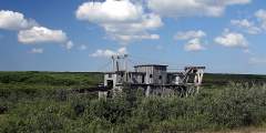
Lee’s Dredge, the last dredge to work the Solomon River, was operated by the Lee family until the 1960s. It now provides nesting platforms for raptors and ravens. You may see green-winged teal and phalaropes feeding in the dredge pond and songbirds in the surrounding willows.
An old road bed leading to a Solomon River overlook is a good spot to look for salmon, Dolly Varden, and Arctic grayling in late July and August. Say’s phoebe will launch from its nest to catch insects. Northern shrike, harlequin duck, spotted sandpiper, and wandering tattler are also seen. In some years, the cliff is occupied by common raven, rough-legged hawk, or other raptors so be careful your presence does not disturb nesting birds.
Approaching the East Fork of Solomon River, a wide pull-off on the left is an excellent place to park and scan the slopes and river valley for wildlife. Northern wheatear and American pipit frequent the rocky slopes nearby. Cliff swallow often build nests on the bridge supports, and ravens and raptors occasionally nest in the area. This view of the river makes it easy to find red-breasted merganser, harlequin duck, tattlers, and gulls.
The rocky outcrop across the Solomon River usually hosts an active golden eagle nest. Look for a huge tower of sticks and splashes of whitewash and orange lichen in the vicinity of the nest and surrounding perching sites. Built by eagles and added onto in successive years, the nest i s distinctive for its large size, construction, and shape. When not occupied by eagles, the large nest may be used by gyrfalcons.
Descending into terrain increasingly dominated by trees and willows, you are more likely to see a moose than a muskox. In late summer grizzlies feed on spawning chum salmon below the Fox River bridge. Salmon carcasses also attract red fox, gulls, and common ravens. Both abandoned and active beaver lodges and dams are found along the Fox River drainage. Dolly Varden, Arctic grayling, and chum and pink salmon can be seen from the bridge. ...more
Look for loons, mergansers, gulls, terns, and kittiwakes where the Snake River flows into the Nome harbor area, either close to the beach or in the salt and fresh water mixing zone. When ice covers the harbor during the spring thaw, the plume of river melt attracts a mixture of arriving species seeking open water near the coast. Many birds stay in the area throughout the summer, making this an important local hot spot for birdlife.
Skirt the harbor and walk toward the west side of the port area along Seppala Avenue, and you’ll cross the culvert where Dry Creek flows into the harbor. Upstream is a wide area of lowland vegetation. This area is subject to salt water intrusion during wind driven high tides, affecting the wetland habitat as it reaches the side slopes of tundra and willow shrubs. Puddle ducks forage and nest here. Look for shorebirds and other species.
The west flank of Dry Creek leads to the Nome Cemetery on a small rounded hill. The narrow cemetery roads cross tundra and willow shrub habitats that dominate the area due to the slight rise in elevation. While being respectful of the grave markers, search for northern shrike, bohemian waxwing, or black-capped chickadee and enjoy the common tundra bird species as well. Don’t be surprised if an eastern yellow wagtail flying overhead escorts you ...more
Bordering the cemetery hill to the north, at the intersection of Center Creek Road and the west extension of the Nome ByPass Road, a large man-made pond from placer mining operations that is slowly becoming vegetated is a good place to find a few species of nesting waterbirds. Red-necked grebe, glaucous gull, greater scaup, northern shoveler, and green-winged teal may be found near the center and edges of the pond.
Returning south of the road to the airport (Seppala Avenue) and west of the Nome port, the beach front area offers a good view of the marine waters of Norton Sound and the barge docking area built of quarried rock from Cape Nome. Depending on the season, the open ocean view will be punctuated with passing flocks of eiders, brant, scoters, murres, auklets, cormorants, and other seabirds.
Anvil Rock perches above Nome, an early landmark for gold miners and an easy hike for those who want to take in spectacular views of Nome, the Bering Sea, and the Kigluaik Mountains. Its resemblance to a blacksmith’s anvil generated names for many nearby landscape features, including Anvil Mountain and Anvil Creek. The hike also promises a good chance to see musk oxen, birds, and maybe even reindeer or red fox. ...more
Unalaska
Unalaska’s Front Beach, on the shores of Iliuliuk Bay, is both inviting and picturesque. Looking toward the bay, watch for boats coming into harbor, eagles fighting over salmon, or mist engulfing the surrounding hills and mountain tops. Back toward Unalaska, you’ll find more emerald green mountain views and historic sites.
A drive or walk up Mt. Ballyhoo is interesting for both birders and those interested in World War II history. It’s such as good view that you might even catch sight of whales in the distance. The view from the 1,634-foot mountain gives you an idea of how birds might see the area (that is, if you can imagine the view with a lot more color and super-sharp clarity)
If your travel group includes a WWII enthusiast, a wildlife devotee, a birder, and a kid who enjoys rolling around on the tundra, Bunker Hill is the perfect spot. Plus, it has the best photo ops, with a 360-degree view of the entire area: Captains Bay, Amaknak Island, Unalaska Bay and Iliuliuk Harbor.
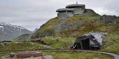
The mild stroll around Strawberry Hill offers great views, wildlife and some historic flavor. Old military roads cover the area, providing easy walking. Adventurers can bushwhack or scramble short distances for better views of the surrounding area or get up close to WWII-era trenches and the remains of old bunkers.
Jutting half a mile into the center of Unalaska Bay, the Dutch Harbor Spit offers a short, sea-level hike for all ages, with beach access, wildlife viewing and birding. The trail follows an old roadbed, which makes for an ideal hiking surface. You’ll want to stop frequently with a ready camera for close-up views of marine mammals on either side of the spit.
Some birds that wind up in Unalaska are “accidentals” that have been blown off course by storms. If they are used to living in forests, there’s only one place to head: Sitka Spruce Park, known to local birders as a “migrant trap” for unusual birds.
Tens of thousands of pots are stacked and stored in yards in between crabbing seasons. The towering stacks are a source of shelter, especially for birds that don’t normally live in Unalaska. Crab pot yards are on private property, but you may be able to view from the road or get permission to walk around.
The 2,300-foot Pyramid Peak is surrounded by Pyramid Valley, Captains Bay and miles of popular hiking trails, including a circuit around the peak. This location is for the birder who wants to get out of the city and industrial areas of town to listen for birdsong while sitting among the wildflowers or berries of the Aleutian tundra.
The “S‑curves” of Airport Beach Road are well-known by locals as a great place to watch for water birds and for whales. Pull off between the Dutch Harbor Post Office and Gilman Way, and start adding to your life-list!
A wide variety of birds and marine wildlife can be seen in Unalaska Bay. Tour by charter boat, or join a guided sea kayaking tour, where your guide can help you spot sea otters, Steller sea lions, and humpbacks.
Locals love the drive along Summer Bay Road, a 7‑mile stretch north of town on the western shore of Unalaska Island. This area, with coves and rolling green hills, is not only picturesque, but serves as an easily accessible place to watch for a good mix of birds — from seabirds and waterfowl to nesting eagles and breeding songbirds. (Except for winter, when the road might be closed due to snow or avalanche risk).
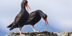
Also known as Second Priest Rock, Little Priest Rock is a large, pointed rock easily spotted near the entrance to Summer Bay. Birds perch on the top and on shorter rocks nearby (many just above the surface of the water). Little Priest Rock attracts many seabirds and shorebirds, including bald eagles, puffins, Emperor Geese, grebes and loons.
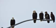
The bald eagle population on Unalaska has fluctuated over the years, and has sometimes been as high as 700. Here, these birds of prey are as plentiful as pigeons are in other cities, giving visitors a rare opportunity to observe our national symbol up close.
Some of the most valuable seabird habitat in the eastern Aleutians is located about 16 miles from Unalaska, east between Akutan and Unalga islands. The group of five volcanic islands are small, but are important nesting grounds for some species that are rarely seen elsewhere.
Chelan Banks is an area where the Bering Sea and Unalaska Bay meet. Fish are plentiful in this upwelling — a real buffet for the birds! You could see thousands of shearwaters, albatross, the rare short-tailed albatross and the very rare mottled petrel.

