Southeast & Eastern Alaska Float Trips
Its Boundaries
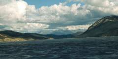
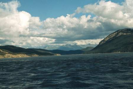
This is that region east of a line from Icy Bay to Mount St Elias. It includes the area around Yakutat, the Lost Coast, Glacier Bay, Lynn Canal and the islands to the south of Juneau, including the Taku and Stikine watersheds.
What It’s Like
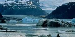
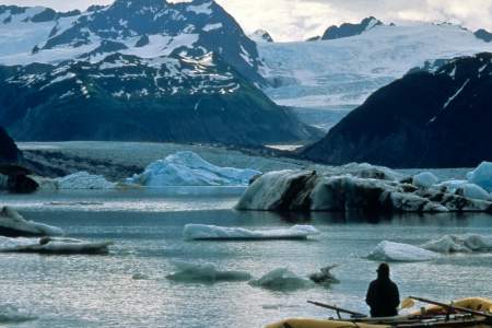
These are typically remote rivers, running along the edge of huge icefields and through huge spruce forests. One exception: The Mendenhall, which offers a fun day trip close to the state capital, Juneau. Indeed, there are countless miles of paddling that you can do in a sea kayak in this region, with Glacier Bay National Park as a major destination; the waters around Sitka are a favorite as well.
Some other highlights:
- The Tatshenshini and Alsek rivers offer some of the greatest wilderness trips in the world
- The Taku River flows out of a lovely aspen parklands in dry interior Canada
- The Stikine River empties straight into the salt waters near Wrangell
Show Map
Float Trips
Southeast Alaska Float Trips

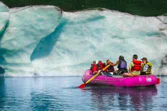
The Tana River is a 36-mile Class IV+ glacial run from the Chugach to Wrangell Mountains, requiring skill for its cold, fast waters. Flowing from the Tana Glacier, a tributary of the Bagley Ice Field, it offers stunning scenery, sand dunes, and tricky rapids. When combined with the Chitina River, a 95-mile trip is possible. McCarthy River Tours & Outfitters is the only company offering guided trips.
The Nizina River flows from the Nizina Glacier into the Wrangell Mountains, offering 45- to 90-mile trips with Class III rapids. A tributary of the Chitina River, it features braided glacial plains, a narrow canyon, and diverse wildlife, including bears, moose, and bison. Surrounded by the St. Elias, Wrangell, and Chugach Mountains, it runs through one of the most scenic and remote wilderness areas in Alaska.
The Nabesna River is a glacially fed Class I‑II river in Alaska, flowing 80 miles from the Wrangell-St. Elias Mountains through canyons and valleys before joining the Chisana River to form the Tanana. It starts steep and swift, then slows as it meanders into the Tetlin National Wildlife Refuge. Ideal for a 3 – 4 day trip, it has no major obstacles but requires constant maneuvering through its busy currents.
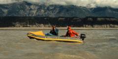
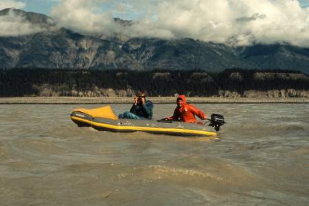
The Copper River drains a vast North American region of mountains, ice, and forests. Its lower reaches flow over 200,000 cubic feet per second, while headwaters carve steep gorges and glacial valleys. Spanning subarctic to temperate zones, it borders the world’s largest nonpolar ice field. The most common trip, from Chitina to Cordova, covers 80 miles in 5 – 7 days. Rafts work well; canoes can be tippy.
The Chitina River flows through a vast Alaskan valley, dividing the Wrangell and St. Elias Mountains. Fed by Logan and Chitina Glaciers, it shaped a mineral-rich region where native populations and miners have long explored. Peaks rise to 16,000 feet as it joins the Copper River. A remote, moderate-difficulty rafting trip, it spans 60 – 112 miles, taking 4 – 10 days through rugged wilderness.
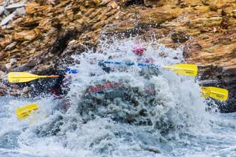
The Alsek River is a powerful, glacial-fed waterway flowing from Canada to Alaska through vast protected wilderness. It features massive glaciers, swift whitewater, and the highest concentration of grizzlies in North America. The journey includes a mandatory helicopter portage at Turnback Canyon and takes 13 – 16 days. Harsh weather and complex logistics make it a true expedition, best suited for expert paddlers.
Expert Advice