Southcentral Alaska Float Trips
Its Boundaries
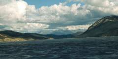
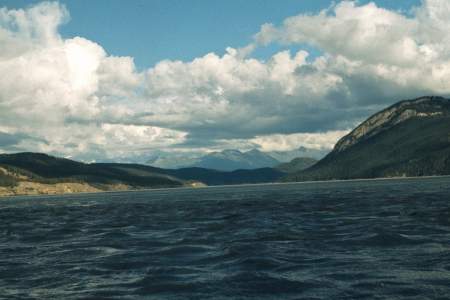
This refers to the rivers flowing south from the Alaska Range and east of the Tordrillo Mountains, north from the Chugach Mountains and the west out of the Wrangell Mountains. All the watersheds of the Susitna, Matanuska and the Copper Rivers are here.
What It’s Like
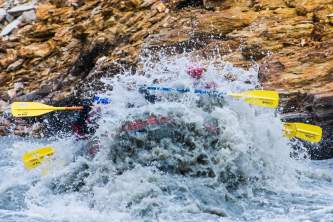
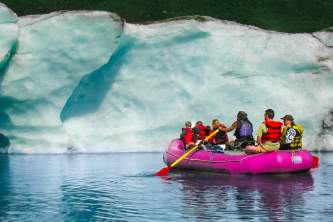
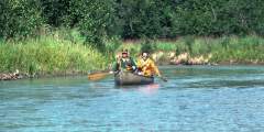
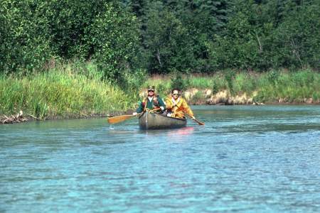
The Southcentral rivers tend to have more whitewater than flatwater, so almost every trip is full of shooting-rapids adrenaline—but you’ll also float through some majestic canyons, and near giant glaciers.
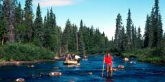
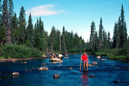
The area offers some great fishing—like at Lake Creek or Talachulitna Creek, which have fishing lodges —but in general, the region’s fishing opportunities are not on the scale of the southwestern rivers. Your consolation prize? The white water found on the Talkeetna, the Chickaloon, the Happy, the Nizina or Copper will give you more than just a fishing trip.
Show Map
Float Trips
Southcentral Alaska Float Trips

Portage Creek is the easiest float near Anchorage, a 1 – 2 hour float down flat water with the option of take outs at mile 4.5 or 6.5. With kids, however, you’ll want to turn it into a half-day adventure, stopping on gravel bars to play and explore. You’re never far from Portage Valley Road, which can provide a sense of comfort. Even though the road does not have a deep wilderness feel, you are surrounded by several-thousand foot mountains which… ...more
Just 40 minutes from Anchorage, the North Fork Eagle River offers a scenic, 7‑mile Class I float with a remote feel. The unbraided river has many bends, making the actual float closer to 8 miles and taking 3 – 5 hours. It’s a great full-day trip, especially with kids, with time for gravel bar play. Despite its gentle nature, sweepers and submerged logs add challenge. It’s more secluded than Portage, with few boats even on busy weekends.
The Talachulitna River, or “Tal,” is a 5 – 7 day float trip through scenic gorges and past the Tordrillo Mountains. It begins with 16 miles of Class I creek, followed by 32 miles of Class I – IV rapids, and ends with 13 miles on the Skwentna River. Best for small rafts and kayaks, it’s a top fishing spot with historic Athabascan significance. The Tal was Alaska’s first catch-and-release-only river for Rainbow Trout.
Overview Six Mile Creek is, perhaps, Alaska’s most accessible technical whitewater run, well suited to kayak or paddle raft, mostly Class IV and one class V canyon. Flowing in the rugged Chugach Mountains of the Kenai Peninsula, within Chugach National Forest, this stream has a reputation of booming whitewater and fast gorge style rapids. A small volume stream, it has 3 distinct canyons, with each one more difficult than the previous. At most… ...more
The Nabesna River is a glacially fed Class I‑II river in Alaska, flowing 80 miles from the Wrangell-St. Elias Mountains through canyons and valleys before joining the Chisana River to form the Tanana. It starts steep and swift, then slows as it meanders into the Tetlin National Wildlife Refuge. Ideal for a 3 – 4 day trip, it has no major obstacles but requires constant maneuvering through its busy currents.
Overview With the Talkeetna Mountains to the north and the Chugach Mountains to the south, the Matanuska River pours forth from the large Matanuska Glacier in a swift, freezing cold, torrent of Class II to Class IV whitewater for nearly 70 miles before it meets the sea where the Knik Arm of Cook Inlet reaches into the interior. The river runs down the trench formed where the Border Ranges Fault line separates the two mighty mountain ranges,… ...more
The Little Su is a clear, warmer Alaskan river flowing from the Talkeetnas. It offers two trips: a Class IV+ whitewater run for expert kayakers and a calmer Class I‑II section ideal for fishing, floating, and camping. Popular routes are 84 or 56 miles, taking up to 5 days. Below the Parks Highway, motorboats are allowed on the second and fourth weekends from Nancy Lake Creek to the Little Su Access Road.
Overview This interesting combination of rivers and lake is a rarely done circuit that would be a great multi-day wilderness float trip for kayaks and rafts. With good fishing opportunities and only Class III at times, it is mostly a Class II trip and for 80 miles it travels through an amazing landscape. The Nelchina River system is a rocky glacial river with daily water level fluctuations amid a forested valley and with spectacular views of… ...more
Lake Creek is one of south central Alaska’s most famous streams, primarily due to its superior salmon runs. King Salmon use Lake Creek and Chelatna Lake as a spawning site and return in large numbers and trout and grayling follow right behind them. Lake Creek is a clear, swift, and at times, very strong river with two sections of Class III+ and IV rapids and many technical boulder garden rapids to get through. The two hardest sections can be… ...more
The Kenai River flows 80 miles from Kenai Lake to Cook Inlet, passing through canyons, whitewater, and Skilak Lake. A 4 – 5 day trip offers stunning scenery, Class III rapids, and world-class fishing. The river is heavily visited, especially in July and August, with powerboats and crowded fishing spots. Most of it lies within the Kenai National Wildlife Refuge, home to one of Alaska’s greatest salmon runs.
The Copper River drains a vast North American region of mountains, ice, and forests. Its lower reaches flow over 200,000 cubic feet per second, while headwaters carve steep gorges and glacial valleys. Spanning subarctic to temperate zones, it borders the world’s largest nonpolar ice field. The most common trip, from Chitina to Cordova, covers 80 miles in 5 – 7 days. Rafts work well; canoes can be tippy.
The Chickaloon River flows from the Talkeetna Mountains to the Matanuska River. A 33-mile Class II-III+ stretch offers fast, continuous rapids with some blind drops requiring scouting. This is not for beginners but is an excellent weekend trip for experienced rafters with good gear and read-and-run skills. The river is glacial-fed, and access to the upper sections is limited, often requiring helicopter transport.
Float Through Anchorage Neighborhoods
Expert Advice