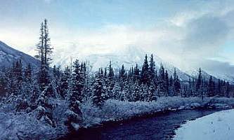
The 23-mile Johnson Pass Trail offers hikers, backpackers and bikers a well-marked route through a lush pass in the Kenai Mountains—featuring gradual climbs, two lakes with fish, spectacular peaks and some way cool gorges. After sufficient snow opens the corridor to snowmachining (often by December), the winter trail gets packed and becomes a great multi-use venue that includes skiing and snow biking. Cyclists often tackle the whole length in a single day, winter or summer, while backpackers or ski campers typically spend one or two nights near Johnson Lake or at one of seven campsites.
A Rare Gem
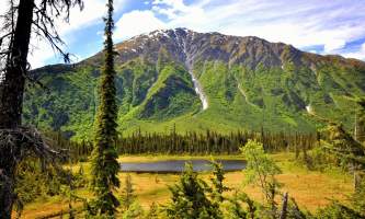
The trail provides one of the Kenai’s least strenuous backcountry adventures with multi-day potential—a family-doable route with only 1,000 feet in total elevation gain that ranges from forested wilderness into the subalpine zone. During high summer, it’s a green, lush habitat with overgrown slopes, whitewater creeks, craggy peaks, and lots of wildlife.
It’s also steeped in gold rush lore. Much of the trail follows or parallels the Johnson Military Road, built in 1907 as a wagon road that helped link Seward with the boom towns of Sunrise and Hope on Turnagain Arm. The route served as a segment in the historic Iditarod Trail across Alaska.
Why So Popular?
Mainly, it’s just so doable. The trail is just the right length for one epic summer day on foot or wheels, or several easy overnights. Also, setting up a shuttle is a breeze. Biking groups regularly drop one vehicle at the south trailhead, then launch from the north trailhead. One hour of commuting, and you’re set to go.
Premier Recreational Cycling Route
Johnson Pass Trail is extremely popular among mountain bikers. Scores of riders often do the route as a one-way day trip during dry, summer weekends. Although sections can be rooty or rocky—particularly in the first few miles from the North Trailhead—much of the trail retains enough of its wagon-road origins to offer remarkably smooth riding. During rainy periods, sections of the trail can flood and be muddy, particularly near the pass or by the lakes. But the challenges are not especially technical, suitable for biking families who can handle 20-plus miles.
When To Go?
The prime summer biking season begins once the trail dries out in mid-June and lasts well into July. NOTE: As the summer matures, brush tends to grow in very thick, with six-foot tall grass sometimes overhanging the trail surface. This “green tunnel” effect makes riding much more challenging, and cycling falls way off in August and September, until frost knocks back the vegetation.
Serene Backpacking
Summer weekdays and late summer-into-fall weekends (after the brush discourages all but the most ardent cyclists) transform the trail into one of the most quiet and lush backpacking experiences on the Kenai. Many people start at the north trailhead and hike south 11 miles to the pass between Johnson and Bench lakes and then return the way they came. Others do the full route, drawn by its relatively short length and mostly flat terrain. Horseback and pack stock campers visit the trail too.
When To Go?
Best backpacking and hiking begins in early-to-mid-June after the trail dries out and lasts into early August. Expect dense brush and grass in some sections—a virtual jungle—from August through fall freeze-up. While the trail is definitely passable to foot travelers in the second half of the summer, conditions may slow you down. If traveling during or after rain, expect to get sopping wet as you push through the vegetation. Consider wearing water-proof-breathable shells to shed the water.
Trail Highlights
- Bench and Center creeks. Starting at the North Trailhead at about elevation 670, the trail skirts the hilly, forested foot of the mountains and then jogs south across a valley, crossing first Center Creek and then Bench Creek on handsome bridges. This 3.6-mile segment—created as a hiking trail and never open to motorized use—features the most challenging cycling of the route with some rugged sections. A mature spruce forest and great views of a roiling whitewater.
- South of Bench Creek. From here, the original wagon road headed northwest on the south side of Bench Creek, crossed Lynx Creek Valley, and emerged at the present location of the Seward Highway west of the East Fork of Sixmile Creek. Remnants of this 110-year-old pioneer route can still be found. The current winter route from the trailhead emerges here. It’s possible to follow rugged trail remnants from the Bench Creek bridge area north to Lynx Creek and return to the trailhead on foot. Most of the route is not bikable. You must be prepared to ford of Bench and Center creeks on foot.
- Mile 5. Groundhog Creek experienced a short-lived and modest gold rush in the summer of 1910 with a tent city springing up south of the bridge. A campsite with a bear box is nearby at Mile 5.3.
- Mile 8 gorge. Watch for a stunning gorge with a long, spectacular view in between two campsites.
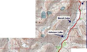
- Halfway is heaven. A sweeping subalpine valley with Bench and Johnson lakes straddle the 1,460 foot-pass between Mile 9 and Mile 11.5, featuring two campsites (one with an outhouse) and fishing.
- The southern half of the trail drops into a dense spruce forest with lots of beetle-killed trees and some grand views of Trail Lake to the southeast.
- Near Mile 17. Watch for the remnants of the old wagon road heading south to the present Alaska Railroad corridor. The original Johnson Military Trail did not follow the present trail along the north shore of Trail Lake but cut south to intersect a station at Mile 34 of the railroad, located about half mile south of the present trail on Trail River northeast of the lake. (Trail mile 6 from the south.) This station is often labeled “Johnson” on topo maps. The current winter travel route, using Trail lake and river, intersects the trail in this area.
Johnson Pass Trail Special Tips
- Expect bugs! The lush terrain has a reputation for generating hordes of mosquitoes and flies after summer green-up and before fall frost. Carry bug dope with Deet, head nets and bug coils.
- Expect bears! Johnson Pass Trail features excellent wilderness habitat for a full range of Alaskan wildlife, including brown and black bears. Note that salmon spawn in the Johnson River, increasing the chances of a bear encounter on the southern 11 miles of the trail. So take the usual precautions: travel in groups, make noise, manage food properly by storing it in vaults and lockers, and carry bear spray for deterrence.
- Try some light-tackle fishing! Bench Lake supports one of the Kenai’s rare grayling populations, and Johnson Lake is known for resident rainbow trout.
Planning Your Trip
Even though Johnson Pass Trail is only 23 miles in length and can “feel” crowded with weekend bike traffic, backpackers and hikers should prep for a backcountry wilderness journey with suitable clothing, food and gear for the season and duration of their trip. Check out our clothing, hiking, backpacking and skiing guides, as well as our primer on Alaska weather. While there are plentiful sources of water along the route, it should be purified before drinking.
In general, Alaska backpacking requires carrying a wider range of clothing than you might pack for a summer adventure in a more southern locale. Alaska’s summer climate swings from chilly rain to hot sunshine, and higher elevations can see wintry temperatures or even snow in any month. On a July outing through the Kenai Mountains, however, you should expect temps to range from the 40s-50s at night to 60s or 70s in the day. Always be prepared for rain or foul conditions, but the Kenai Mountains can experience stretches of dry, sunny weather during summer.
Set Up a Shuttle
If you want to hike from one end to the other, you need to set up a shuttle or book a trip on a local trail taxi. This is a snap if you have two vehicles. The North Trailhead is at Mile 64 of the Seward Highway, with the south exit only about 32 miles by vehicle further south, at Mile 32.5 on the way to Seward, just west of Trail Lake.
Call Wildman’s for a taxi or shuttle. The easiest solution for out-of-state visitors or parties with a single vehicle may be to book a ride! The folks at the Wildman’s store at Mile 47.5 of the Sterling Highway offer a shuttle or taxi service to and from Kenai Mountain trailheads for a group rate of $125 per hour. Call 907-595-1456 to figure out what it will cost for your itinerary and make a reservation.
Keep In Mind
- You will be off the grid. Though relatively short, the trail traverses a mountain valley into a remote setting. Plan on being self-sufficient. If you hike over the pass itself, you will be at least 12 miles from the road system and the nearest outside assistance. Assume you will NOT be able to phone out.
- The Forest Service adds this message: Safety is your responsibility. Be prepared. Let someone know where and when you will return and follow Leave No Trace outdoor ethics along the way.
- Shop before you leave town. Once you leave Anchorage or other towns like Seward or Soldotna for the mountains, there are no specialized camping retailers or large grocery stores along the route. Especially if doing a multi-day trip, plan on leaving town with your trip’s staples and essential gear in hand.
- Seasonal concerns. Johnson Pass can still have deep snow in early June. Sections can remain gooey and muddy into July, and trees can topple across the trail any time. The trail is closed to horses and pack stock April 1 to June 30, and to all motorized use from May 1 to Nov. 30 from Mile 3.3 (Bench Creek bridge) to the south trailhead. No motorized vehicles are ever allowed on the hiking trail between the north trailhead to Mile 3.3 (Bench Creek.)
- Special winter access details. Once snow dumps and creeks freeze, use different access points. From the north trail, take a segment of the Johnson Pass Wagon Road (go down the gated road at the western edge of the parking area) instead of the hiking trail. From the south, use the Johnson Creek winter route—head north across frozen Trail Lake about one mile up the Trail River and access the Johnson Pass Trail about Mile 7.8. Check with the Forest Service to make sure the route has been opened to snow machine travel before going and to get a reading on ice conditions of Trail Lake.
- Winter hazards. There are several snow avalanche paths that impinge upon the trail. If traveling or exploring off trail during snow season, learn to recognize and avoid potential avalanche paths.
For More Information
Current conditions: Contact the Seward Ranger District, 33599 Ranger Station Spur (mile marker 23.5), Seward, AK 99664. (907) 288-3178
For fact sheets, maps and GPS coordinates:
Johnson Pass Trail south access
Johnson Pass Trail north access
Johnson Pass Trail fact sheet and map with GPS (PDF)
Nearby weather
Summit Lake Road Weather (Mile 45.5)
Tern Lake Road Weather (Mile 37)
Grandview on the Alaska Railroad
(In a separate valley a few miles east of Johnson Pass but often reflects similar conditions.)
History


