Skagway Parks & Trails
There's so much else to do in Skagway, few visitors consider it a destination for hiking other than making the epic trek along the Chilkoot Trail. But the National Park Service, U.S. Forest Service and municipality maintain a half-dozen scenic trails leading to historic gravesites, campsites, cabins, glaciers, lakes and beaches. They show of this scenic valley that many cruise passengers miss. Start by picking up a copy of the Skagway Trail Map at the visitor information center on Broadway, or printing the online version.
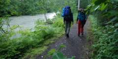
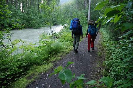
Here's a sampling of some favorites close to downtown. The Lost Lake Trail and riverside sections of Chilkoot Trail make for fun afternoon outings at Dyea, 10 miles northwest of Skagway.
Show Map
Skagway Hiking Trails

Tucked on the mountainside overlooking the cruise ship docks, this moderate hike offers great views down Taiya Inlet and an idyllic camping spot. This 8‑mile round trip trail is unknown even to some locals. It leads through a mixed stand of trees and descends to a beachfront jutting south towards Haines on Lynn Canal.
If you’re in Skagway for a summer job or just a weekend fling, take your bike. Mostly flat terrain and a compact urban layout makes this town a fantastic spot to see on two wheels. There’s even a free bike-repair station out front of Skagway’s public library.
This park across from the Skagway River offers ballfields, horseshoe pitches, a BMX trail, and a disc golf course. Outdoor town events and concerts, including the annual solstice celebration, are held at the park’s stage/amphitheater.
An amazing look at the history of the Alaskan Gold Rush, with the added novelty of hiking from Alaska to Canada. This trip offers a variety of scenery and distinctly different ecosystems: river valley, coastal temperate rainforest, exposed alpine, and arid boreal forest. (CURRENTLY CLOSED TO THROUGH-HIKERS)
This moderate, 2‑mile loop trail near the Skagway River circles a boulder strewn outcropping. It also features sunny lookouts while meandering through a birch and pine forest and leading to a protected cove and picnic area.
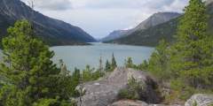
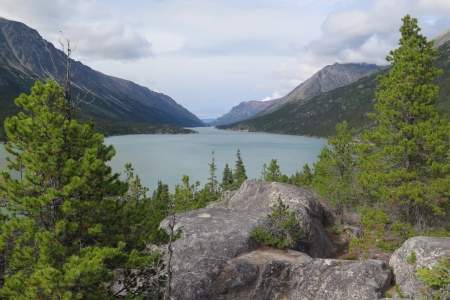
Completing this all-day climb, a 10-mile round trip climbing nearly 5,000 feet, isn’t for beginners. But at the top, you’ll be on the ridge separating the Dyea and Skagway river valleys, with an awe-dropping, 360-degree view. Once above the treeline, some rock cairns mark the way, but the trail can be vague due to heavy brush and rocky terrain.