Palmer / Wasilla Hiking Trails
For more, see our Anchorage Parks & Trails Page.
Palmer / Wasilla lies just 45 minutes from Anchorage. See our list of other area trails that you can get to in about an hour.
If interested in a guided hike, check out our recommendations.
Show Map
Parks & Trails
Why Take This Hike This trail, located 90 minutes north of Anchorage just across the Matanuska River from downtown Palmer, makes no pretense about its purpose. Almost immediately after leaving the parking area, it begins to climb straight up the steep west face of Lazy Mountain. For some 2,000 feet, there’s nary a switchback or respite as the trail winds up to the summit ridge. It’s a truly breathless workout. The Details Out of Palmer,… ...more
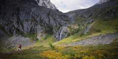
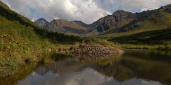
This is a popular, 4.3‑mile-long (8.6 round-trip) trail located 2 hours north of Anchorage in the Hatcher Pass area. It’s also gorgeous. At one point it climbs directly alongside a sheet of waterfalls falling from a wide granite ledge. As the trail winds its way to these falls, it passes the lake into which the falls drain. And after the falls, the trail ends at the tarn from which the falls drain. In other words, hike this trail and you’ll see a ...more
Beginning a 1‑hour drive north of Anchorage in Government Hill Recreation Area, Government Peak Race Trail offers a fine opportunity for a hard workout; it climbs some 3,700 vertical feet in just 3 miles. Plus, this climb doesn’t include any extraordinary dangers. (A friend refers to one short ledge on this trail as “death rock,” but she tends to exaggerate.) Some sections require special care to negotiate, but you won’t have to traverse any ...more
In the Talkeetna Mountains between the towns of Willow and Palmer, Hatcher Pass is a local favorite for recreation or a scenic drive. Hike in alpine tundra dotted with wildflowers and ptarmigan, ski fresh, deep powder, or visit Independence Mine Historical State Park.
No official trail in Southcentral Alaska climbs as high as Matanuska Peak Trail. Beginning in a subdivision across the Matanuska River from Palmer, this nearly 6‑mile-long trail runs up some 5,700 vertical feet. Your destination is the 6,119-foot summit of Matanuska Peak, the very prominent rock spire that fills the sky just east of Palmer. But despite the imposing appearance of this mountain, the trail to its summit requires no extensive ...more
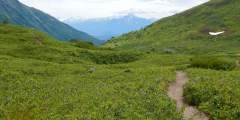
This 4.5‑mile trail, some 2 hours north of Anchorage on the west side of Hatcher Pass, climbs 1,000 feet up a very typical Talkeetna valley — long, broad, and lined with towering peaks on both sides. It also passes by relics and ruins of old mining days, when these valleys echoed with the sounds of picks and drills.
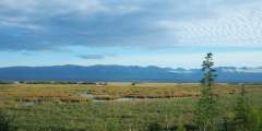
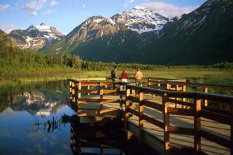
This short, paved trail is an hour’s drive north of Anchorage in southern Wasilla. It leads out to a bluff on Palmer Hay Flats — a large stretch of wetlands with all kinds of wildlife. There, a viewing platform overlooks the flats and the Chugach Mountains beyond.
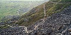
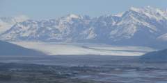
It’s not very often that people can see a glacier in an untamed and remote location, far from any road or cruise-ship route. But if you feel capable and confident enough to climb a very rough trail up many vertical feet of rocky terrain, then you might consider undertaking the hike to Snowbird Pass, located high in the Talkeetna Mountains just north of Hatcher Pass. From this vantage point you can look down the entire length of Snowbird Glacier. ...more
Located one-third of the way from Palmer to Wasilla, this 33-mile trail system meanders through boreal forest, farmland, and the rolling moraines left by the glaciers of the last Ice Age. The trails are some of the only non-mountain, non-motorized pathways in the area, and they’re popular with dog walkers, mountain bikers, geo-cachers, cross-country skiers, runners, and equestrians.
There are some nice long downhills with banked turns, a few shallow creek crossings, and some chunk sections. Most of this trail lies on south-facing hillsides, with views of the Knik River Valley and Pioneer Peak.
Are you a mountain runner looking for a tough workout? Consider Pioneer Ridge Trail. This trail, located a 1‑hour drive north of Anchorage on scenic Knik River Road, climbs some 5,200 feet over its 6 miles. Other trails, like Lazy Mountain Trail and Mount Marathon Race Route, may be steeper or rockier, but no trail in the Chugach Mountains climbs so steadily for so long as Pioneer Ridge.
Some 50 miles north of Anchorage, this 1.5‑mile trail makes for a fine family outing. From the picnic table at the uppermost end of the trail, you’ll find a satisfying panoramic view of the Matanuska River and Knik River valleys. It’s a view as good, or better, than that from many summits.
The 5‑mile-long Eska Falls Trail is located a 2‑hour drive north of Anchorage in the mountains above the town of Sutton. And it leads to one of nature’s symmetrically framed wonders — a 100-foot waterfall located at the end of a mile-long valley that’s flanked by two massive summits. This setting makes Eska Falls not so much a hike to a destination as much as a hike to a presentation.
Visible outside the windows of the Mat-Su Convention and Visitors Bureau, this state wildlife refuge is the result of the 1964 earthquake. Literally overnight, the land dropped by 6 to 20 feet; hay fields and pastureland became salt flats and marshland. Once home to cows and grains, the land is now prime habitat for moose, birds, and fish. Some 20,000 acres are protected in the refuge, which is a popular recreation and wildlife-viewing… ...more
A straightforward trip with big scenery payoffs, like the picturesque Mint Hut and a valley dotted with hanging glaciers. This trip is a great first backpacking trip in Alaska with simple logistics. It’s 16 miles with options for additional miles and side trips.
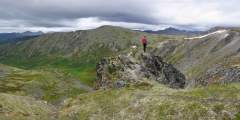
Want to feel dwarfed by Alaska’s mountains? Take a 2‑hour drive north on the Parks Highway and then up Hatcher Pass Road, where you’ll find this 2‑mile-long ATV trail — a wide but occasionally steep path that leads to the crest of Box Lake Ridge. From the big, rounded top of this ridge, you can’t help but feel overwhelmed by the enormous Talkeetna Mountains that surround you.
How to get ThereThe Plumley-Maud Trail can be accessed from the end of Maud Road, or from the corner on Plumley Road near Caudill Road. 1) Access from Maud Road: From Palmer go south east 3 1⁄2 miles on the Old Glenn Highway, take a left on Maud Road, follow Maud Road for 1 1⁄2 miles. There is a small turn around and limited parking before the creek directly east of the road. Please be careful not to block the entrance to the trail or the… ...more
Two trails travel over the Mat-Su College lands; one from the college and one from Snodgrass Hall. The Mat-Su College trailhead leads to a hilly loop and opens to beautiful views of Lazy Mountain, Twin Peaks, Bodenburge Butte, and Knik Glacier — the best mountain views in the entire greenbelt system.
Summit Lake, located some 60 miles north of Anchorage at the crest of Hatcher Pass, offers a short, memorable lakeside ramble. Here you can explore the surrounding gullies and slopes or just sit and watch hang gliders drift out over the long Willow Creek Valley, which extends for miles from the west side of the pass.
Explore the expansive gravel beds or meander along the mighty Matanuska-Susitna River and link up with the Matsu River Park trails, located in the trees to the west.
The Fishhook Trailhead parking lot is located at mile 16.5 of Hatcher Pass Road. This area is actively used year round. In the summer it’s a great area to hike and in late summer the slopes are abundant with blueberries. This trailhead also leads to Marmot Mountain, were paragliders launch from the top and land in the parking lot. In the winter, the area draws individuals to sled, ski and snowmachine. This trailhead intersects with The Hatcher ...more
As you approach the Independence Mine Parking Lot, the trail can be seen to the far right end. It crosses over a small bridge, and winds up past an old abandoned mining cabin, and then up a debris field and finally to the lake. Round trip, the hike is almost 2 miles, and the elevation gain is approximately 600 feet. The trail can be muddy and wet for the first .25 miles, but it’s worth the hike to see Gold Cord Lake, and a great view of the Mine ...more
With a length of just 1.5 miles and a summit reaching only 874 feet, West Butte Trail on Bodenburg Butte — a 45-minute drive north of Anchorage — makes for a fine family outing. But even if you’re a more experienced hiker, don’t let the butte’s dwarf-like height dissuade you. This small bump in the center of a grand alluvial plain offers far-reaching views from its summit; plus, the climb includes a pulse-quickening 0.25 miles of stairs up the steep ...more
Two trails travel over the Mat-Su College lands; one from the college and one from Snodgrass Hall. The Mat-Su College trailhead leads to a hilly loop and opens to beautiful views of Lazy Mountain, Twin Peaks, Bodenburge Butte, and Knik Glacier — the best mountain views in the entire greenbelt system. There are signs indicating what you see in the distance, as well as benches in a few areas. (Be prepared for construction as the college grows… ...more
Very few hikers use this trailhead (most opt for the Matanuska Lakes Trailhead), but it’s a good walk. It’s also very popular for anglers. Be prepared for a rutted gravel access road, which may not be plowed in winter.
Flathorn Lake Trail is approximately 21 miles long and traverses the vast wetlands of the Susitna Flats Game Refuge and rolling hills of the Fish Creek watershed. The trail allows snowmachiners, dog mushers and skiers to travel from the Point MacKenzie area to the ‘Susitna Station’ on the Susitna River. The trail crosses the Little Susitna River, through a maze of frozen swamps and ponds, along Fish Creek, across Flathorn Lake before heading… ...more
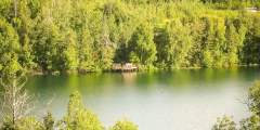
This trailhead is just 100 yards from Matanuska Lake (the area’s most popular lake), and is wheelchair-accessible down to the lake and the fishing docks — it’s a great walk in the woods, past prime waterfowl habitat.
This 2 mile round trip hike begins right at the Summit Lake Recreation Area parking lot at the crest of Hatcher Pass.
Located north of Wasilla about 45 minutes on the west side of the Parks Hwy. Lakes are all connected with trails, and make for a great day of canoeing. They can also be skied in the winter and campgrounds are available as well. This hike can only be done in winter or the lakes will not be frozen enough to walk on.
On the west side of Bodenburg Butte, this somewhat steep trail leads to the top of the butte, which juts out of the valley and offers panoramic views of all the area’s top features: Matanuska and Knik River valleys, Talkeetna Mountains, Pioneer Peak, and even the Knik Glacier. The first ½ mile is a wide gravel path through spruce and alder trees, and there’s a bench where you can sit and enjoy a nice view of the Talkeetna Mountains and… ...more
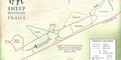
This amazing trail system was started by miners 50 years ago, and today they are maintained by Sheep Mountain Lodge Sheep Mountain Lodge owner Zack Steer. Zoom down Thriller on your mountain bike, enjoy a picnic with a view at the top of Corkscrew, search for a geocache site or come berry picking in the fall. There are 12 miles of maintained trails, which are groomed for cross-country skiing in winter. Peak blueberry season is from Aug. 15… ...more
Access to the Palmer-Moose Creek RR Trail is slightly tricky. Parking is available in the wayside. Cross the highway, then follow the creek side trail to the old railroad bed and trail.
Alcantra Athletic Complex Trail System has approximately 1.6 miles (2.5 kilometers) of trails which form two loops; one short loop around the baseball fields and another longer loop that parallels the residential area to the south. There are two shorter trails that connect the athletic fields, Larson Elementary School and Teeland Middle School to the loops. Most of the trail network traverses gentle terrain through a mixed forest of birch and ...more
This trail leads to numerous mines in the area. This is a great place to explore old mining sites and get some pictures, as well as gold pan. This is a good day hike and can be long or short depending on what you want to do. Be sure to take the whole family on this one!
This is a mellow, 1.1‑mile-long, family-friendly loop trail, easily accessible from the Glenn Highway. The highlight is the built-up viewing deck, where visitors can get a breathtaking view of the Knik Arm, the surrounding mountain ranges, and the Palmer Hay Flats. Bring binoculars.
Only a few miles outside of Palmer, this popular winter recreation area features groomed cross-country skiing trails that are also open to snowshoeing and skijoring. The upper trails are designed for novices, while the lower trails are meant for experts. If you really want to go big — and have good weather — access the Lazy Mountain Trail and climb high into the alpine, with views of the Matanuska and Knik River valleys. (Note: To avoid a… ...more
You’ll get stunning views of Knik Glacier, the Knik River, and the Chugach mountain range. Watch for eagles, either conversing on the sand bars or soaring overhead.
This is a short day hike, but a fantastic fishing spot. There are many lake trout, grayling and whitefish. It is one of the best fishing spots in the area. Fox, bear, moose and caribou are often seen in this area and there are good berrypicking opportunities along the trail.
Explore its many branches and beautiful views. You’ll also be rewarded with flat, gentle hiking, all with gorgeous views.
You’ll find even more playgrounds that take advantage of the unique assets of their locations. Here’s a list of our top picks!
The hiking here is mostly flat with a few forested hills, and there are nice views from the fields overlooking Matanuska Lake. For beginner hikers and bikers, this is the best place in the greenbelt for easy walks.
With flat stretches and steep hills (that are groomed in winter), this trail is very popular with mountain bikers, trail runners, and cross-country skiers. It was built on landfill, so as it expands, these trails will change. Most of it is rolling forest that has covered the gravelly moraines left by retreating glaciers.
A steep trail leads down to the creek from the gravel parking lot. Only pedestrian traffic is allowed on the trails (sorry, no ATV’s). The trail is difficult going at times due to its steep grade and lack of upkeep so watch your footing and perhaps take a hiking stick.
Beautiful ponds, waterfalls, and mountain scenery make this a worthwhile hike. Many birds, Arctic Ground Squirrels and even a few ducks can be sighted enroute. The trail ends at Lane Hut at the end of the Valley. Extra exploring opportunities are everywhere!
This is a challenging trail with views that make the enduring climb worthwhile.
The Matanuska River Park features almost two miles of family-friendly trails just minutes from downtown Palmer. Trails meander between the adjacent campground and the Matanuska River, rolling gently through old-growth forest.
This is a wheelchair-accessible trail that is for walkers. This is not a challenging running trail. The trail offers a beautiful panorama of Three sisters, Pioneer Peak, Knik Glacier, Bodenburg Butte, and the Talkeetnas. The observation deck overlooks Okeson Pond.
This trail provides spring, summer and autumn waterway access to remote Refuge wetlands as well as the upper reaches of Knik Arm. Recreational opportunities include fishing during the summer and waterfowl hunting access each autumn. When winter conditions are right, ice-biking is popular as well.
At the Government Peak Recreation area you will find an extensive trail system for nordic skiing, walking, hiking, fat tire biking, and mountain biking. The newest addition is a Chalet that is available to warm winter visitors. It’s also available for rent.
Easily accessible from downtown Palmer, the trail follows a sometimes narrow path along bluffs above the glacially fed Matanuska River. Traveling from the Palmer side, views of the Chugach Mountains peek through birch and cottonwood forest.
This riverbed trail follows the Knik River towards the Knik River Glacier, with Pioneer Peak looming above. Hike this trail and you’ll understand why Pioneer Peak is called “The Watcher.” Head east towards the Chugach Mountains, meanwhile, and you’ll get a glimpse of the Knik Glacier, glittering 20 miles in the distance.
The trail begins at the end of Archangel road. It meanders through alders and brush, gaining elevation slowly at first. Eventually it will lead you to a cabin up in the alpine meadows.
Just past Archangel Road, you will see a pullout on the left. In the winter months, this is an extremely popular spot among backcountry skiers and snowboarders. However, this steep, unmaintained freestyle is not recommended for novices. During the summer months the trails are used for mountain biking.
This well-maintained Borough trail is great as a standalone hike through dense boreal forest or as a connection point to Lazy Mountain or Matanuska Peak.
Part of the Palmer Hay Flats State Game Refuge, this trail meanders through tidal flats and wetlands. Highlights are great views of the mountains surrounding Palmer (Pioneer Peak, the Chugach and Talkeetna ranges) and excellent bird watching.
How to get ThereAccess to the Lake Lucille Park Trail System is located at the north end of Endeavor Road in Wasilla. From Wasilla — go south on the Knik-Goose Bay Road, 2 miles from Wasilla take a right on Endeavor Street and follow it for 1⁄2 mile to the park entrance and parking areas.General DescriptionLake Lucille Park has approximately 1.6 miles (2.5 kilometers) of trails built around the perimeter of the park and connecting the athletic… ...more
The Talkeetna Mail Trail and Central Trail are year round, multi-use trails that run north south between Willow Creek and the Kashwitna River. The trails were originally used for hauling mail, but recent logging has opened new access and short dead-end trails leading both east and west. Some of the trail crosses wet areas that are sensitive to heavy use. Plans are underway to harden or relocate portions of the trail to better accommodate year… ...more
A winter trail system consisting of a series of loops that allow dog mushers (and other nonmotorized trail users) to travel 3, 5, 7, 10, 12 or 16 miles depending on the route one takes. The trails traverse large swamps and Black Spruce forests and are generally wide enough for one dog sled (3 – 5’). In some places along the trails the tracks are wide enough for two sleds to pass. The trails must be traveled in a specific direction to avoid… ...more
This trail is part of the historic Chickaloon-Knik-Nelchina Trail System and, in the early summer, almost always has Dall sheep birthing low on the mountain sides. There are moose here all the time. Be careful when crossing Boulder Creek.

