McCarthy-Kennicott Parks & Trails
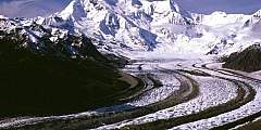
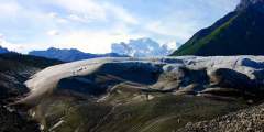
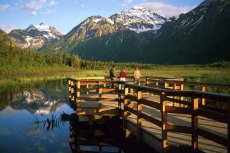
Experience the grandeur of the Wrangell Mountains by exploring the trails. Take the popular 4-mile long hiking trail that winds alongside the Kennicott and Root Glaciers. Or, if you are looking for an in-town stroll, take the Wagon Road Trail which connects McCarthy and Kennicott via a 1.5 hour walk. The trail was once the walking/wagon road when the railroad was still running. You can access the trail both from McCarthy and Kennicott.
Show Map
Parks & Trails
To get a little further away from civilization, you can also camp at the end of the Root Glacier trail, about 4 miles from Kennecott. This is hardly a traditional campground; there are a few creative spots to pitch a tent, one of which is on the trail itself. There’s also a bearproof food storage box, since this is definitely bear country. But few people and amazing views make the hike out here worth it. You’ll know you’re at the end of the… ...more
Getting out to the Kennicott Glacier is the first challenge. You need to hike onto the Root Glacier, cross over the monster rock moraine to your left, cross another tongue of ice on the Root Glacier, then cross yet another monster rock moraine between the Root and the Kennicott glaciers. It’s tricky terrain and not to be taken lightly. When facing down the second moraine, you’ll want to hit the low point that’s close to where the black mud… ...more
This route begins at the Park Service and Information Station. Follow the flags, and they will lead you to an unmaintained footpath. This trail requires a lot of bushwacking and the footholds are not strong, especially after the first four miles.
Liberty creek is accessible via Liberty Creek Campground. The campground surrounds a clearwater creek at the bottom of a beautiful waterfall. Campgrounds are on either side of the creek in a surreal setting.
Looking for a mellow 3- to 4‑hour walk and a nice spot to relax with a book or a journal? Check out McCarthy Creek. To get here, just walk straight through McCarthy’s Main Street, past Ma Johnson’s Hotel (on the left), down the hill, and past the Wrangell Mountain Center.
If you’ve spent the day in Kennicott, on the glacier trail, or in the mountains and still can’t get enough of the outdoors, skip the shuttle ride down the hill to McCarthy and take this nice 1.5‑hour walk. The Wagon Trail cuts off the main road just to the right of the St. Elias Guides office.
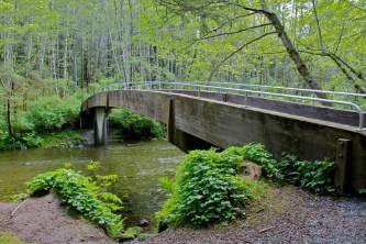
Copper brought people to Kennicott/McCarthy, and gold kept them coming, usually via Dan Creek Road. The Cordova Chamber of Commerce built this road back in 1914 to promote access into the gold-rich interior of Alaska. Today you can use this road to get to the old airstrip, a miner’s cabin at the top of the bluff above McCarthy Creek (a 25-minute walk from McCarthy), and the Nizina River, some 9 miles away. Watch for the bridge over McCarthy… ...more
This historical trail through the woods between McCarthy and Kennicott was the walking/wagon road when the railroad was still running. It’s a nice alternative to walking or biking up the 4.5‑mile-long road between McCarthy and Kennicott, where you’ll find more vehicles and dusty conditions.
Camp right at the toe of the Root Glacier, in a National Park Service camping area. This is a great way to experience the glacier without the traffic of hikers and tourists that pass through during the day. The area has a few camping spots carved out of the hillside, as well as bear boxes (and there’s another just past Jumbo Creek). Jumbo Creek is the boundary for camping – with no permission to camp before you cross it. Be wary of bears: In… ...more
Located in Wrangell-St. Elias National Park, this 4.4‑mile trail takes hikers through a rugged landscape of ice, rock, and streams. It’s a moderately challenging hike that offers stunning views of the glacier and surrounding mountains.


