Mat-Su Valley Cross Country Skiing
Explore miles of groomed and backcountry trails on cross-country skis in the Mat-Su Valley, just 45-minutes from Anchorage.
Show Map
Cross Country Skiing
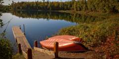
This recreation area is just a mile and a half from town, but it feels like wilderness — with deep woods and several lakes, it’s a great place to hike, run, canoe, fish, or look for wildlife. In winter, cross-country ski, walk, or fat bike on the multi-use trails.
In the Talkeetna Mountains between the towns of Willow and Palmer, Hatcher Pass is a local favorite for recreation or a scenic drive. Hike in alpine tundra dotted with wildflowers and ptarmigan, ski fresh, deep powder, or visit Independence Mine Historical State Park.
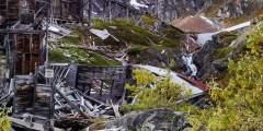
At its peak, the Independence hard-rock gold mine was home to 206 workers and 16 families who lived high above tree line. Digging and blasting, these workers recovered 140,000 ounces of gold before the mine shut down in the wake of World War II. There are 1.5 miles of paved walkways throughout the site, with informational placards for a self-guided tour.
At the Government Peak Recreation area you will find an extensive trail system for nordic skiing, walking, hiking, fat tire biking, and mountain biking. The newest addition is a Chalet that is available to warm winter visitors. It’s also available for rent.
Located north of Wasilla about 45 minutes on the west side of the Parks Hwy. Lakes are all connected with trails, and make for a great day of canoeing. They can also be skied in the winter and campgrounds are available as well. This hike can only be done in winter or the lakes will not be frozen enough to walk on.
March is the month to get outside. The days are longer and the weather is starting to warm, but winter still has its icy grip. To avoid going stir crazy or for some good, clean Alaskan winter fun, head north to Trapper Creek for the Cabin Fever Reliever. Held the second Saturday in March in this picturesque small town (there are great views of Denali), the celebration includes a pancake breakfast, a raffle, cross-country ski races, games, ...more
With flat stretches and steep hills (that are groomed in winter), this trail is very popular with mountain bikers, trail runners, and cross-country skiers. It was built on landfill, so as it expands, these trails will change. Most of it is rolling forest that has covered the gravelly moraines left by retreating glaciers.
A winter trail system consisting of two north-south trails and one east-west route that allow snowmachiners, dog mushers and skiers to travel the area lying north of Petersville Road and west of the Parks Highway. The combined mileage of the trails is over 50 miles.
How to get ThereAmber Lake-Trapper Lake Winter Trails are west of the Susitna River. There are three trailhead parking areas along the Parks Highway. Each trailhead and associated trail are listed below:Milepost 82.5 Parks Highway (Trapper Lake Trail) Milepost 89 Parks Highway (Parker Lake Trail) Milepost 105 Parks Highway (Trapper Lake-Rabideaux and Amber Lake Trails) General DescriptionThe winter trail system lies west of the Susitna River… ...more

