Kodiak Points of Interest
Show Map
Points of Interest
Look for salmon and bald eagles here.
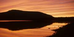
This quiet lake is lined with USCG housing, and has excellent views of Barometer and Pyramid Mountain. Stop by Lake Louise in the evening for a beautiful sunset.
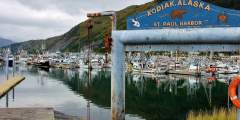
Come to this downtown harbor to see salmon-fishing boats, longliners, and crabbers, as well as guide-operated sport-fishing boats and personal sailboats. There are 250 slips here, accounting for roughly one-third of the boats in Kodiak. Walk the docks and see if you can identify a trawler, seiner, or crabber. The fishermen will have already “pitched” their catch, but you can still watch them chopping bait, mending nets, or shoving off for… ...more
There’s a radio receiver & emergency phone available to the right.
Watch the bustle of the seafood industry and get great photos of a truly giant ship — the Star of Kodiak is 441 feet long and can hold 10,000 tons of cargo! Produced as part of a five-year government program during WWII, this ship was constructed in Portland, Maine and originally named the Albert M. Boe. Launched in 1945, it had only one year as an active military ship and saw very little action. Part of an improvised effort to get Kodiak back… ...more
Aptly named, this island is close to town (you can walk over the bridge or drive here) and is an interesting place to explore by foot, bike, or car. The island is home to St. Herman’s Harbor (where big boats dock), a float plane landing site, and the Fisheries Research Center. You can also spot sea lions from Ramp 3 at the boat harbor.
This is a well-used and busy ATV road that leads up the American River and over a pass to Saltery Cover. It is only open to trail bikes, ATVs and hikers. While it is possible to hike the road, be aware that you will need to ford some streams.
Stop off at the bridge and fish or raft on American River (there’s a good fishing spot to the left when you get to the bridge).
This road was named for the designer of the Alaska flag. Ben Benson created the navy blue flag with the stars of the big dipper and the North Star when he was just 13, in 1927. “The blue field is for the Alaska sky and the forget-me-not, an Alaskan flower. The North Star is for the future state of Alaska, the most northerly in the union. The Dipper is for the Great Bear — symbolizing strength,” he wrote when submitting his design. It was… ...more
Deadman’s Curve provides panoramic views of the harbor and outlying islands.
About 20 minutes from Kodiak, Womens Bay is a census designated place within the Kodiak Island Borough. Roughly 700 people live in the area, and as with the rest of the island, Womens Bay is also home to abundant wildlife. If you’re by the water, check for Sea Otters and Sea Lions. You might even see a Harbor Seal! Or if your’e interested in Kodiak’s boats and aircrafts, USCG C‑130 aircraft and helicopters may be seen on hangar apron, and… ...more
Monashka Bay with Monashka Mt. in the background.
This scenic, tranquil bay is a great place to access the water (there’s a boat launch) and to start hikes. You can hike to a beaver dam from a turnoff on the right at MP 11.6. Look for the white granite in the cliffs; this is the “backbone” of the geology here, the rock that the island is formed upon. From the end of the road, there is good hiking to a waterfall. To the right is a 2.5‑mile trail to Cascade Lake. You’ll have to cross the Red… ...more


