Fairbanks Parks & Trails
Fairbanks is known as the gateway to the arctic, being the primary access point to all adventures that travel above the Arctic Circle. That’s a huge area of trails and wilderness worth exploring. But there are also plenty of opportunities to get out in the immediate vicinity with stunning scenery, winding waterways, and a high probability of wildlife encounters as your reward.
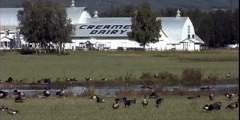
In fact, many of Fairbanks’ best opportunities to explore fall within city limits. Trails traversing historic sites allow visitors to connect with the past, including Creamer’s Field (on site at a historic dairy). The Chena Riverwalk spans downtown Fairbanks and passes by the original site on which Fairbanks was founded in 1901. These are pleasant and easy options that can fit into any schedule (particularly underneath the midnight sun).
Day hikes start right at the edge of town, on the UAF Trail System or atop Murphy and Ester Dome. The rolling hills outside of Fairbanks provide quick access to great views of the Alaska Range (including Denali) and Fairbanks on a clear day.
Strap on a backpack and bring along the bear spray for longer forays into the Interior’s wilderness on well- trod trails at Angel Rocks, Granite Tors, and Wickersham Dome. Each boasts panoramic top-of-the-world views and are suitable for multi-day excursions. Many of these trails also have shorter sections available if you’re only looking for a day hike.
Show Map
Fairbanks Hiking Trails
This path was constructed to provide a place for hikers to view the plantlife around interior Alaska. This is a unique trail that allows hikers to view things that would be impossible to hike without a trail. There are all types of wildlife and small plants. Waterboots are recommended in spring.
This 15-mile loop is well worth the moderate to strenuous hike. This trail provides views of tors, unusually shaped outcroppings that were formed 70 million to 90 million years ago when molten rock pushed upward and cooled before reaching the surface.
The White Mountains National Recreation Area is home to 200+-miles of trail traversing a million acres of wilderness and a mountain range named for the dominant color of its limestone foundation. To get there, drive 28 miles on the Elliott Highway from Fox (where it splits with the Steese) and look for signs marking the trailhead. The trailhead is the starting point for both the Summit Trail, and the Ski Loop Trail, a 5‑mile loop and a nice ...more
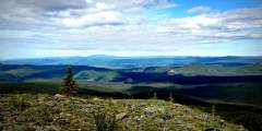
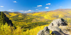
Easily one of the most scenic drives in the Interior, the trip out to Table Top Mountain from Fairbanks winds deep into the center of White Mountains National Recreation Area, rising up hillsides and dipping down into valleys for a rolling picture show of spruce forest and snaking riverbeds. The hike to Table Top Mountain is just as spectacular, providing panoramic views of the White Mountains from the center of the range, and is a short “must ...more
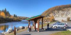
The Chena Riverwalk makes for a relaxing self-paced stroll along the Chena River and through the most scenic parks and plazas of historic downtown. It’s best when flowers are in full bloom (July-August). The path stretches approximately 3.5 miles between Pioneer Park and Airport Way, with longer options available. Or — park at Immaculate Conception Church or in the Downtown Transportation Center for a shorter jaunt.
A winter use trail that accesses two cabins; Angel Creek Lower Cabin and Angel Creek Upper Cabin. It’s possible to hike in during the summer, but the ground is usually very wet, so it’s advisable to take the new summer trail to the upper cabin. It leaves from near the lower cabin and traverses the hillsides for several miles before descending to the upper cabin.
This is the site of the original airfield in Fairbanks, from which the first airplane to leave the ground in Alaska took flight in 1913. Today, residents often use the grassy open areas to fly kites, exercise their dogs, or have a picnic. School children walk between the library and elementary school that border the park to the east and west. Wildlife sightings are always a possibility, particularly for birds and moose.
A short or long day hike awaits at Angel Rocks, a scenic drive out Chena Hot Springs Road and within easy range of the rejuvenating waters that have drawn travelers for over a century. The best option for a short day trip in this area is the 3.5‑mile loop that begins on even ground along the north fork of the Chena River and then sharply climbs up 900ft. For a longer hike to end with a refreshing dip in natural hot springs, park at the same ...more
Recreational and competitive cross-country skiers alike are passionate about Birch Hill Recreation Area; a favorite among locals with its extensive and challenging trails that are always well-groomed, for both classical and skate skiers.
One of the best trips near Fairbanks features incredible views, excellent walking, and easy logistics. For much of the route you’ll follow rock cairns accompanied by mileage posts as you cruise through undulating alpine terrain. This is a suitable trip for a beginner backpacker who has a high level of fitness.
From the top of the domes, take the side trails to the south sides of the hills and look for both blueberries and cranberries.
This is an extension from Lower Angel Creek Cabin and serves as the summer access route to reach Upper Angel Creek Cabin because the winter route is too wet to hike until the trail freezes.
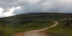
Murphy Dome is a recreational site most popular with ATV riders and hikers. It lies about twenty miles outside of the Fairbanks, most of which are traveled on Murphy Dome Road off of Sheep Creek Road which can be accessed from the UAF campus. This Dome is also a popular place to watch sunsets in the summer and fall, or to observe the northern lights in winter.
Once a small dairy owned by a couple named Creamer, this land is now an extraordinary wildlife refuge. More than 100 species of birds and mammals call this wilderness home (sandhill cranes and mallards show up all summer), and there are miles of trails that meander through a variety of habitats.
This is a moderately difficult 5 mile long trail that begins and ends at the Wickersham Dome Trailhead at Mile 28 Elliot Highway. This trail offers beautiful views of the Alaska Range and Denali (Mt. McKinley).
This public use area roughly 2,000 acres is sandwiched between Sheep Creek, Goldstream and Ballaine roads. The area is criss-crossed with dog mushing, skiing, skijoring and snowmachine trails. This is also is a popular blueberry-picking spot.
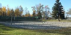
Growden Park is an expansive park situated in downtown Fairbanks. Growden’s playground and open play areas are popular with Fairbanks families, and utilized for a variety of recreational activities ranging from frisbee football to medieval arts and role playing.
Grapefruit Rocks is on the short list of favorite spots for local rock climbers, who make frequent weekend trips to these limestone formations and boulders standing 50 miles north of Fairbanks. Grapefruit Rocks is both “off the beaten path” and yet still accessible by road, and offers some of the best rock climbing in the Interior. It makes for a great day hike to watch climbers attempt runs on a variety of limestone facades. Feeling bold? ...more
The idea of this downtown plaza stemmed from a celebration of the silver anniversary of Alaska’s statehood in 1984. Through the work of Festival Fairbanks, Inc. ’84 Director, William R. Wood, the Fairbanks City Council supported the creation of the Golden Heart Plaza. Construction was completed in 1987 and funded by donations from Fairbanks citizens, families, businesses, and associations.
This hike is great for the early-rising fly fisherman. The lake is full of grayling and there are often caribou, moose and bears along the trail. The hike follows an old mining trail that parallels the Susitna River to Snodgrass Lake. There are many active mines along this hike and be sure to keep an eye out for grizzleys.
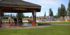
Located on Santa Claus Lane, the Terry Miller Memorial Park features a picnic area, children’s playground, a spacious gazebo donated by the North Pole Rotary Club and an up close view of the Alaska Railroad as it passes by.
One of the ways in which the University of Alaska Fairbanks (UAF) distinguishes itself is through an institution-wide affinity for the outdoors (their newest slogan is “Naturally Inspiring”). And much to the delight of students and residents, UAF maintains an in-town trail network for skiing, hiking, snowshoeing, biking, and running that is directly accessible from campus (also very popular with dog walkers).

