Eagle River Parks & Trails
Embark on an exploration of Eagle River’s remarkable parks and trails, just 20 minutes north of Anchorage. Immerse yourself in nature’s playground as you hike, bike, or stroll through stunning landscapes, including notable trails like South Fork and Mt. Baldy.
Show Map
Parks & Trails
If people suggest climbing Flattop, tell them you’d rather climb Rendezvous Peak. Flattop is arguably Alaska’s most popular (and therefore, most crowded) mountain; Rendezvous is far less crowded and offers better views from the summit. See them by hiking up 1,500 feet to the 4,050-foot summit.
Forty minutes from downtown Anchorage lies Eagle River Nature Center, a gateway to Chugach State Park and a glacial river valley as wild and dramatic as any in Alaska. Enjoy an easy, 3‑mile nature walk on the Albert Loop or trek up-valley 5 miles to see plunging waterfalls and 3,000-foot cliffs. In winter, traverse the trails on cross-country skis or snowshoes.
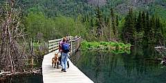
If you don’t mind the 45-minute drive from Anchorage up to the Eagle River Nature Center, where this trail begins, this trail is one of the most scenic easy hikes anywhere near Anchorage. You’ll walk a well-maintained loop that passes through beautiful forest, over a couple nice wooden bridges, past beaver deams, and along the swiftly flowing glacial waters of Eagle River.
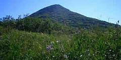
The trail goes up for a short distance and then joins with the original trail which is more direct but it crosses private property. Continue up, and when you get to the saddle, you can turn right onto the Mt. Magnificant Trail to follow the ridge that ends at the mountain, or left continuing along the original trail. The trail offers nice views of Cook Inlet and even Denali on a clear day.
Short, flat hike to access main braid of Eagle River. Walk is approximately one mile through woods. To the right of the parking lot is a smaller braid of the river that blends into main channel in about 1 mile as well. The river at this point can be floated very easily, but unless you have experience with rapids, recommend you get out at the bridge. Although the bridge is only 5.5 miles from where you put in as the crow flies, the river is… ...more
It’s not as difficult as you might think to hike to stand atop the precipitous, gully-scarred face of Bear Point. But it’s not easy, either. The 2‑mile hike ascends 2,100 feet and can be tricky. But your reward is an amazing view in all directions, from the Kenai Peninsula to Denali and the Chugach Mountains to Matanuska Peak.
This is a flat and easy trail. There is no bridge at South Fork Eagle River like you would expect. This is a nice ski trail as well. The trails continue on to the opposite side of river.

