Chugach State Park Parks & Trails
Chugach State Park is a day-hikers paradise with treks of every flavor and ability level. More than 280 miles of maintained trails launch from a dozen major trailheads, stretching from Eklutna Lake in the north to the mid-Hillside above suburban Anchorage to the Turnagain Arm fiord in the south.
You can find the itinerary that works for you, whether you seek a leisurely stroll to a stunning overlook close to the parking lot or want to spend the whole day traversing mountain ridges. Whatever your ambitions, don’t hesitate to visit prospects that ultimately reach many miles into the backcountry or warn of strenuous sections. Alaskan families and people with limited time regularly hike out-and-back from almost every trailhead. Go as far, or as little, as you like.
Looking for a guided option? Contact Traverse Alaska. They offer custom day hikes, backpacking, packrafting, and more.
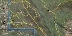
Show Map
Parks & Trails
Forty minutes from downtown Anchorage lies Eagle River Nature Center, a gateway to Chugach State Park and a glacial river valley as wild and dramatic as any in Alaska. Enjoy an easy, 3‑mile nature walk on the Albert Loop or trek up-valley 5 miles to see plunging waterfalls and 3,000-foot cliffs. In winter, traverse the trails on cross-country skis or snowshoes.
If people suggest climbing Flattop, tell them you’d rather climb Rendezvous Peak. Flattop is arguably Alaska’s most popular (and therefore, most crowded) mountain; Rendezvous is far less crowded and offers better views from the summit. See them by hiking up 1,500 feet to the 4,050-foot summit.
Some 50 miles north of Anchorage, this 1.5‑mile trail makes for a fine family outing. From the picnic table at the uppermost end of the trail, you’ll find a satisfying panoramic view of the Matanuska River and Knik River valleys. It’s a view as good, or better, than that from many summits.
This trail quickly gains elevation on its way to an alpine meadow framed by the dramatic Twin Peaks and Goat Rock, but climbs to magnificent views overlooking the entire valley. Dall Sheep are often spotted above the timberline. From here there is a spectacular view of the lake below. This is also a good place for berry picking in the fall. Because of the crushed rocks, the trail is hardly ever muddy.
Rarely do two lakes lie within a few feet of each other. Fortunately, the trail to see this geological rarity begins just a 30-minute drive north of Anchorage. From the trailhead for South Fork Eagle River Trail, it’s a gradual 4.8‑mile (one-way) climb up a wide valley, leading to a narrow isthmus between the green waters of Eagle Lake and the blue waters of Symphony Lake.
You don’t have to be a mountaineer to reach the summit of O’Malley Peak — the prominent spire rising from the Front Range above Anchorage — but don’t mistake it for an easy climb. Some of the 5‑mile-long trail climbs quite steeply; other parts add very loose gravel to the incline. Still, these conditions don’t make this hike excessively dangerous, just satisfyingly laborious.
Considered to be one of the best hikes in all of the Chugach Mountains, Crow Pass follows a portion of the original Iditarod Trail, including its highest point. End to end, it’s a 21-mile trail, which most people do in 2 days, but just the first 4 miles will lead you past some breathtaking scenery. Along the way you’ll find glaciers, waterfalls, wildflowers, wildlife, mine ruins, and berries (in late August and September). Hiking is not ...more
This trail has its own sitting area and viewing deck with views of Anchorage, the Alaska Range, and Cook Inlet. It is really good for seeing sunsets in the evening but it is also windy. The whole route is wheelchair accessible. This is a good short hike for the family to see the view over Anchorage, but not a good trail for the training runner.
Flattop is Alaska’s most visited peak. Ascend the 1.5 — mile, 1,350 vertical foot trail to the rocky, football field-sized summit in about an hour and take in panoramic views from Denali (Mt. McKinley) to the Aleutian Islands. If you want vistas without the hike, walk the short path from the parking lot to the overlook.
You’ll have a hard time losing your way on this 2.5‑mile climb of 4,301-foot-high McHugh Peak. You’ll also have a hard time forgetting the view from the summit, which extends up the length of Turnagain Arm and across Knik Arm to the Alaska Range. It’s even more satisfying knowing that you found your way to the summit with only minimal help from the trail.
Who can say no to a cool waterfall only a half-hour’s drive from town? One of the most popular “first hikes” for families with small children, the one-mile trail to Thunderbird Falls traverses a handsome birch forest along the Eklutna River canyon to reach a deck with views of a 200-foot waterfall. During winter, the falls can freeze, forming fabulous columns of blue ice.
The easy-to-follow Ptarmigan Valley Trail guides you through forested slopes and eventually to open alpine tundra in the Ptarmigan Valley. It starts out relatively steep and gradually climbs until you hit the tundra above the tree line.
If you only have a little experience doing off-trail hiking, then this scenic 5‑miler will help you get a bit more under your belt. Beginning on Rabbit Creek Trail, in the Front Range just above Anchorage, this hike visits a surprisingly expansive and scenic plateau that remains hidden from sight until you actually climb to it.
Not everyone should undertake this 13-mile traverse that begins at Glen Alps above Anchorage. Considerable off-trail hiking, plus a steep climb to a ridge top, might be outside your comfort zone. But this trail does offer a profound sense of solitude and some spectacular views. It also includes the novelty of hiking a mile-long sheep trail that traverses the back of The Wedge, some 500 feet above the secluded waters of Ship Lake.
Trail is narrow and stream crossings not bridged. Wilderness character, woodland vegetation, small lake.
This trail is an offshoot of the South Fork Trail that leads to Eagle and Symphony Lakes. It provides some awesome views of the Eagle River Valley and South Fork Eagle River as it works its way up into the hanging valley perched above the Eagle River Valley floor. The final destination for most hikers, near the end of the valley, is the hidden Hanging Valley Tarn, nestled in a secluded cirque. This is an excellent camping area garlanded with… ...more
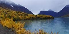
Long, beautiful hike. 1st five miles flat and easy, so you can ride your bike in and ride on in the woods. Spectacular view of Eklutna lake below and Bold Peak. This long day hike or overnight trip offers one of the best panoramas in Chugach State park and is good for berrypicking in the fall. Bikes are available for rental at the trailhead.
This wide trail continues from mile 4, up the valley to the Bird Creek crossing. A less developed trail continues on for another 2 miles, then quickly gains elevation to the pass. Traveling to the East from Bird Creek Pass will lead you to Grizzly Bear Lake and Moraine Pass.
While many people find satisfaction in climbing to the top of Bear Point, others may wonder about reaching the summit of Mount Eklutna, the prominent peak rising just to the east. It involves two more miles of hiking, up 1,100 feet, including a short, sharp scramble up a gravel trail. You can return to the Peters Creek Trail trailhead via an alternate route, which makes for a fine loop hike.
With just a short walk from the parking area you will find a beautiful 20 foot water fall. The trailhead starts off paralleling the Turnagain Arm and there are a number of small trails that go to different lookouts. Take the trail to the left for a short distance and you will find the McHugh Trail branching off to the right. The trail zig-zags upward through the woods and provides ever better views of the Turnagain Arm and mountains.
Steep mountain walls, mountain peaks, beautiful valleys and streams, mature Sitka spruce forest, and areas rich in wildlife provide plenty of enjoyment. Dall sheep can sometimes be seen grazing. Use binoculars to scan grassy fingers below ridges across the valley, especially during spring and summer mornings.
After parking, continue down the road until it narrows into a trail. The land crosses briefly some private land. Hundreds of people hike or ski this trail every year. The trail is a gradual ascent up Rabbit Creek Valley, with the creek and McHugh Peak on the right and the back side of flattop, and Ptarmagan Peak on your left. The trail starts in alders, but within a mile or two, opens onto alpine meadows. The trail eventually takes you to… ...more
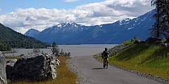
Without hesitation, the Bird to Gird is the most beautiful bike path in Western Alaska. This trail is 12 miles one way or 24 miles round trip; either way, the paved ride hugs Turnagain Arm and connects three communities (Girdwood, Bird and Indian). It’s perfect for any level biker — whether you just want to just cruise, go fast on a mountain bike, or experience the trail as a tourist (or even as a curious local). It’s a shared trail, so you’ll ...more
Trail head begins by traversing private land, but an easement has been provided for such. Easy to bike, ski, run or walk to mild slope with a wide sides, making is safe from avalanches in the winter. Should you choose to turn left at the start, you can go to Flat Top as an alternative route or Peak 2 or 3, depending how far down you go down the trail before turning left. Ptarmagan Peak would be a more prominate peak just before the Rabbit creek ...more
A Chugach classic with big glacier views, this trail is widely considered one of the best in Alaska! It begins outside of Girdwood and ends at the Eagle River Nature Center, with an option to packraft roughly 9 miles of Eagle River. Suitable for a novice backpacker and beginner packrafter (if you choose the packrafting route option).
This is part of the Hillside Trail System. It is one of the trails that is groomed for skiing in winter. You can access this trail via the Powerline, Gasline, Denali View, and Golden Grass Trails.
This is part of the Hillside Trail System. It is one of the trails that is groomed for skiing in winter. There is access to this trail available via the Powerline, Gasline, White Spruce, Blueberry Hollow, Alder, Panorama View, and Golden Grass trails.
The start of this trail leads to the secluded Eklutna Lake, a great spot to picnic, hike, or fish. The trail is nice and easy, and takes you out 10 miles where you can then continue on to get a better look at Eklutna Glacier! Eklutna Lakeside Trial is also a popular biking trail. Alternate days 4 wheelers have use, but they cannot use the cutoffs closest to the lake. The trail follows the lakeshore for 7 miles, then onto glacial gravel… ...more
This hike is popular in spring for those looking for an aerobic workout. It is very steep, but offers secure footing. One of many highlights along the scenic Seward Highway, Bird Ridge Trail climbs 3,000 feet in a little more than a mile to magnificent views of the fjord-like Turnagain Arm.
This trail is perfect for days when your time or energy for a longer hike is lacking. Lying on the outskirts of Anchorage, these trails are mostly flat. Though it is popular with locals, especially for skiing and snowshoeing in the winter, the trail is hardly crowded.
The trail goes up for a short distance and then joins with the original trail which is more direct but it crosses private property. Continue up, and when you get to the saddle, you can turn right onto the Mt. Magnificant Trail to follow the ridge that ends at the mountain, or left continuing along the original trail. The trail offers nice views of Cook Inlet and even Denali on a clear day.
Older books might have referred to this as the old Johnson Trail, but another trail of the same name on the Kenai Peninsula made it too confusing for them to both keep their names. This trail is the first of the trails available for hiking in the spring. It follows the highway, with mild elevation gains to allow awesome views of the Turnagain Arm.
If you like cascading waterfalls, a great stream, and exceptional views of Turnagain Arm, you don’t want to miss this hike. The rumbling stream with gradual cascading falls and mountain views provides a picturesque valley setting unique to this trail. The trail is rough and steep and climbs high enough that you’re likely to see Dall sheep, golden eagles, and Arctic ground squirrels in the higher elevations. Spruce grouse can also be spotted… ...more
A short road called Konikson located just past Bird Ridge heading east will take you to the trailhead. Stay to the right until you see a trail about a quarter mile in going right and up. The trail follows a small drainage, and quickly gets past the tree line.
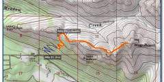
Black Tail Rocks is a very airy climb that stretches to 4,446 feet above Eagle River, a town located just north of Anchorage. It’s a journey that involves only a minimal amount of hand-over-hand scrambling; you’ll be following a trail for most of the 4‑mile, 2,750-foot hike. And you’ll have a fine view from the top, looking up the length of the secluded Meadow Creek Valley and well into the deep inner reaches of the Chugach Mountains.
This trail is a good one for runners with dogs. Dogs must be on a leash when on the trail and open fires are prohibited. This is a beautiful trail any time of year and is easy and a good trip for the whole family. Please be sure to avoid the water because there are beavers in the area and it is possible to get beaver fever aka Giardiasis.
This trail is popular in the winter for skiing (low avalanche danger) and summer for views, and berry picking. Many people begin at Glen Alps Parking lot and initially follow Powerline Pass trail until it turns off to the left. Go down and over the creek and then follow the trail up an easy slope towards what is commonly known as the Ramp and the Wedge, on either side of the valley. When you get to the pass, or ridge, look down towards the… ...more
The trailhead to this route provides access to Bear Mountain and Mt. Eklutna. It leads along an old roadbed that can be steep and muddy in sections. The trail also has a few stream crossings without bridges for the average adventurer.
This area is accessed from multiple trails. Most people start at the Glen Alps parking lot and follow the trail toward Williwaw Lakes. Once you cross over Campbell Creek, you can go over the ridge by taking a right where the trail forks (steep but fast) or around to left (easier, but much longer). Good for hiking, snowshoeing or skiing. Some even run this trail.

