Chugach National Forest Parks & Trails
Spanning an impressive 5.4 million acres, the Chugach National Forest is the second-largest national forest in the United States. Stretching from the Kenai Peninsula to Prince William Sound and the Copper River Delta, the forest encompasses an impressively diverse range of natural wonders. This list includes more than 60 trails, making it a great guide for your journey.
Show Map
Parks & Trails
This is a day use site that offers 13 picnic sites with tables, a fish viewing platform, water, toilets, an information board, and fire grates.
If you have the ability to transport bicycles, this trail makes for a great afternoon trip. The dirt path winds through the Portage Valley, passing glacial lakes and ending at Portage Lake (this part of the trip is 5 miles each way). Make sure to bring your camera: you’ll see hanging glaciers and, very likely, some wildlife.
This leisurely, 0.75-mile trail begins just south of Whittier, a little seaside town located some 2 hours south of Anchorage. The trail doesn’t climb much, but it will take you high enough to get an unobstructed view of numerous waterfalls, including the long-dropping waters of Horsetail Falls as it sheets over the sheer rock face of Blackstone Ridge.
This 38 mile long USFS trail climbs Resurrection Pass (elev. 2,600) and descends to the north to another trailheadtrailhead near Hope on Turnagain Arm. There are 8 public use cabins along the trail, making this an advanced but comfortable day cabin-to-cabin hike. There are also 19 campsites available along the trail.
Winner Creek Trail in Girdwood (45 minutes south of Anchorage) is one of our favorite trails to take visiting friends and family. It’s an easy 3‑mile hike or bike ride on a wide, well-developed trail with a gentle elevation gain that winds through America’s northernmost rainforest, crosses a wooden bridge over a thundering blue-water gorge. 2022: Hand tram currently closed, may replace with bridge. Local weighing in.)
This trail is a good day hike for the whole family. It alternates between open meadows and forests and offers the option of tent camping or staying in Crescent Lake Cabin. There are options for longer hikes and there is a lot of wildlife to be seen such as moose, goats and bears.
More a gated road than a trail, this hike largely remains a local secret among the residents of Cooper Landing, the fishing mecca located some 105 miles south of Anchorage on Sterling Highway. Many in this town consider it their personal getaway, which makes it quite a popular secret. A foreman for Chugach Electric (the company that manages the dam on Cooper Lake) said he often experienced congestion while driving to the dam, due to the heavy ...more
Located about 3 miles up a gravel road from Snug Harbor Road along Kenai Lake. A primitive camping area is nearby overlooking the lake
This short day hike — with an easily accessible trailhead a few hundred meters from the Begich Boggs Visitor Center — offers you big views of the Byron Glacier.
If you have some outdoor experience and an adventurous spirit, consider this 11-mile traverse up the Colorado Creek valley and down the Summit Creek. Beginning 2 hours south of Anchorage, this traverse doesn’t involve any rock scrambling, river crossings, or arduous bushwhacking. But if you feel comfortable hiking in wide and trackless country, you may reap the reward of having an entire valley to yourself.
This 4.1‑mile trail starts through forest and muskeg meadows. You’ll cross a beautiful bridge over a creek that in mid-July and August is full of spawning chum salmon Then once you’re at the top take in views of Cordova, Nelson Bay, and Prince William Sound.
If you want a great workout — to stunning mountain views high above the valley floor below — but want to save your knees on the way down, this trail is for you. It leaves from the Alyeska Resort tram building and climbs steep switchbacks 2.2 miles and 2000 feet to the mid-mountain restaurant where you can catch a free aerial tram ride back down to the hotel.
Considered to be one of the best hikes in all of the Chugach Mountains, Crow Pass follows a portion of the original Iditarod Trail, including its highest point. End to end, it’s a 21-mile trail, which most people do in 2 days, but just the first 4 miles will lead you past some breathtaking scenery. Along the way you’ll find glaciers, waterfalls, wildflowers, wildlife, mine ruins, and berries (in late August and September). Hiking is not ...more
Well-maintained and suitable for summer hiking and biking, the 10-mile Devil’s Pass Trail features a steep route up a spectacular V‑shaped valley that intersects with the Resurrection Pass Trail and a rental cabin in the alpine realm. The country is rugged, with great access to cross-country tundra exploration and berry picking.
This meandering, single-track path leads to some of the Kenai Mountain’s most remote and fragile high country. On a route once trekked by gold rush prospectors, this trail ascends from spruce forest through the jungled zone of alders into a realm of sweeping tundra, with incredible views and productive berry picking. Plus, the top of the nine-mile journey ends in Resurrection Pass, about midway through the 39-mile Resurrection Pass Trail.
This family-friendly, 2.5‑mile trail climbs 3,600 feet to a summit halfway between the sea and the heavens
The 23-mile Johnson Pass Trail offers hikers, backpackers and bikers a well-marked route through a lush pass in the Kenai Mountains — featuring gradual climbs, two lakes with fish, spectacular peaks and some way cool gorges.
This 38 mile long USFS trail starts in Hope and climbs Resurrection Pass (elev. 2,600) towards the south before descending to the opposite trailhead near Cooper Landing. There are 8 public use cabins along the trail, making this an advanced but comfortable day cabin-to-cabin hike. There are also 19 campsites available for tent camping.
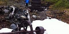
No other mining trail on the Kenai Peninsula climbs as high or takes in more extensive views as the 6‑mile-long Crown Mine Trail. Beginning some 2 hours south of Anchorage on the appropriately named Mine Road just south of Trail Lake, this trail climbs to 3,900 feet above sea level to a unique spot — a glacial cirque littered with mining paraphernalia.
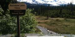
This trail is also called the Primrose trail at the north end. It begins in a beautiful rainforest and eventually takes you up to a multiple of beautiful lakes in high meadows. Anglers can fish for rainbow trout in the lake.
This 2‑mile-long, family-friendly trail, which begins 90 minutes south of Anchorage at the far end of the Whittier Tunnel, remains the only easy way to see Portage Glacier on foot. And it’s has a spectacular conclusion: After cresting Portage Pass, the trail drops through glacial scrub before popping out on the wide gravel shores of Portage Lake, directly across from the snout of gorgeous Portage Glacier.
The wildflowers are abundant and verdant undergrowth can be check high sometimes. Most of the trail lies below treeline, so there are established camp clearings along the way that are nestled into the trees. One of the best campsites is 10 miles in from the northern trailhead, set among trees on a spruce-covered knoll looking over the trail and Bench Lake.
Beginning 103 miles south of Anchorage on the Seward Highway, the 3.5‑mile-long Ptarmigan Lake Trail makes for a fine family outing. The lake itself is a long and narrow body of water squeezed between ridges and mountains that tower as high as 6,000 feet. It even offers a small beach upon which to relax and enjoy the view while cooling your feet.
Primarily built to provide pack-rafters and kayakers access to the headwaters of Twentymile River, this 9‑mile-long trail has also proved a draw for hikers — and with good reason. Just 45 minutes south of Anchorage, it makes for a very scenic hike into some high, wild, glacier-girted country.
Popular with hikers and backpackers, this easy-to-follow trail connects the state’s most intense sockeye salmon sports fishery with stunning mountain backcountry. It offers many of the Kenai Peninsula’s highlights in one trip. The 21-mile route accesses Russian River Falls, Lower and Upper Russian Lakes, Cooper Lake, 3 federally managed recreational cabins, and numerous campsites
This wildlife sweet spot is worth a visit. The Russian Lakes Trail begins off the access road to the Russian River Campground in Cooper Landing, at milepost 52 of the Sterling Highway. Get off-the-beaten path, hike two miles to the falls and enjoy the immediate reward of spectacular salmon viewing.
This trail is part of the Hillside Trails System. It is not one of the trails that is groomed for skiing in winter. This trail meanders up and down hills and alongside beautiful Long Lake. Wildlife can be seen from the lake, mostly birds with the occasional moose.
This is part of the Chickaloon-Knik-Nelchina Trail System. The trail is rough and indistinct and interconnects with many other trails in the system. There are many moose, caribou, brown bear and Dall sheep in the area. Sheep cannot be hunted on Sheep mountain.
If you want a taste of dim spruce forest along a wild river bottom, try the first few miles of this mostly level route into the Resurrection River Valley. From the trailhead Mile 7 of Exit Glacier Road, the trail runs 4.5 miles to Martin Creek and is suitable for mountain biking or skiing after snowfall. It features two primitive campsites and occasional access or views of to the river.
This is an easy .8‑mile boardwalk trail with lots of stairs. The boardwalk leads to overlook of the Copper River Delta with many signs. Be sure to bring your camera, this is a great place to see moose and bear.
Features: Skiing
This trail follows an old mining road to the-still active- Primrose Mine. After mile 4 the trail becomes steep and eroded. There is a viewpoint that offers nice vistas here. The trail continues to a bridge that will take you to Lost Creek and Lost Lake eventually. This is a good 2 – 3 day hike for fishing and camping.Keep an eye out for black bear and mountain goats.
The trail follows the south end of Cooper Lake and ends at Upper Russian Lakes Cabin, 13 miles from the winter trailhead. There is little elevation gain or loss on this forested trail.
The first mile and a half of this trail leads up over rocky slopes that offer a great view of Eyak Lake and the Orca Inlet. At this point the trail splits in two and the hiker has a choice of going around the south end of Mt. Eyak or climbing straight up to the top.
The trail begins at mile 12.1 of the Seward Highway. Watch closely for the sign and pull into the off-highway parking area. The trail begins as the Iditarod Trail, and many improvements have been made to this section. The Troop Lake Trail branches off of this famous trail approximately 1 mile from the start, reaching the lake about a half mile later.
This is a steep climb that ends where Crater Lake sits. The first half climbs over rocky sections with numerous switchbacks, with muddy areas and wood bridges. The second half continues to climb, but at a much nicer grade. At mile 1.2 there is an intertie to Ski Hill trail and at the lake there is the option to hike the Alice Smith Intertie. The entire loop from Crater Lake to Power Creek Trailhead is 12 miles. Along this trail there is good… ...more
These popular trails lead to two beautiful, pristine lakes. Even better, they’re both easy hikes, which makes them perfect for people of all ages. Bring a fishing pole and angle for stocked trout in Meridian Lake or grayling in Grayling Lake.
This trail is a connector between the Hotel Alyeska and Crystal Mountain Rd.
This trail is basically a mining access trail that is very steep in the beginning, very wet in some places, but levels out to a beautiful mountain valley.
This trail follows Power Creek then leads it’s hikers up multiple switchbacks. Midway, the Cordova Electric Hydropower Dam Can be seen from the trail. The last half passes by many beaver ponds and hanging glaciers.
A Chugach classic with big glacier views, this trail is widely considered one of the best in Alaska! It begins outside of Girdwood and ends at the Eagle River Nature Center, with an option to packraft roughly 9 miles of Eagle River. Suitable for a novice backpacker and beginner packrafter (if you choose the packrafting route option).
Located at Mile 1.0 of the Portage Highway, this site has a short boardwalk trail along several ponds. It is a good site for observing waterfowl that nest and rear their young in the ponds and river channels.
This is an easy 2.4‑mile hike with excellent fishing for sockeye, Dolly Varden and cutthroat. You’ll find access to McKinley Trail and McKinley Lake public use cabins. It is a well-maintained trail that has several bridges for easy stream crossings and interpretive signs to explain the trail’s history.
This trail crosses Indian Creek several times on its gradual climb through the old growth forest. Brush and Alder give way to a panoramic a‑line near Indian Creek Pass. Parts of the trail can be difficult to follow, especially when traveling through the grass of the sub-alpine. This is part of the “Arctic to Indian” winter ski traverse.
Palmer Creek and the road that follows it were named after George Palmer, who in 1894 first discovered gold on its banks. The creek was the site of early placer mining and later lode mining. Evidence of the historic Lucky Strike and Hirshey mines, as well as the Swetmann camp, can be found along trails that lead to Palmer Lakes. Several hiking trails are accessible from the Palmer Creek Road.
The hike begins through the forest before it begins to climb. There are rock cairns to help guide you along the way. From the top, you’ll have impressive views of the Sheridan and Sherman glaciers.
This very active glacier forms a wall along the fabled Copper River near a historic railroad route that once serviced the world’s largest copper mine. NOTE: A bridge at Mile 36 of the Copper River Highway is currently (2020) impassable, with repairs not expected for several years. Child’s Glacier is not currently accessible by road. Contact Cordova Ranger District for current venders providing transportation options to the far side. ...more
Trails were established by prospectors traveling through the Turnagain Pass area. The Ingram Creek trail followed the creek from Turnagain Arm up to Turnagain Pass. After the pass, the trail followed Granite Creek to Sixmile Creek, which then led prospectors to Sunrise and Hope.
Known to locals as the Divide Ski Area, this trail was built by dedicated community volunteers from the Seward Nordic Ski Club.
This is a lightly sloping trail that parallels the Scott Valley and passes the shores of large and small lakes. The trail passes through an area that was previously logged. It is not a well-maintained trail.
There is a good guide for this trail available at the Begich, Boggs Visitor Center at Portage Glacier. Numbered trail posts correspond to things in the guide. This is a great place to view spawning salmon in the fall. It is a well-maintained path with a thirty-foot bridge. This hike is wheelchair accessible and there are lots of berries and various wildlife species.
The trail takes hikers past mine activity on the lower part of the trail. The first mile is steep, but after that it levels out. Mountain goats and brown bears are seen on the mountainside occasionally. There is excellent berry-picking here in the fall. This trail should only be traveled in the summer due to avalanche danger.
This 1,100 foot long woodchip trail winds along the Kenai River. It was established in 1992 to preserve, protect and interpret the Kenaitze Indian Tribe cultural and natural resources in this area. This is also a good spot for fishing.
Located at Mile 17 of the Copper River Highway. An accessible boardwalk leads visitors to stunning views of both the expansive wetlands of the Copper River Delta and the surrounding mountains. A wide variety of wetland animals including trumpeter swans, moose, brown bear, and shorebirds can be seen in the area, especially during the spring and fall. The first half of this trail is paved with geoblock, so that it does not have a negative… ...more
This trail has impressive views of the Chugach Mountains. Short spur trails offer access to five small lakes that are excellent for cutthroat fishing.
This ski trail weaves through muskeg and forest and gradually gains elevation until it ends. The trail leads to a high muskeg that overlooks the Copper River Delta, Heney Range and the Gulf of Alaska. This trail is very wet during all seasons excluding winter and is not a hiking trail.
This trail was once used as access to gold mining territory. In 1925 a diptheria epidemic threatened Nome and the route was covered in 127 hours to deliver serum to those who were ill. It is now raced every year on dog sled to commemorate that and is the longest sled dog race in the world. The trail is easy in pieces and difficult in its entirety.
Hiking up Mt. Alyeska is a challenge, but the reward is great views of Turnagain Arm, the seven “hanging” glaciers of Girdwood Valley, and peaks stretching deep into the Chugach Mountain range. Below you’ll find our recommended routes to the top; all leave from the Alyeska Hotel (where you’ll find trail maps). While any summer day is good for this hike, try to time your visit around one of the area’s events — you’ll have something extra to… ...more
This lake is in a valley with two other lakes but this one has its own trail. The trail is well-maintained. It is a gravel trail that leads to a great spot to camp and fish. This is an ideal family day hike or overnight.
The 3.3‑mile long trail is mostly boardwalk over muskeg. This is an excellent spot to bird-watch, look for waterfowl feeding on Eyak Lake. Trumpeter swans frequent this lake. Most fly south for the winter however, up to 100 swans will winter here in this ice-free lake.
Take a stroll down the boardwalk as it winds along the river. There are several interpretive signs with information about fishing, dall sheep, rafting and boat safety. You’ll also find access to Pioneer Village where you can pan for gold at Prospector John’s Authentic Gold Panning.
We do not recommend this trail, because sometimes the only access is across a railroad trestle.
The Johnson Pass Trail originated in the 1890s as a route for Iditarod miners who raced north from Seward to Nome. It later was developed into a wagon road by merchants and miners who settled the area. The Alaska Road Commission then used it as a thoroughfare through the 1930s. Today this popular hiking trail travels portions of the historic Iditarod Trail between Moose Pass and Granite Creek with bridged streams, mostly easy grades, and… ...more
This well-maintained trail has a level path with gradual grades. It follows an old wagon road and parallels Turnagain Arm. There are many berries, which makes this a fun activity for the whole family. It is suggested that you bring binoculars to see wildlife up-close on the mountains above.
This ridge route has amazing views of Prince William Sound, Eyak Lake, and the Copper River Delta. About halfway down the trail, there is small shelter available for day use or overnight camping. It is available on a first-come first-serve basis.

