What Spending a Day on the Matanuska Glacier is Really Like

By Jeff Schultz
Professional Photographer and Photo Tour/Workshop Guide
“This ice is so dense, so hard. I had no idea a glacier would be like this.” Was the reaction from one my three friends as they hiked across the glacier. We were all spellbound by the amazingly clear rivulets of water running on top and through the ice. “This is an astounding geological experience!” was her follow-up comment.
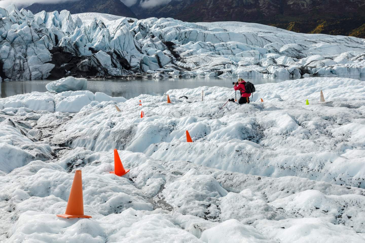
The land managers lay out orange construction cones to mark a safe trail across the glacier.
We had driven 90 minutes from Anchorage to the Matanuska Glacier, a 4-mile-wide, 27-mile-long river of ice that’s America’s largest glacier accessible by car. I’ve lived in Anchorage for 40-plus years, but they were all newcomers to Alaska, and hiking the glacier is one of the state’s iconic experiences. We could have hired a private guide or joined an interpretive experience with a small group, but decided on a self-guided hike.
The Matanuska Glacier is so massive that we got our first glimpse of it five miles before the turn off! We then reached the entrance, located on private property at Mile 102 of the Glenn Highway. After completing a liability waiver, whichever-so-clearly put our fate on this dangerous and potentially deadly ice sheets quarely in our own hands, we paid our per-person fee to drive several miles on a gravel road to within ½-mile of the ice.
At the parking area, we got a grand, up-close view the view of the glacier. While the immediate area looked like the surface of the moon with nothing but grey boulders, black gravel, and pulverized rock the consistency of flour, the view was broken up with intermittent green and yellow foliage and deep ponds of water. The calm water was reflected the stark white ice.
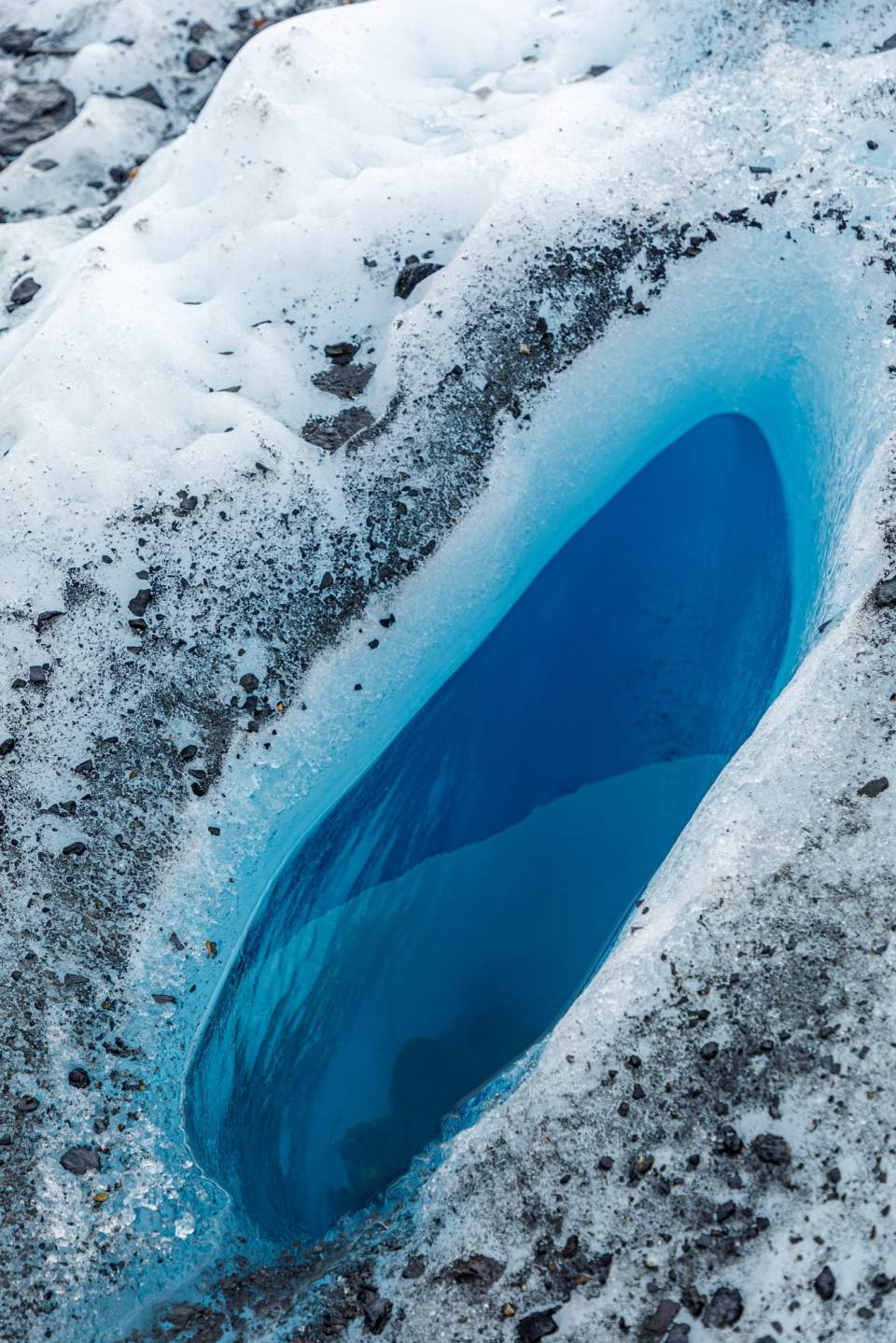
Deep pools of blue water can be found tucked into the glacier.
We walked over rock and gravel moraine to the terminus of the glacier—a trail marked with orange construction cones. Over some of the small crevasses, and where the glacial mud was too deep for walking, the land managers had placed diamond metal grating for safety. It’s a trail that changes daily, as the ice underneath the rock and gravel trail melts.
Onto the Ice
As the gravel trail gave way to ice, we stopped to attach ice cleats to our hiking boots. Oddly, safety gear isn’t mandatory. Some guests were even wearing tennis shoes, though their expressions displayed a slight panic. But it’s easy—and much more comforting—to attach elastic-bound, 3/8-inch micro spikes to one’s boots, creating a sure-footed experience on the slick, undulating ice.
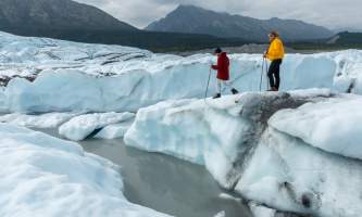
My guests were ecstatic to experience this cold, rock-hard environment and see the crevasses, water streams, and moraine. We could hear the sound of rushing water as we hiked, though we couldn’t see it underneath the frozen surface. Over one rise, the water formed a deep blue pool in what seemed to be a bottomless cavern.
We could wander off of the clearly marked trail, provided we stayed inside the boundary. So we did, taking paths less traveled and make our way on the lower flanks of the glacier’s runout to the 100-foot-tall face. From the parking area, we had made it here in less than 30 minutes.
At the bottom of the face was a small, gray-colored lake, reflecting the vertical spires and graphic patterns of the ice flow—and making for exceptional graphic patterns in our photos. Beyond from the glacier, the fall colors reflected in the lake, creating a dichotomy of vibrant foliage and a stark-white glacier that seemed, on the surface, almost lifeless.
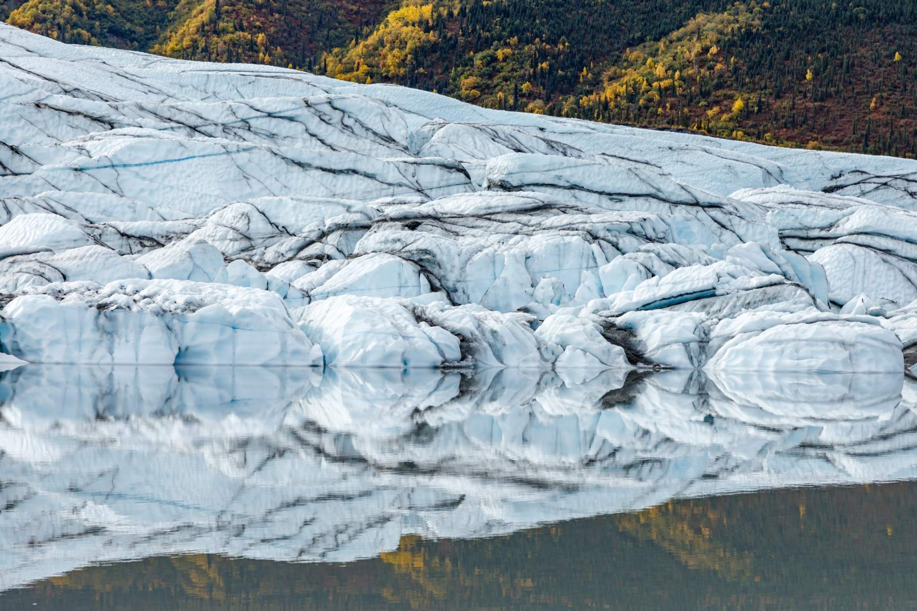
The four of us spent another 45 minutes gingerly walking slowly along the lake edge and ice shelves, as well as up and down the uneven ice, investigating even the smallest of formations. We enjoyed taking photos of the wide range of shapes and outlines, as well as hypothesizing just how the glacier may have traveled in recent times, creating its distinctive holes, ruts, and crevasses.
We finally sat on a section of ice, formed like a bench, to look and listen, mesmerized by the stark beauty. Eventually, we decided it was time to saunter back to the car for the drive home—our memory banks and photo cards filled with a unique Alaskan experience.

