The Best Drives to See Fall Colors in Alaska
By Zen Godfrey
Alaska.org
Red and gold fills the landscape—a colorful contrast against craggy peaks dusted with the season’s first snowfall—as the air becomes crisper and the days grow shorter. Welcome to autumn in Alaska — a brief but breathtaking season that typically runs from late August through September.
It’s a magical time to explore the state, particularly for photographers looking to capture Alaska’s fall colors. Aspen and birch trees transform into a bright yellow that’s especially picturesque at sundown, when the mountainsides light up with a warm, golden glow. Meanwhile, the tundra-covered ground turns a brilliant mix of orange and vibrant red.
Higher elevations often hit peak color in early to mid-September, with lower elevations following their lead. While the leaves can turn quickly and fall soon after, the fleeting nature of the ancient process only enhances its beauty. For anyone fortunate enough to time their visit just right, the rewards are spectacular.
So, is it worth trying to catch Alaska’s fall foliage during this short window? Absolutely! And to help maximize your time among the vibrant colors, here are some of the best drives in Southcentral, Interior, and Southeast Alaska.
We’re sure you can fit at least one into your itinerary.
Hatcher Pass: Palmer, Alaska
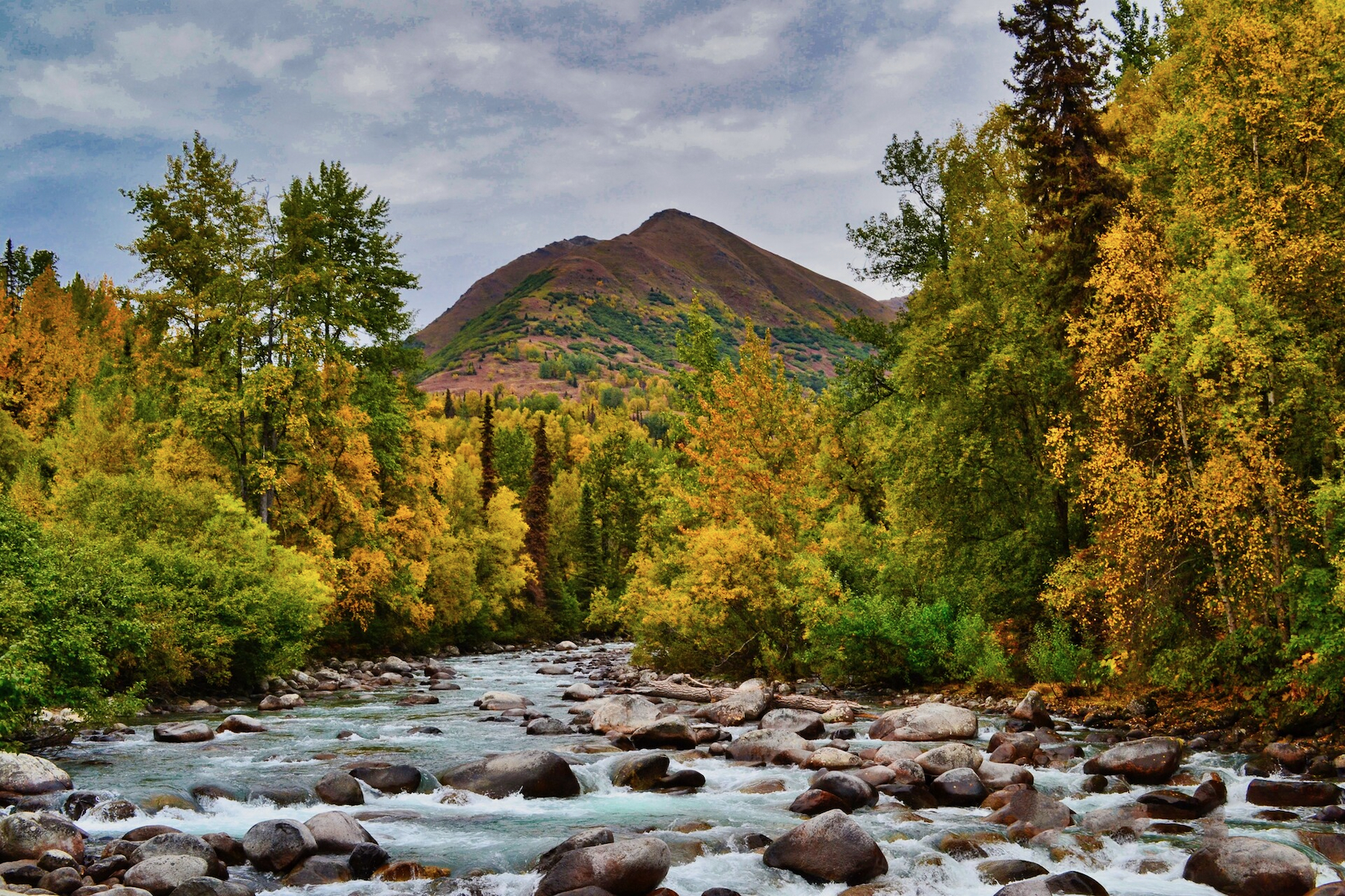
This drive into Hatcher Pass winds past the little Susitna River, through alpine meadows, and past Independence Mine State Historical Park, with panoramic views of the Talkeetna Mountains. Plus, there are several great hiking trails to help you get even closer to nature
- Best viewpoints:
- Little Susitna River. Stop at the pullout by the Susitna River to see water cascading over massive boulders, with a backdrop of yellow aspen and spruce.
- Fishhook Trailhead: Enjoy the view looking down the road you just drove, or hike the short but steep trail for an even better vantage point.
- Independence Mine State Historical Park: Here above the treeline, you can see the reds and golds of the alpine tundra surrounded by mountains.
- When to go: Late August through mid-September. The fall colors become especially vibrant as the month progresses , but by the end of September, many of the leaves are already gone after getting zapped by the first frost.
- Duration and tips: From Anchorage, it takes about 75 minutes to reach Independence Mine near the top of the pass. The scenery becomes amazing when you hit Palmer-Fishook Road. From there, it’s about 25 minutes to Independence Mine, but spend some time exploring. You can drive through the pass to the town of Willow, but the road (which closes mid-month) becomes gravel and isn’t recommended without 4WD. For that reason we recommend turning around and returning the same way you came.
Photos by: Kelsey Horne, Heather Wood
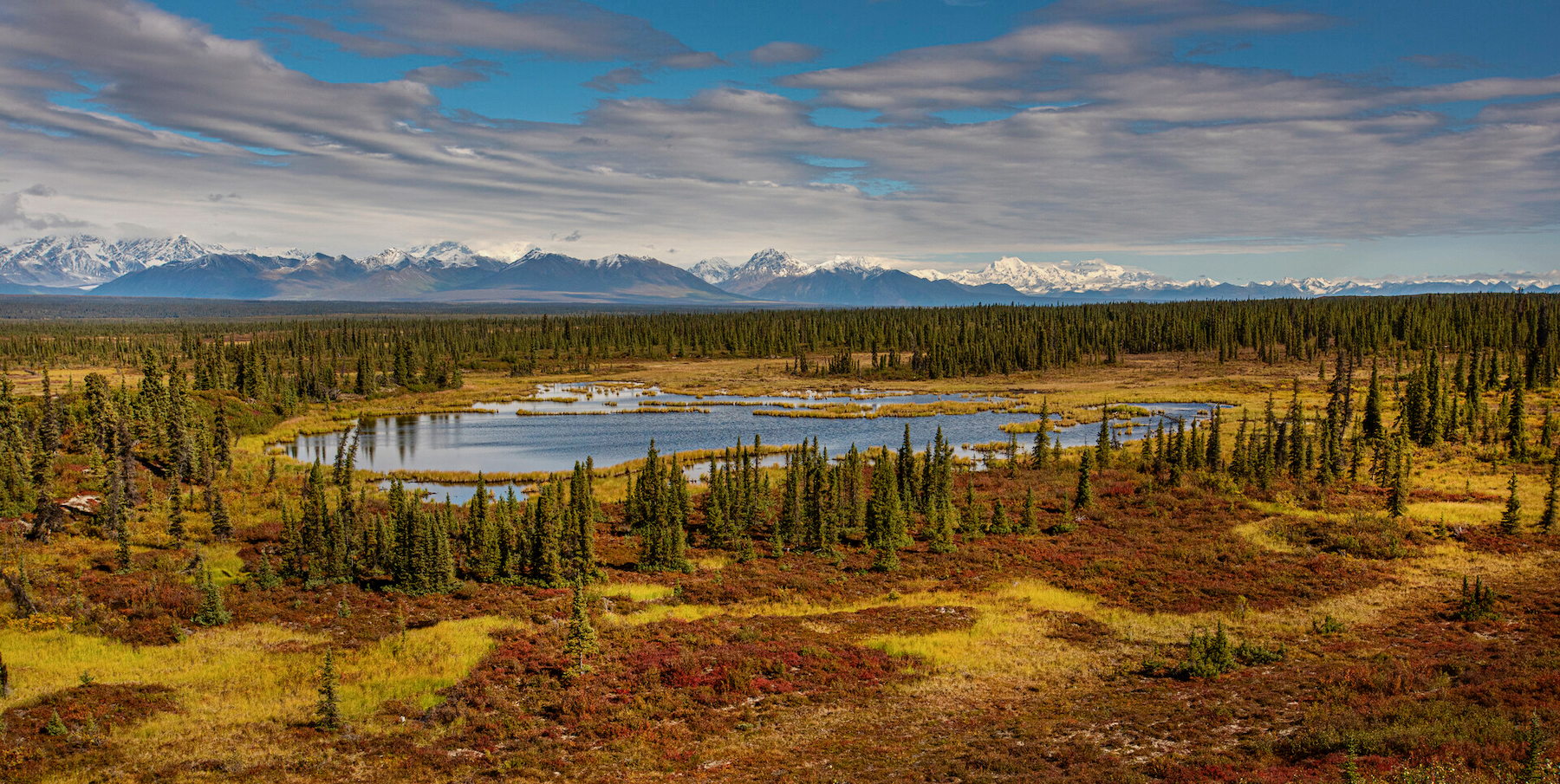
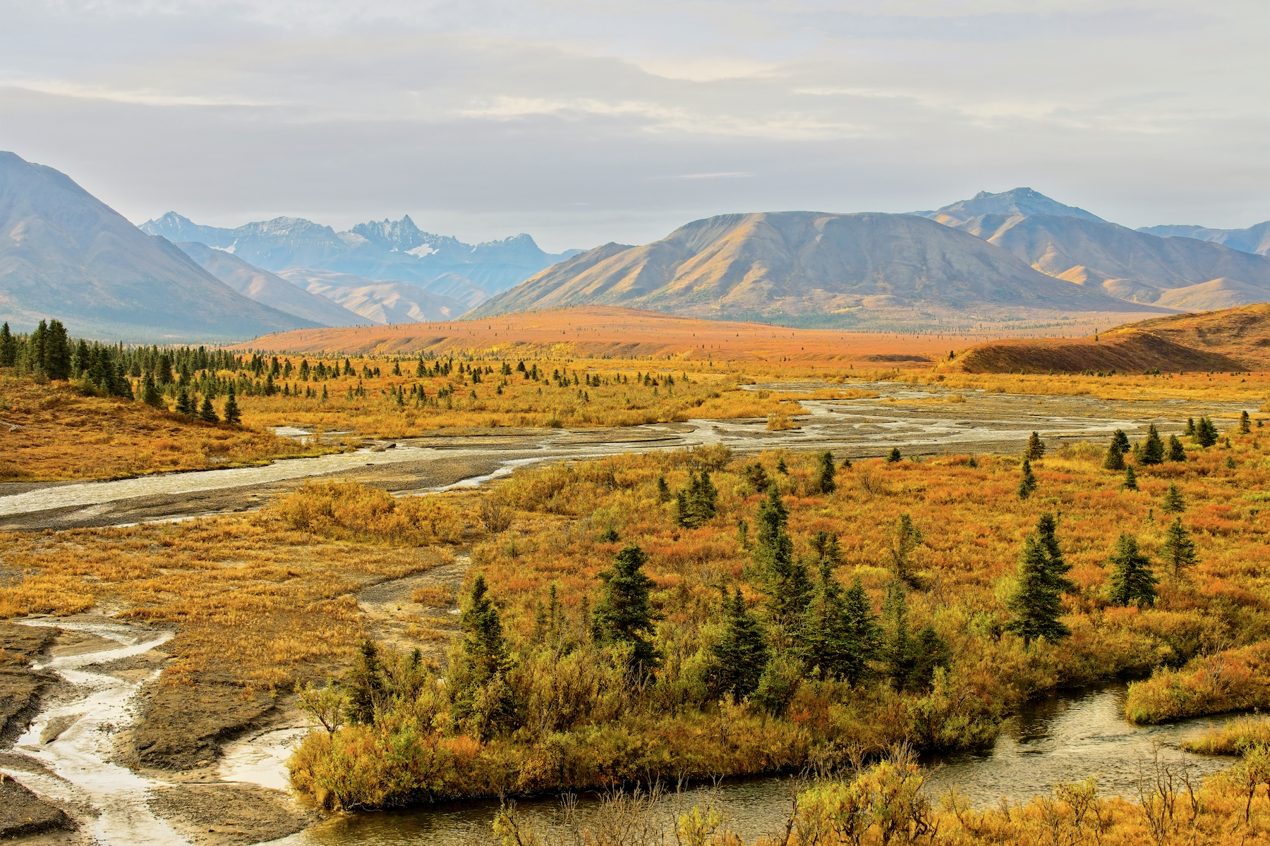
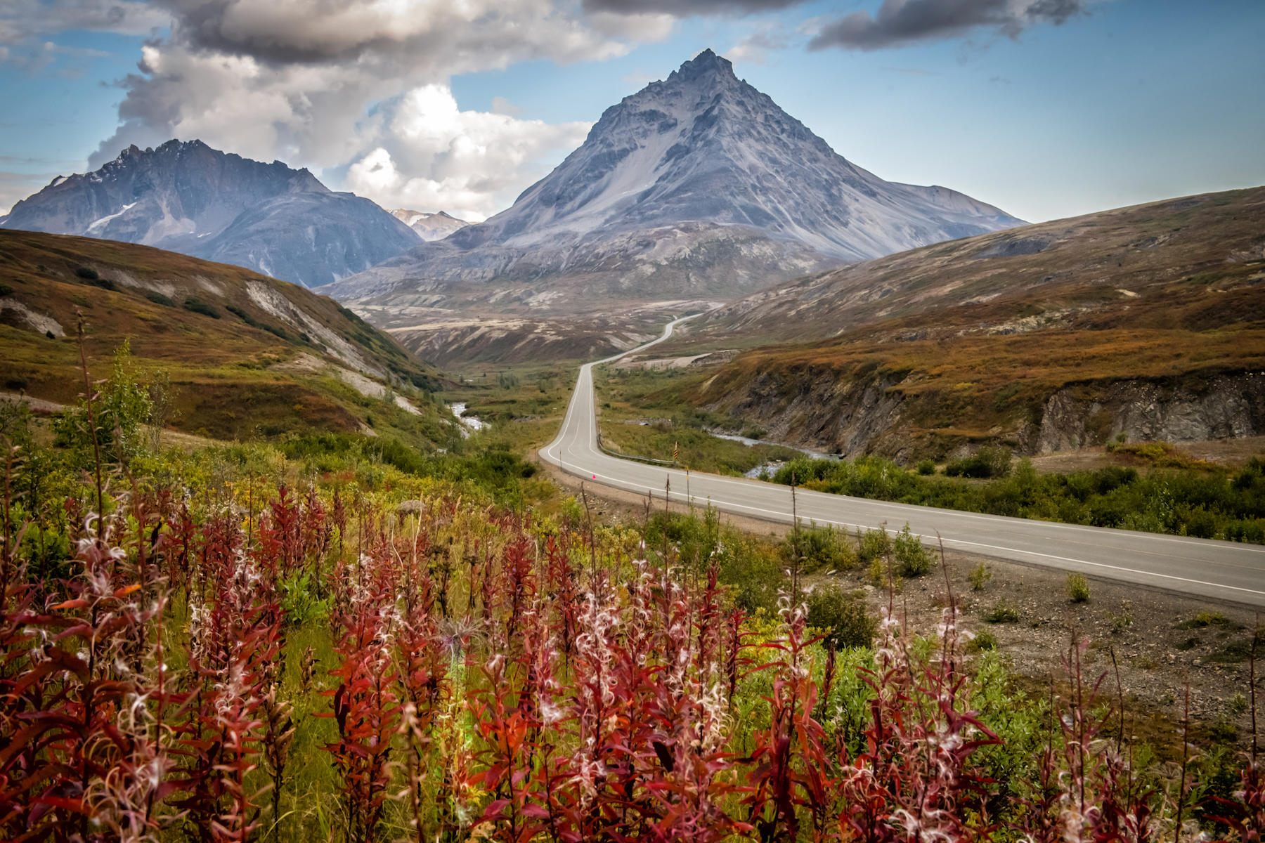
Denali Highway: From Paxson or Cantwell
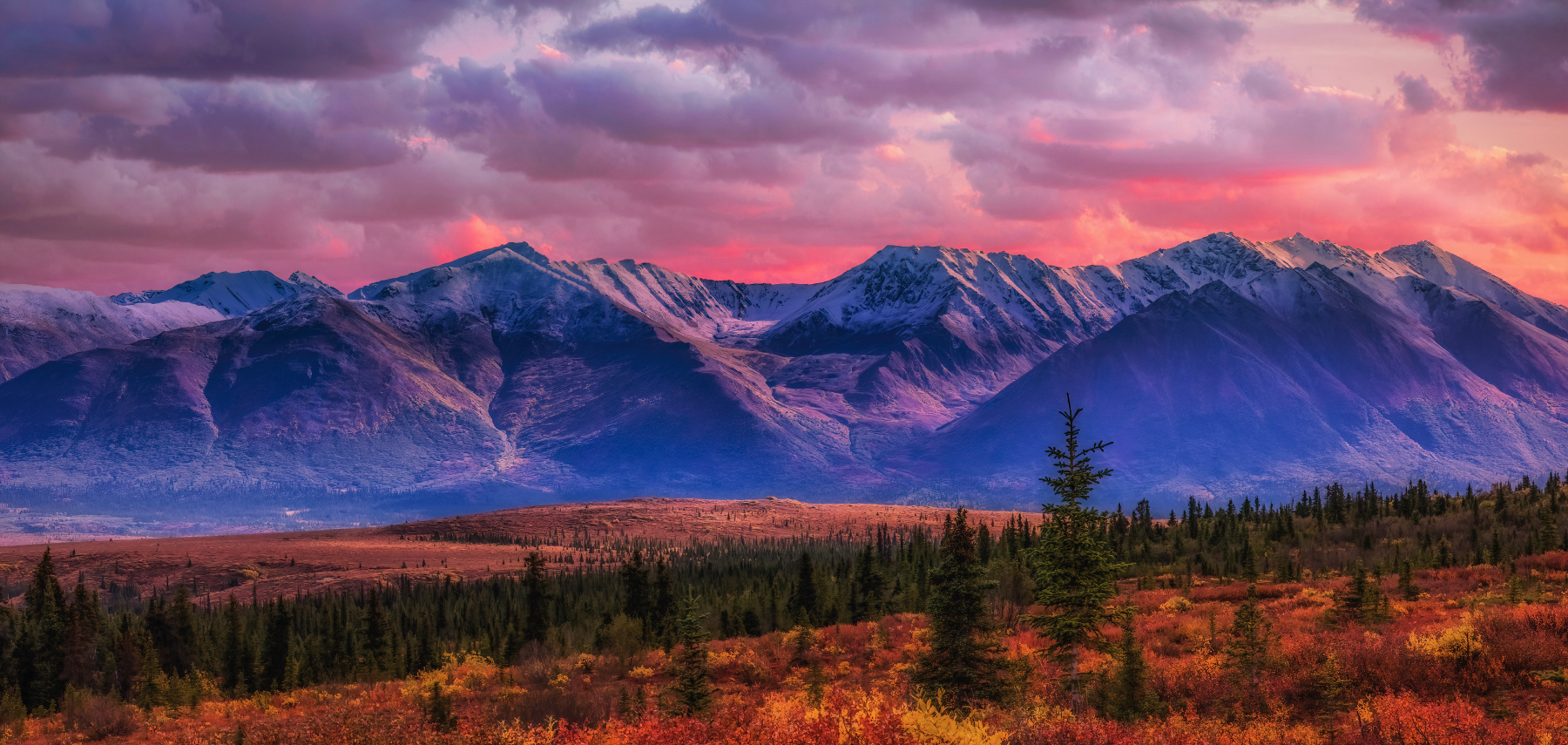
You can find one of the world’s most spectacular drives on this gravel road. Much of it lies above timberline, so the vistas go on forever and are particularly beautiful in the fall. You’ll cross glacial rivers and be treated to panoramic views of the Alaska Range. During autumn, the tundra is transformed into a vivid tapestry of reds, oranges, and yellows, providing a stunning contrast to the snow-capped peaks
- Best viewpoints (Direction of Cantwell to Paxson):
Susitna River Bridge (Mile 79.5): Stop at the pullout before the bridge and admire the vibrant fall foliage along the riverbanks.
Maclaren Summit (Mile 37): At the highway’s highest point, 4,086 feet, you’ll find sweeping views of the surrounding tundra, the Maclaren Glacier, and the peaks of the Alaska Range.
Tangle Lakes (Mile 16): This area is particularly beautiful in the fall, with the vibrant colors of the tundra reflecting in the still waters of the lakes. It’s a great spot for photographers.
When to go: The fall colors on the Denali Highway are typically at their peak from late August through mid-September.
Duration and tips: The Denali Highway stretches for 135 miles between Paxson and Cantwell, and the entire drive takes about 4 to 5 hours without stops. However, with so many scenic viewpoints, hiking opportunities, and wildlife sightings, it’s easy to spend a full day or more exploring. There are lodges and campgrounds if you want to make it a multi-day experience. You’ll need to rent a vehicle from an operator that allows their cars on gravel roads—such as Alaska 4x4 Rentals, Alaska Overlander, or Alaska Auto Rentals—and follow the speed limit to avoid damage. Cantwell is 3.5 hours north of Anchorage and 30 minutes south of Denali National Park. Paxson, on the eastern side of the highway, is accessible via the Richardson Highway. Also, note that the highway is only maintained seasonally and is usually closed from October through mid-May.
Photos by: Robert Kowalski, Michael Ging
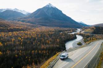
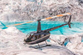
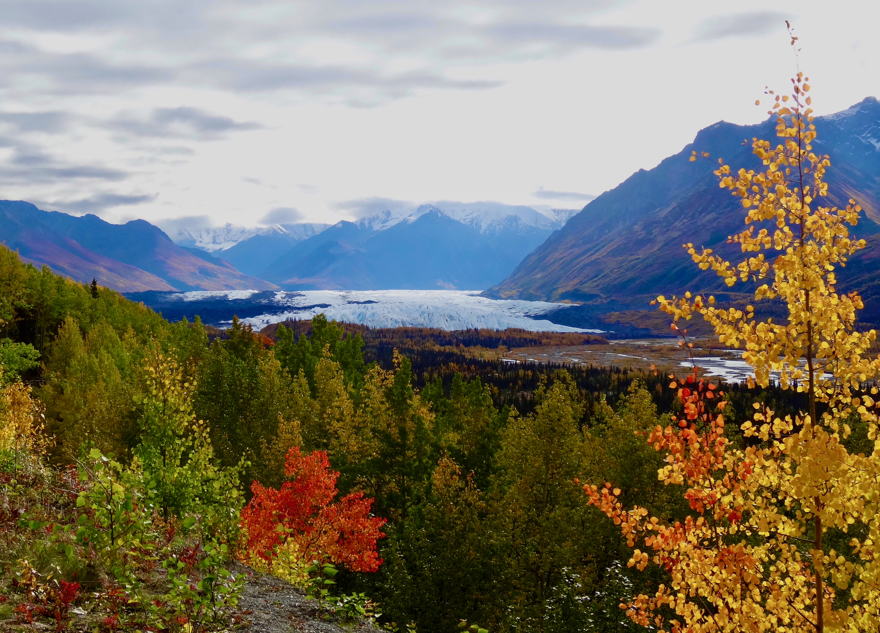
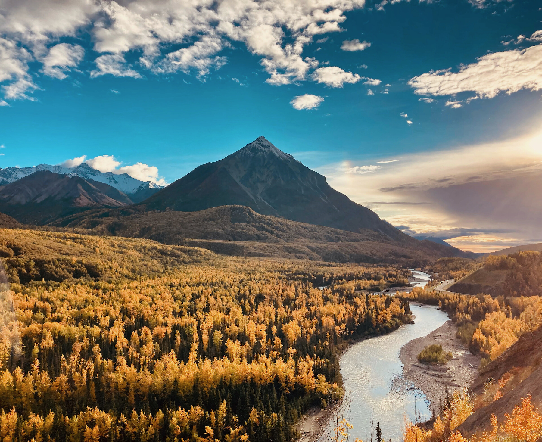
Glenn Highway: Anchorage to the Matanuska Glacier or Glennallen
The Glenn Highway offers views of the Matanuska River, the Chugach Mountains, and the majestic Matanuska Glacier. In the fall, this road becomes even more beautiful as the birch and aspen trees along the highway turn golden, creating a striking contrast against the towering mountains and glacial ice.
- Best viewpoints:
- Susitna River Bridge: Matanuska Glacier State Recreation Site: About 100 miles from Anchorage, this viewpoint offers an unobstructed view of the Matanuska Glacier—one of Alaska’s most accessible. The glacier’s bright blue ice contrasts beautifully with the surrounding fall colors. There’s a spotting scope and an easy, one-mile trail to views of the glacier. Parking is $5.
- Sheep Mountain Lodge Area: Located near Mile 113, the area around Sheep Mountain Lodge provides breathtaking views of the Chugach Mountains. Hike the nearby trails and grab a bite at the lodge
- Eureka Summit: At Mile 129, Eureka Summit offers panoramic views of the Talkeetna and Chugach mountain ranges. In the fall, the tundra around the summit is ablaze with color, providing a magnificent landscape for photography.
When to go: Late August through September.
Duration and tips: The drive from Anchorage to the Matanuska Glacier State Recreation Site is about 2 hours. Book a tour and you can walk right ON the ice. The drive to Glenallen, 138 miles away, typically takes around 3 hours without stops. However, with numerous scenic pullouts, hiking opportunities, and places to explore, it’s easy to spend a full day enjoying the journey.
Photos by: Jennell Hartman
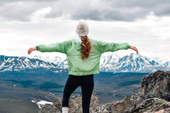
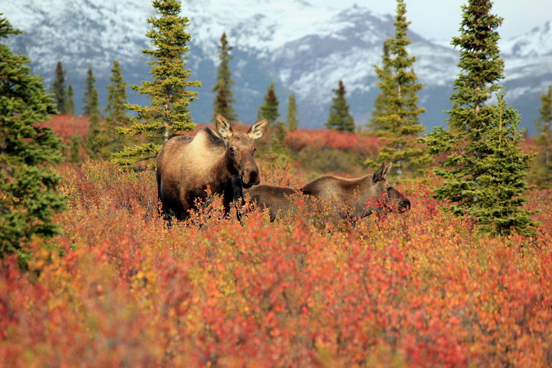
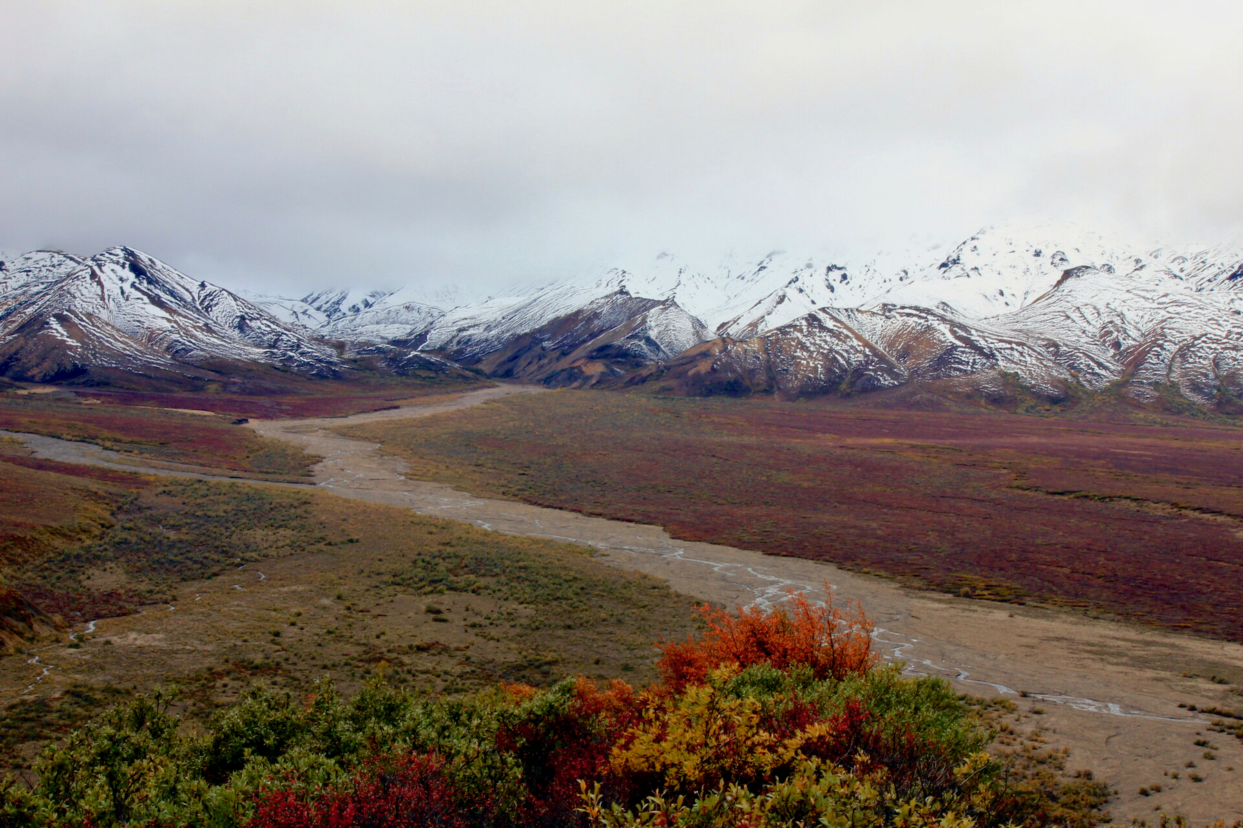
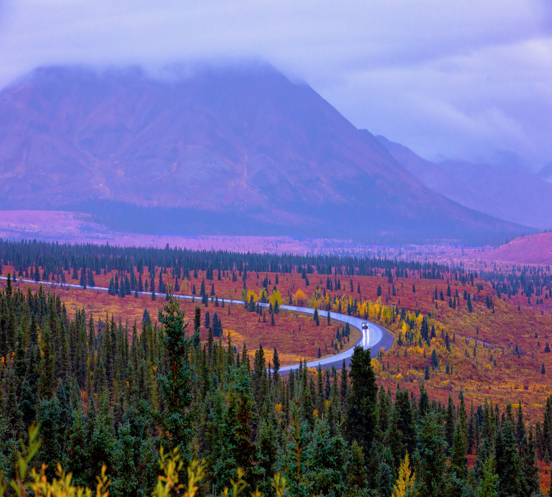
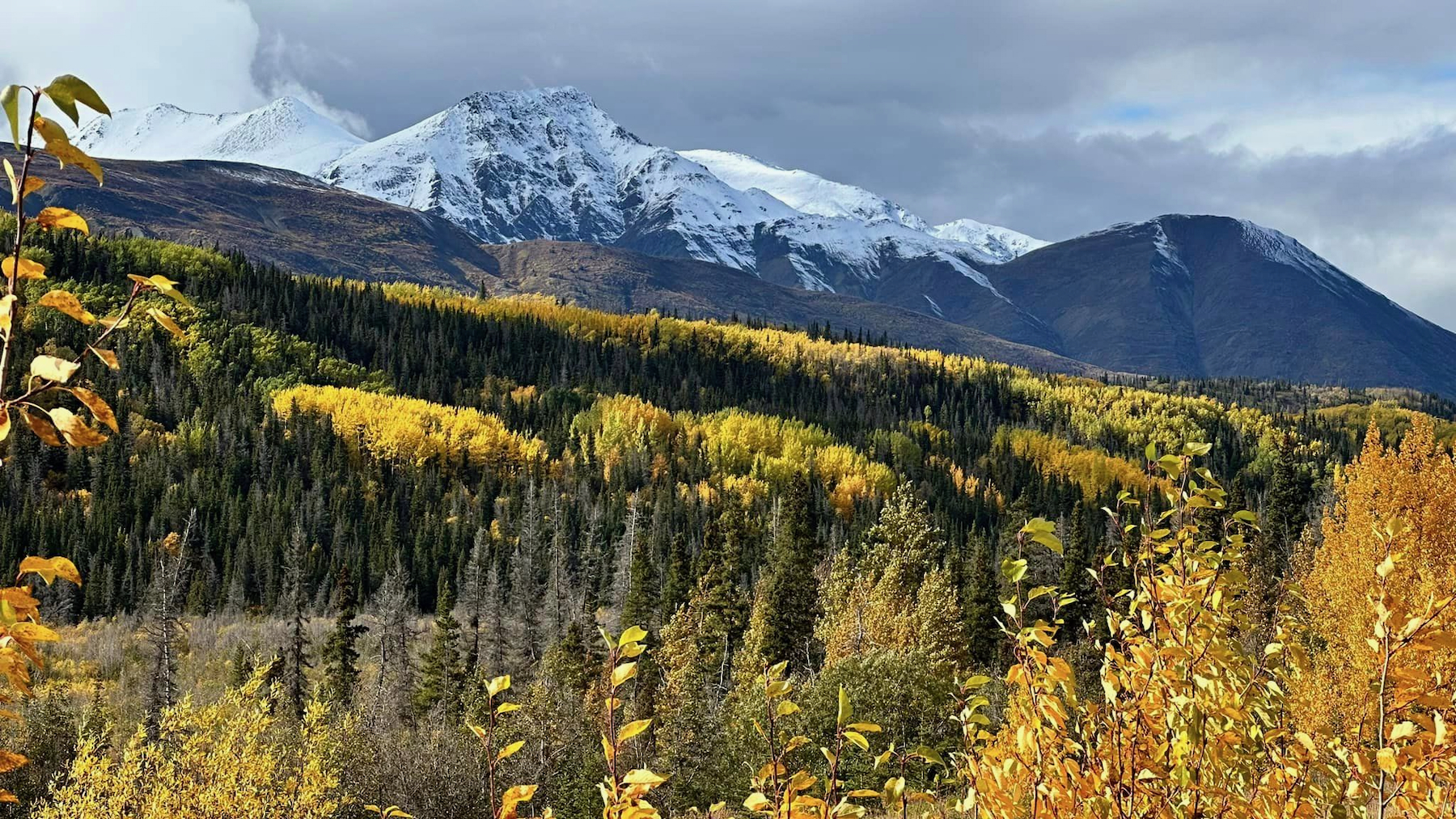
The Denali Park Road: Denali National Park
Winding through the heart of Denali National Park, this iconic road serves up spectacular views of the tundra, forests, and, of course, Mount Denali. During the fall, the landscape transforms into a rich mosaic of reds, oranges, and yellows, making it a prime destination for leaf peepers and nature enthusiasts. As the thick foliage starts disappearing, you’ll have better odds of spotting wildlife like grizzly bears, caribou, and moose.
- When to go: The reds, browns, and oranges of the tundra start to creep in around mid-August, followed by the yellowing of the aspen, birch, and poplar trees. Peak color season arrives a couple weeks later. It’s a short window. With the first frost, the leaves fall and the tundra begins to turn fully brown.
- Duration and tips: The Denali Park Road is 92 miles long, but private vehicles are only allowed on the first 15 miles. To go deeper, take the park shuttle bus or a 4- to 12-hour guided tour. Tour service ends the second Thursday after Labor Day, and private vehicles can travel to Mile 30 until October 15 (or whenever snow closes the road at Mile 3.4 at the Park Headquarters). Denali National Park is approximately 4.5 hours from Anchorage and 2.5 hours from Fairbanks. NOTE: Over the past several years, an ongoing landslide has intermittently closed part of the Denali Park Road, requiring a massive effort by the National Park Service to keep the area safely maintained for visitors and staff. Through 2026, construction will continue on a bridge bypassing the landslide. During construction, visitors will have access to the first 43 scenic miles of the park road.
Photos by: Sue Yenoli, Gary Smith, Preetam Bakshi
Turnagain Arm: Anchorage to Girdwood
This drive along Turnagain Arm on the Seward Highway to Girdwood is hands down one of Alaska’s most scenic any time of year, featuring dramatic views of coastline and mountains, with glaciers tucked into their peaks. During the fall, the Chugach Mountains and surrounding forests come alive with vibrant colors, making this a must-see drive for autumn enthusiasts. In August and September, you also have a chance to see Beluga Whales in Turnagain Arm.
- Best viewpoints:
Potter Marsh: A major stopping point for migratory birds in the spring and fall. Walk the 1,500 feet of boardwalks over the marsh looking for arctic terns, trumpeter swans, and the occasional moose.
Beluga Point: Get expansive views of Turnagain Arm, the surrounding mountains, and, if you’re lucky, beluga whales!
Bird Point: The $5 parking fee gets you access to vault toilets, spotting scopes, and the “Bird to Gird” path, which parallels the highway.
When to go: The fall colors along Turnagain Arm usually peak in mid- to late September. Plan your drive for sunset to see the yellow birch and aspen leaves that make the hillside look like it’s glowing gold.
Duration: The drive from Anchorage to Girdwood takes about 45 minutes without stops. However, with so many scenic viewpoints and opportunities for exploration, you can easily spend a half or full day enjoying this route.
BONUS! Portage Glacier Highway: Add on the short but scenic drive down the Portage Glacier Highway just beyond Girdwood. It’s just 10 minutes end-to-end, but take time to go walking or biking at the pullouts and the 5-mile Trail of Blue Ice. Stop at the Williwaw Fish Viewing Platform to see spawning sockeye, coho, and chum salmon from late August through mid-September. Turn around at the parking area by the Begich Boggs Visitor Center, which closes to visitors mid-September. Or drive the nearby Byron Glacier Road and hike the 2.8-mile round-trip trail to an overlook of Byron Glacier.
The Haines Highway: Haines to the Border, Haines Junction, YT or Skagway, AK
The Haines Highway is one of the most scenic drives in Southeast Alaska, especially during the fall when the landscape is transformed by vibrant yellow foliage. The highway takes you through the Chilkat Valley, along the Chilkat and Klehini Rivers, and eventually crosses into Canada, offering breathtaking views of mountains, rivers, and potential wildlife sightings.
- Best Viewpoints:
Chilkat River: You’ll find numerous pullouts to stop and drink in the stunning scenery. The river is lined with bright yellow cottonwoods and aspens, creating a beautiful contrast against the backdrop of the mountains, which are often dusted with fresh snow by mid-September.
33 Mile Roadhouse: Located at Mile 33, this historic roadhouse is a great place to stop for a meal while enjoying the fall colors. The surrounding area is rich with autumn foliage, and the roadhouse itself is famous for its hand-cut fries, hand-pressed burgers, and homemade pies.
Chilkat Bald Eagle Preserve: Combine beautiful fall colors with the chance to see bald eagles and other wildlife. The preserve is home to the world’s largest concentration of bald eagles, and the fall is a prime time for viewing.
When to go: Colors start changing in early September and typically peak in mid- to late September. The foliage is primarily shades of yellow which, when paired with blue skies and fresh snow on the mountains, creates a spectacular scene.
Duration & Tips: Short option—Drive to the U.S.-Canada border: Traveling from Haines to the U.S.-Canada border at Mile 40 offers a concentrated experience of the highway’s fall beauty, including river views and wildlife. Stop in at the 33 Mile Roadhouse.
2- to 3-day option—Drive the Golden Circle: This 350-mile loop, which connects Haines to Skagway via the Yukon, is aptly named for its spectacular scenery, which includes towering mountains, expansive valleys, and historic towns. The loop takes you from Haines up the Haines Highway to Haines Junction, across to Whitehorse and then down to Skagway. Take the ferry back to Haines.
Full-day option—Travel to Haines Junction: This 150-mile journey takes around 3 hours each way and offers even more spectacular scenery as you cross into Canada, with opportunities to explore the rugged beauty of the Yukon.
Photos by: Visit Haines
Steese Highway: Fairbanks to Eagle Summit
Stretching from Fairbanks to Circle, the Steese Highway offers a remote and breathtaking journey through Interior Alaska. The highway takes you through boreal forests to the high alpine regions at Eagle Summit, where the views are nothing short of spectacular. This is also a popular drive to look for the Northern Lights, which can be seen as early as August 20.
- Best Viewpoints:
- Cleary Summit (Mile 20.3): Cleary Summit is one of the first major viewpoints along the Steese Highway. Located just 20.3 miles from Fairbanks, it offers stunning views of the surrounding valleys and hills, which are particularly beautiful in the fall when the trees are ablaze with golden hues. It’s also a popular spot for catching the aurora borealis in the fall and winter.
- Twelvemile Summit Wayside (Mile 85.5): Between here and Eagle Summit, be on the lookout for caribou until mid-September.
- Eagle Summit (Mile 107): At 3,685 feet, this is the highest point on the Steese Highway. Enjoy panoramic views of the surrounding tundra, which turns a brilliant tapestry of reds, oranges, and yellows in the fall.
When to go: Peak typically happens from late August to mid-September. The summit’s elevation gives it bragging rights to the first signs of fall—just come prepared for unpredictable weather (even snow).
Duration and tips: Eagle Summit is 107 miles from Fairbanks, and the drive takes about 2.5 hours. The road makes up one section of the 161-mile highway to Circle—the largest settlement on the Yukon River before the Klondike Gold Rush. The first 81 miles are paved, providing a smooth ride through boreal forests and along the Chatanika River. The gravel road that follows requires a suitable vehicle; rent one through agencies like Arctic Outfitters, Alaska 4x4 Rentals, Alaska Auto Rentals, and Alaska Overlander.
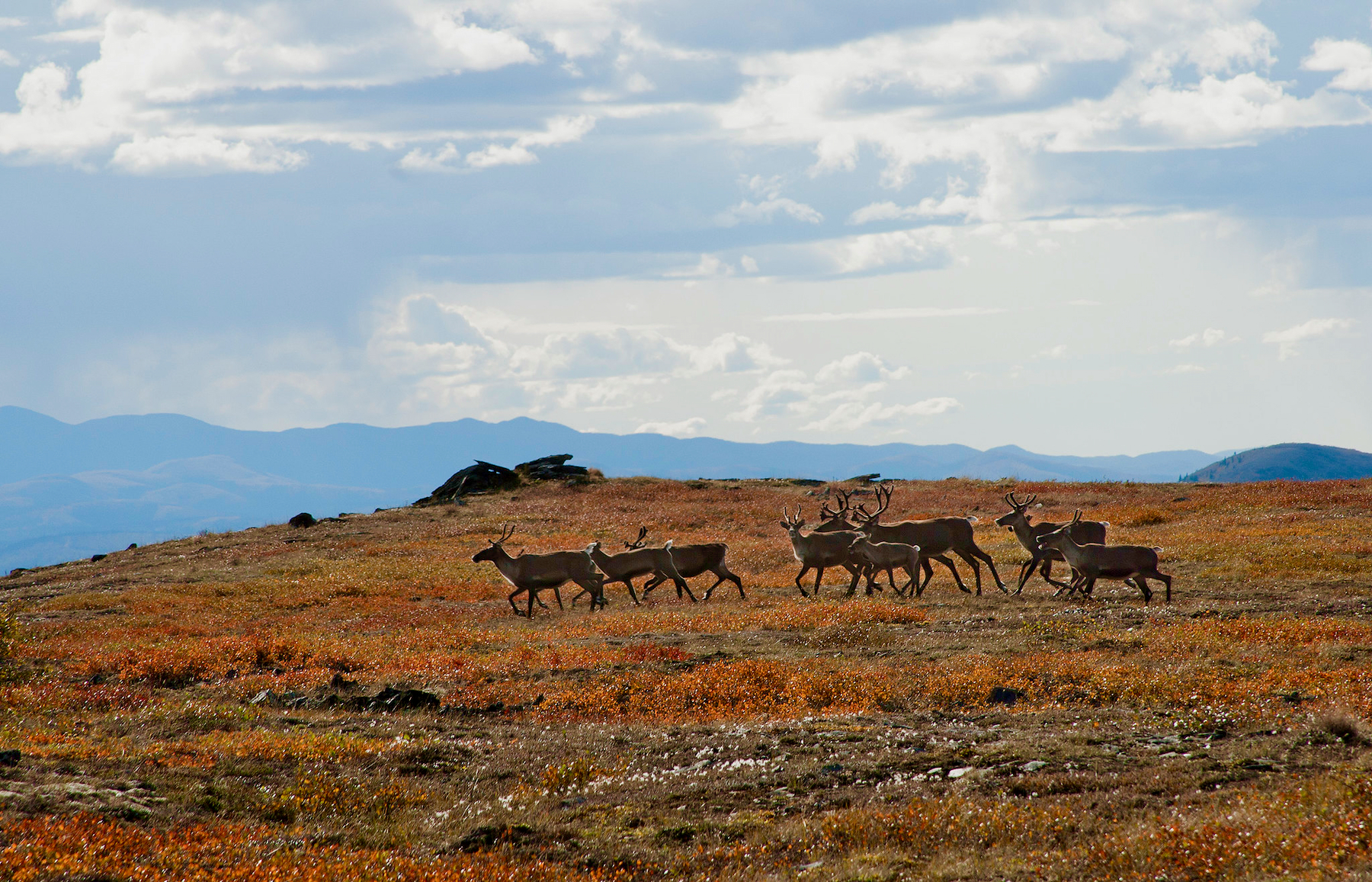
Photo: Craig McCaa, Alaska BLM
Comments
Explore Further