Backcountry travel in Alaska affords an opportunity rarely found in the Lower 48: off-trail navigation! While some routes here have well-maintained official trails or popular social trails that are easy to follow, some trips will require off-trail travel using topographic maps.
Many people will be looking at these maps using portable GPS devices and cell-phone applications like GaiaGPS. These tools, of course, helpfully place you on the map and usually indicate the direction you're going. But paper maps and a compass will always have a place on your backcountry packing list; while they require you to determine your location and trajectory, keep in mind that they never run out of batteries.
Reading a Topographic Map
Analog or digital, there are a few key things to look for on these maps:
Color
Start simple and differentiate these maps by color. Blue indicates water (ponds, marsh, rivers, streams, and glaciers), brown shows tundra or rock, and green shows vegetation (the more saturated the green color, the denser the vegetation). Occasionally, maps or more remote parts of Alaska show everything in brown, making them ore difficult to read.
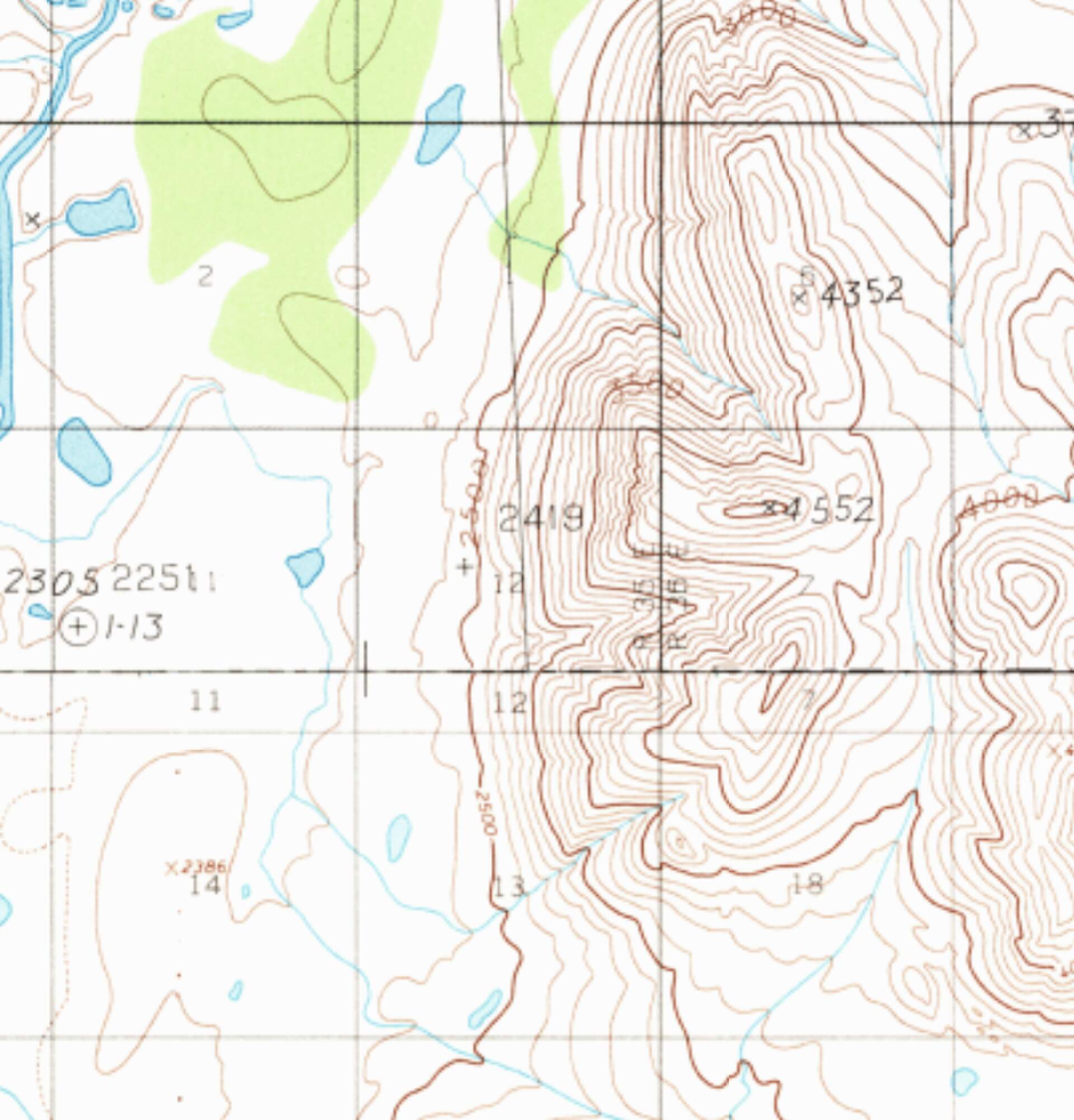
Sample of the blue (water), green (dense vegetation) and brown (rock/tundra/alpine) of a typical topographic map. (photo courtesy of Haley Johnston)
Contour lines
These indicate the steepness of the terrain. The closer the contour lines, the more quickly the terrain is gaining or losing elevation over a given distance. Every map has a scale that indicates the vertical distance between these lines. Typically, maps in the Lower 48 feature 40- to 80-foot contours. Maps of Alaska usually use 100-foot contour lines, meaning tightly spaced contours indicate extremely steep terrain.
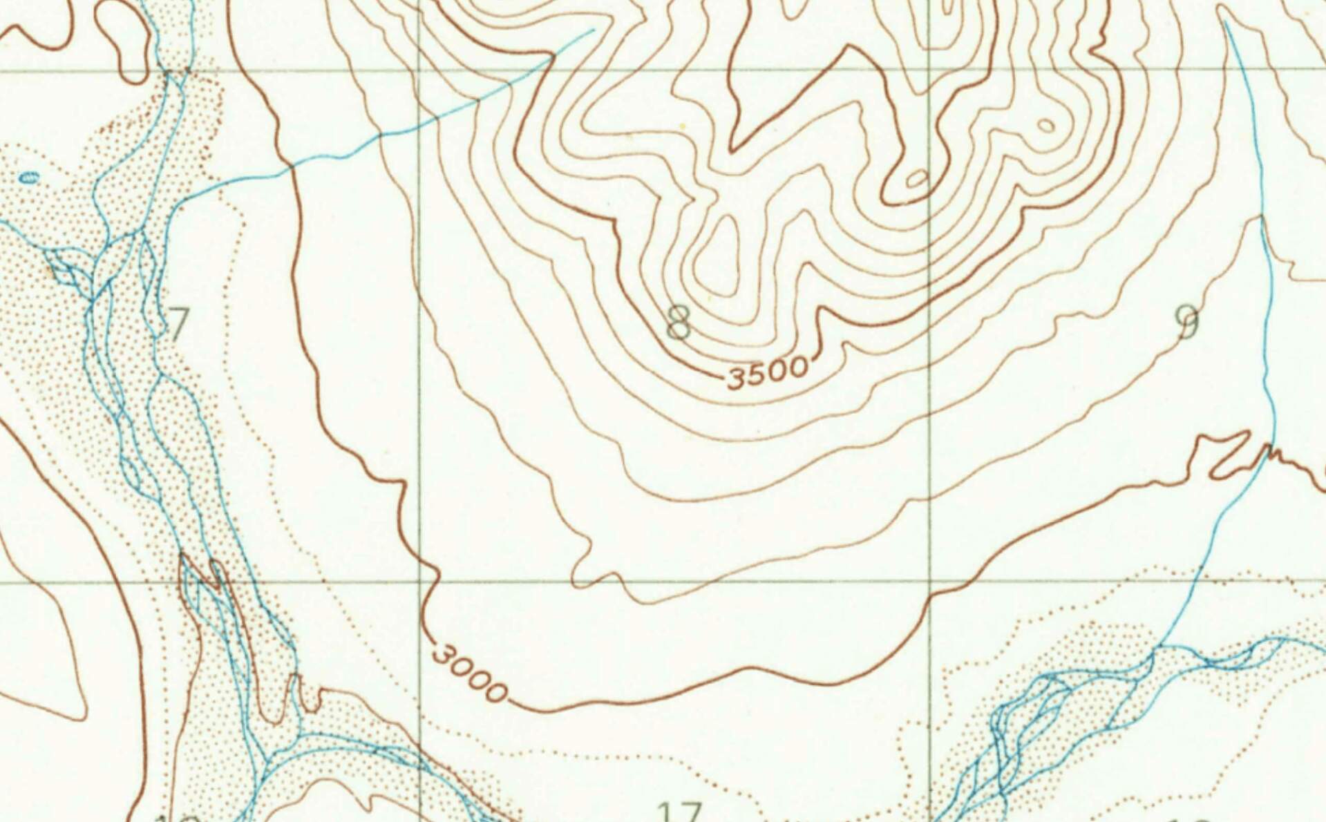
Example of 100 foot contour lines - elevation labeled each 500 feet. (photo courtesy of Haley Johnston)
Date of Revision
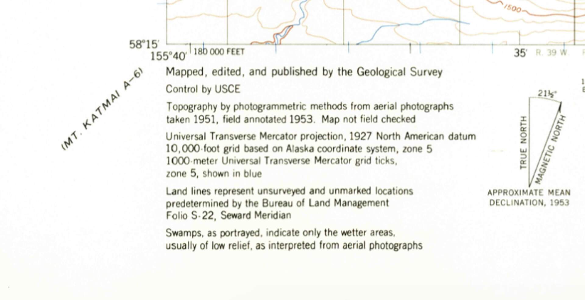
At the bottom of a paper topographic map, you'll see when the map was last revised. This is especially important in areas with glaciers. Because most glaciers in Alaska are retreating, a map dated 1958 will show more extensive glaciation than currently exists. As glaciers retreat, they leave behind unstable piles of talus; use caution in these areas.
(photo courtesy of Haley Johnston)
Declination
Usually also indicated at the bottom of a paper topographic map, declination is the number of degrees you'll need to adjust your compass to point true north, instead of magnetic north. Declination increases at higher latitudes, meaning declination in Alaska is greater than that in Ohio. Declination also changes over time, so be sure you have the current declination for your location.
Regardless of your navigational tool, backcountry navigation can be split into three categories: route selection, macro-navigation, and micro-navigation.
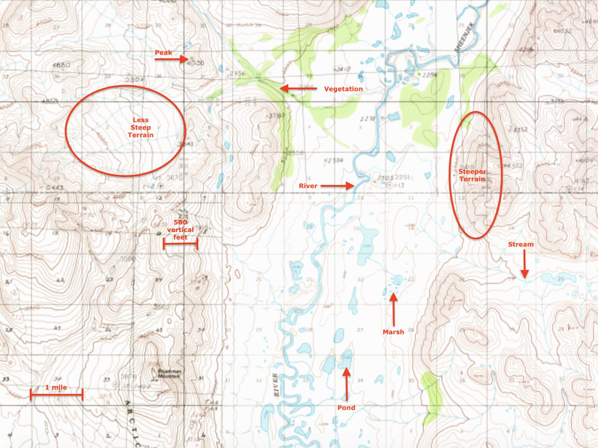
Sample topographic map with a variety of terrain features. (photo courtesy of Haley Johnston)
Route Selection
Route selection happens before you trip. You'll decide where to start and end your trip, and how to move from Point A to point B. Sometimes, route selection is obvious. If you're hiking the Chilkoot Trail in southeast Alaska, for example, you'll start in Dyea, AK and end in Bennet, BC, following the maintained trail. But sometimes, you'll have 100 different possible combinations of start/end locations and routes to follow. Route selection also happens during a trip when your intended route is no longer safe or appropriate. More snow coverage than anticipated, flooding rivers, or, say, the health of a trip member are just some of the many reasons you may reevaluate your route selection and change your original plan.
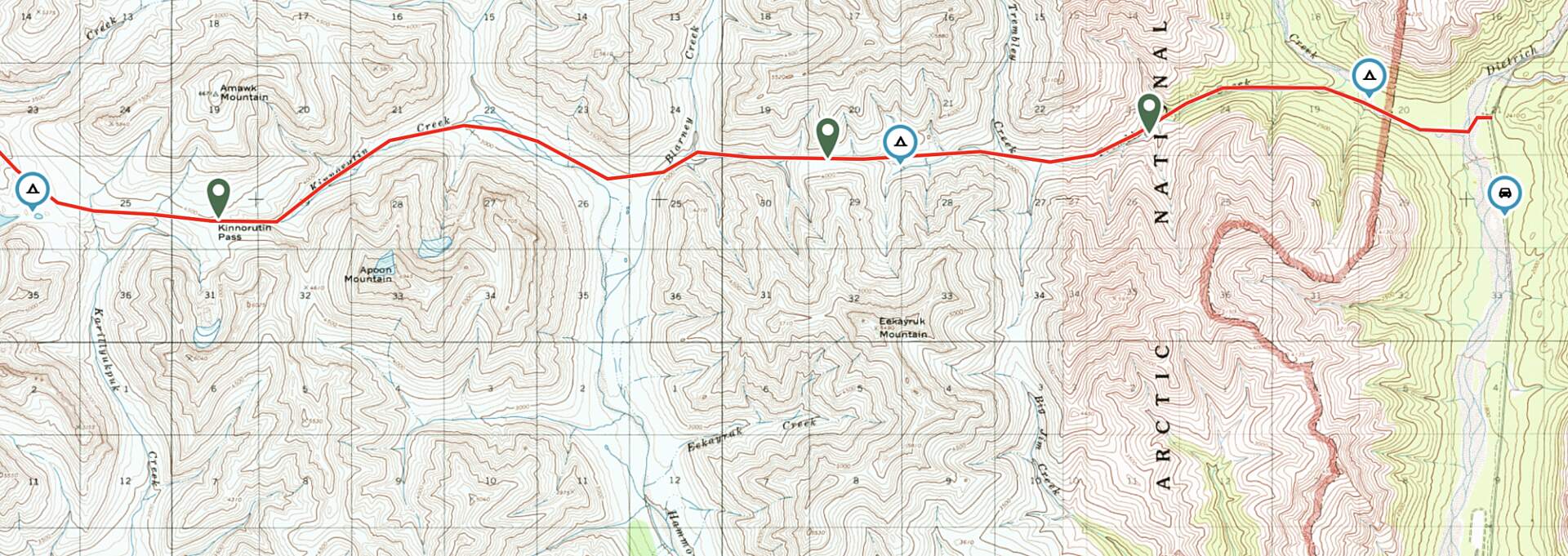
Using digital topo mapping tools to plan routes, including starting point, campsites, general routes and prominent passes. (photo courtesy of Haley Johnston)
Macro-navigation
Macro-navigation is the large-scale view of your travel for a section of your trip, like ascending the pass at the end of the valley where you're backpacking, or continuing downstream until the next confluence in your packraft. In conjunction with your GPS or map, you'll use large terrain features - rivers, streams, obvious cliffs, large peaks, and ridgelines - for this type of navigation. Begin by asking yourself some basic questions: Is there a large river on my left? Do I see a pointy peak to the northeast of me? Which direction is the creek in front of me running? These questions will help you orient yourself in the landscape and on your map (whether it's paper or digital). Once you're confident in your general location and trajectory, you can move on to micro-navigation.
Micro-navigation
Micro-navigation is the collection of small decisions you make all day to reach your large-scale goals in the most efficient way possible. And the scale of terrain to consider is often not represented on maps. Perhaps the south-facing side of the valley you're in has less vegetation and will be easier to travel through. Or maybe what looked like a nice, broad valley on the map is actually a mire of ankle-twisting tussocks, and you should ascend to slightly higher terrain.
Braided Alaskan rivers especially require micro-navigation. Of the many channels represented on the map, some may no longer exist, some may have moved, or new channels may have been created. Searching for the deepest water at each channel intersection will help you avoid having to drag your boat back to deeper water.

