So you want to plan a sea kayaking trip in Prince William Sound, Kenai Fjords, or Glacier Bay? You've found the right spot!
We've mapped hundreds of dropoff spots and campsites. You can search them by feature, such as locations where you can paddle amongst glacier ice, or that have good nearby fishing or hiking. You can also search camping locations by size. We've also compiled dozens of expert advice articles to help you plan your trip.
Browse Kayaking Trips by Feature: Glacier Ice, Good Hiking, Good Fishing
Kayak Rentals
If you need to rent some gear for your kayak expedition, contact our friends at Alaska Outdoor Gear Outfitter & Rentals. Talk them about your trip and they'll recommend the best equipment.
Guided Options
Love sea kayaking, but not committed to camping or going it alone? See our list of guided options in Alaska, or tuck into a yurt with unlimited access to kayaking. There are two outside of Seward, Alaska. The first is Orca Island Cabins which boasts 7 yurts located on a private island in picturesque Humpy Cove, each with a private deck and bath. The other is Shearwater Cove, where you'll find two yurts tucked into a picturesque cove.
Show Map
Sea Kayaking Trips
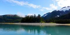
A large, popular beach for camping and water taxi drop offs and pick ups. Only 17 miles from Whittier it is often a first or last camp spot for intermediate paddlers without a water taxi. This beach provides large durable camping areas and fresh glacial streams in the vicinity.
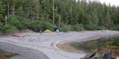
A wonderful beach campsite for a calm day. Surrounded on two sides by the sea, this campsite has beautiful views out to Nellie Juan-College Fjord and over to Perry and Knight Island. Large durable camping area, but beware of high tides. Both beaches are steep unless at low tide and could be used as a water taxi drop off location.
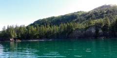
A popular drop off and pickup beach for water taxi, however camping is not an option on this beach. Most people choose to paddle a short distance towards the glaciers for durable and level camping.
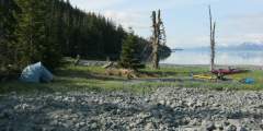
This beach has all the amenities of a perfect kayak camp spot. A raging river splits the cobble beach in two, and a hanging glacier provides the perfect background for a few packed, grassy tent spots. Within a morning paddle distance from Meares Glacier, Brilliant Beach is an excellent launching point. The beach is safe from the highest tides, and is long enough for multiple parties to camp out. Since it is so far up the Unakwik Inlet,… ...more
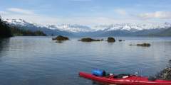
A wonderful treasure for the paddlers wanting to be in the middle of Prince William Sound. This site is well protected between two halves of Olsen Island and has well established camping spots for many tents in the forest, and good trees for hanging food. The beach is steep and wide with oyster catchers patrolling the shore. Freshwater is not on the island, but can be found in the adjacent Olsen Cove or further west on the mainland.

Icy Bay lives up to its name with an active tidewater glacier often clogging the fjord with icebergs. This remote fjord in Prince William Sound is a special spot for paddlers looking for spectular views of Tiger and Chenega Glacier descending into the sea. Beware of tight ice conditions changing with the tide and strong cold katabatic winds off of the Sargent Icefeild.
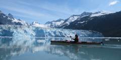
This is a true jewel at the end of Unakwik Inlet. Located just Northwest of Meares Glacier, this steep, sandy beach is about as close as a kayak dares to paddle towards an active tidewater glacier.
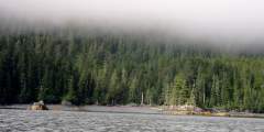
There is a small creek for fresh water, and wooden walkways in the trees. Tent platforms are tucked up on the inside of a small spit of land, and the drop off beach faces due East on the opposite side of the spit.
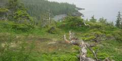
Tipping Point, on Northwest Perry Island, is a very accommodating beach campsite with excellent views out to Port Wells and Perry Passage. There is fresh water, beach camping for a few tents, and possibilities for hiking up on Perry Island.
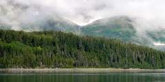
Facing Beloit Glacier, 17 Mile Lagoon and the nearby Eagle´s Nest beaches are popular beaches for kayaking trips nearby the tidewater glaciers. This point is easy to find as it lies just on the glacier side of the very shallow terminal moraine of Beloit Glacier on Willard Island.

Humpback whales commonly swim along the shore and you can hear them from your tent. With tidewater glaciers, wildlife, and many scenic paddles in close proximity, Dual Head is a good base camp. Fresh water can be found on the North end of the beach.
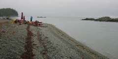
Crafton Island will amaze everyone! Overhanging cliffs and caves, green-blue waters, cobbled beaches, and fantastic views. You also get great exposure to Knight Island Passage and greater Prince William Sound. Few beaches are comparable to those on Crafton Island.

This is a popular area for kayaking, and there are a series of flat beaches-which are actually alluvial fans formed by glacial outwash along the east shore of Blackstone Bay, where kayakers get dropped off.

As you cruise through it, this spectacular passage necks down narrower and narrower until you are looking straight up at lush green walls that seem to enclose the boat on both sides. You’ll rarely see another boat in here.
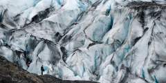
Paddle around a quiet lagoon with the impressive Shoup Glacier at one end and icebergs that have calved from the glacier, marvel at the lively black-legged Kittiwake Rookery, and take in the feeling of being somewhere remote — even if you’re only 5 miles from town.
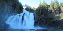
Cascade Bay Campsite, in Eaglek Bay, Prince William Sound, is a remote, tent-only site managed by the U.S. Forest Service. Accessible only by boat, it offers 3 primitive campsites amid spruce and hemlock with a waterfall backdrop. Ideal for solitude, it’s perfect for kayaking, fishing, and spotting marine wildlife like seals and whales in untouched wilderness.

A two-hour kayak ride up Mitchell Bay toward Hasselborg Lake takes you through a serene, pristine wilderness. You’ll share the area with water birds, eagles, salmon and of course, brown bear. Portage at a U.S. Forest Service cabins to stay awhile and take in more of the incredible Tongass National Forest.
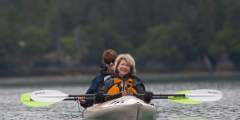
Although this can be a busy spot, it is a lot less congested than the Homer Spit. Things to do here include: taking small day hikes, paddling in the lagoon, camping, staying at one of the three nearby public use cabins, and the most popular, fishing for Kings during the month of June.

The 125-mile water trail is intended to inspire exploration, understanding and stewardship of the natural treasure that is Kachemak Bay. People will take their own boats, kayaks, skiffs, or canoes on a mapped route which highlights the stops and the views along the way. On the website, you will find suggested itineraries.

A popular place for cruises and kayaking. You can stop along the shore, pitch a tent and enjoy the solitude and scenic views for a day or two.
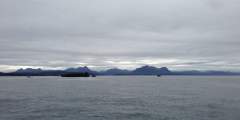
Shuyak Island offers sea kayaking for both the novice and the experienced kayaker. The inner bays (Neketa Bay, Big Bay, Western Inlet, Carry Inlet, and Shangin Bay) are well protected from weather and generally remain calm enough for novice kayakers. The outer coast is exposed, and large swells, rough seas, high winds, and heavy surf are common there. Only skilled kayakers should paddle the outside waters. Under all circumstances, be alert… ...more

From Big Bay paddle out the west entrance of the bay along the northern shoreline. Head north at the entrance and follow the shoreline to North Cape. Paddle east to Dead Bird Beach. A short, unmarked portage through the rye grass brings you into the back lagoon of the NW arm of Big Bay. This portage is short at high tide; it is longer and muddier at low tide. This loop can be done in either direction and takes 3 to 5 hours. Be cautious when… ...more

From Big Bay paddle to the far end of the NE arm of Big Bay. Follow the river-like waterway into Middle Lagoon, paddle across the lagoon, and follow the passage out. Skiff Passage goes completely dry at low tide and can only be kayaked at a high tide of 12 ft.* or more. Water floods into Skiff Pass from two directions; It flows north from Big Bay into Middle Lagoon and south from the outer coast into Middle Lagoon. When the tide turns, the… ...more

Humpback whales, sea otters and harbor seals are scattered throughout the Beardslees, with whales and otters most likely to be seen on the western side of the islands — nearest to open water. Watch the shore for black bears and moose. Black oystercatchers – black shorebirds with bright red-orange bills – nest on the islands. Look for harlequin ducks, pigeon guillemots, pelagic cormorants, arctic terns, marbled murrelets and large flocks of ...more

Nestled in the south end of Dangerous Passage, Jackpot is remote, protected, and is in an area close to the glaciers in Icy Bay. With a vast lake system to the North of Jacpot Bay, there is plenty of freshwater flowing into the protected lagoons. Whales are common in the area.

From Carry Inlet paddle north out of the entrance of Carry Inlet along the eastern shoreline to Carshan Pt. Go around the point and paddle SE along the shoreline into Shangin Bay. Paddle approximately 2⁄3 of the length of Shangin Bay, then paddle west into the large arm of the bay. At the far NW end of this arm there is a marked portage trail leading into Carry Inlet. This is a short portage at high tide, but is not recommended at low tide. If… ...more

From Big Bay paddle to the long beach between the NW and NE arms of Big Bay. There is a portage trail, marked on both sides with buoys, leading from Big Bay into Western Inlet. Portage this 1⁄8 mile trail, then paddle along the shoreline to Dead Bird Beach. A Short, unmarked portage through the rye grass leads to the back lagoon of the NW arm of Big Bay. The many islands at the entrance to the Western Inlet are fun to explore in a kayak. Relax… ...more

From Big Bay paddle to the SW arm of the bay and portage the hump between Big Bay and Neketa Bay. During high tide, it is a very short, easy portage. (The hump floods completely over during tides larger than 15 ft*.) At low tide, the portage is longer and muddier. Paddle SW out of Neketa Bay. At the entrance, head north. Follow the shoreline to Eagle Cape, then paddle west into Big Bay. This loop can be done in either direction and takes 3 to… ...more


