Alaska Road & Highway Maps
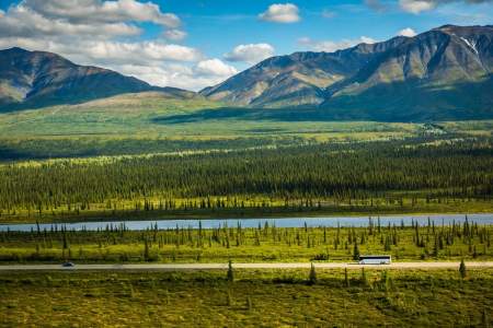
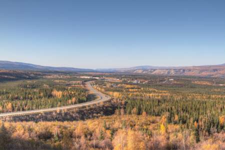
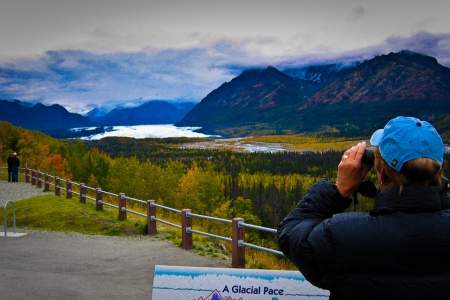
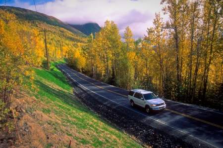
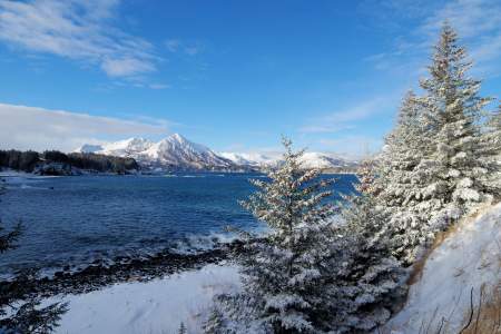
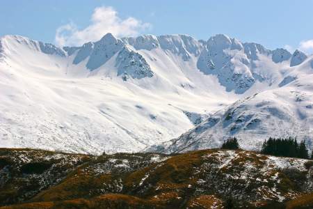
Beyond the glaciers, the magnificent waterways, and abundant sea life lies an Alaska even more rugged, more remote, and more personal. It’s Alaska on the road – the open road.
Alaska’s rugged network of highways beckons travelers into its heart. Unlike any road trip in the lower 48 states, you’ll journey into a wilderness that completely surrounds you on all sides. Rabbits, foxes, eagles, and other wildlife appear before you then fade into the landscape. Moose browse alongside creeks. Bears forage in the distant hills. Scene after scene unfolds as a movie projected onto your windshield.
Driving in Alaska is not about getting from point A to B, it’s about experiencing what’s in-between. Our best advice is simple: Take your time. Let your attention – and the steering wheel – wander.
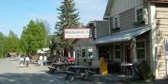
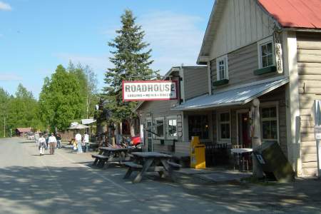
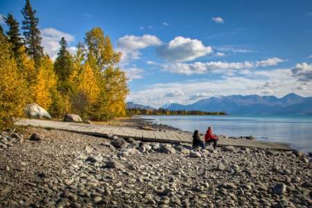
Explore side roads that often lead to rivers where you can pull out collapsible chairs, write in your journal, contemplate the music of the river, or even have a campfire. Other roads lure you into small towns where the pace of daily life slows dramatically, especially in summer, a timeless period when light lingers pretty much around the clock. Take this opportunity to meet local characters, hear their stories and learn how the Alaskan wilderness fuels their imaginations and lives.
In Alaska, the adventure happens while you’re getting there. Step into the car and back in time, and enjoy the freedom, adventure, escape, and even self reflection offered by driving Alaska’s open roads.
Highway Guides
Connecting you to Alaska's top destinations
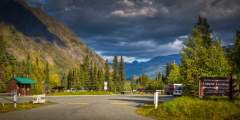
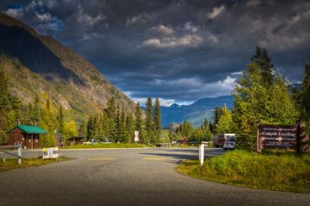
Eight signs will guide you through the Copper River watershed landscape. See if you can visit all eight signs on your tour through this upriver basin formed by the ancient, glacial Lake Atna!
Driving non-stop from Anchorage to Homer would take a good 4.5−5 hours. However, you’ll find plenty of reasons to pull over on the drive south: Wildlife often appears along the roadside. Pullouts offer photo opportunities of whales, waves, and volcanoes. Trailheads lead to fabulous alpine and ocean views. Restaurants offer lunch breaks beyond the usual fast-food fare. Enjoying all the scenery and activities along the way could easily stretch this ...more
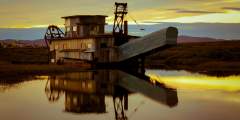
Fairbanks, Alaska’s second-largest city, is a former gold-rush town with a cutting-edge university-and it still holds onto its fiercely independent roots. Tour old gold mines, take a historic riverboat cruise, or just wander around downtown.
Just two hours north from Anchorage, Talkeetna is a town with authentic pioneer feel and modern tours and lodging facilities. It’s the perfect stop en-route to Denali, or as a day drive from Anchorage. Top excursions include rafting, jet boat tours, and flightseeing tours of Mt. Denali.
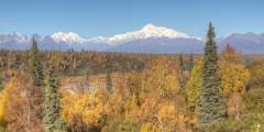
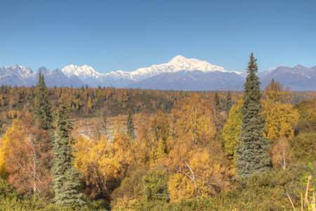
It’s a 5‑hour drive up to the park from Anchorage, and you’ll find a number of scenic highlights and activities along the way
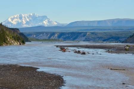
This drive follows the 368 mile Richardson highway from Valdez to Fairbanks, and takes approximately 7.5 – 8 hours to complete. Even though the travel time is an investment, like most Alaskan highways, the views are incredibly rewarding.
The drive from Anchorage to Valdez takes 6 to 7 hours on average. But, there are many scenic vistas and unique places to stop along the way making it easy to spend more than 6 hours on the road. You will have views of several mountain ranges, glaciers, and more.
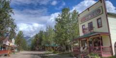
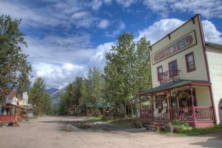
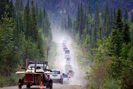
The drive to McCarthy and Kennicott isn’t your run-of-the-mill road trip. It’s 7 – 8 hours from Anchorage, with the last 61 miles-between Chitina and the Kennicott River-on an historic, gravel road. Not all rental vehicles are allowed on the McCarthy road, so check with your rental agency before you travel.
The Sterling Highway begins at the Tern Lake Junction of the Seward Highway and stretches 142 miles to the town of Homer
The Glenn is hard to avoid if you want the full Alaska experience. Not only does it connect you with popular destinations and other major highways, this well-maintained road takes you from downtown Anchorage to Alaska’s farmlands, glaciers, and beyond.
This northernmost section of the Parks Highway, paved and open all year, takes you through small towns and stretches of wilderness.
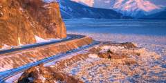
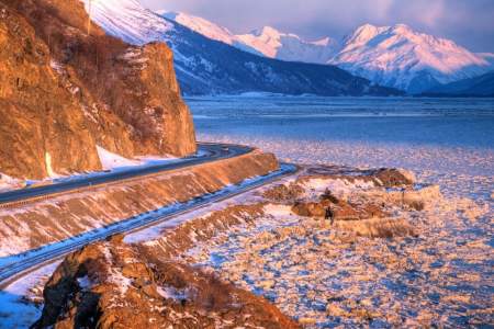
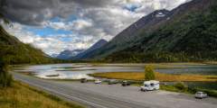
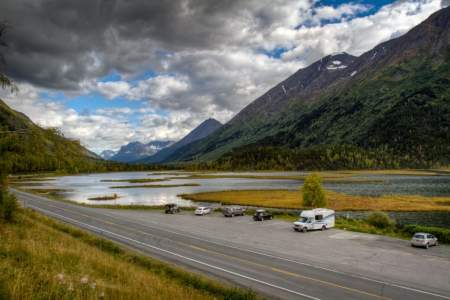
The drive from Anchorage to the seaside community of Seward begins with two hours of spectacular views as you pass between the dramatic shorelines of Turnagain Arm and the jutting peaks of the Chugach Mountains.
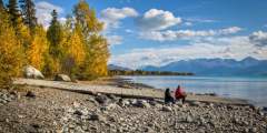
Scenic Day Drives
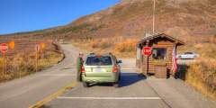
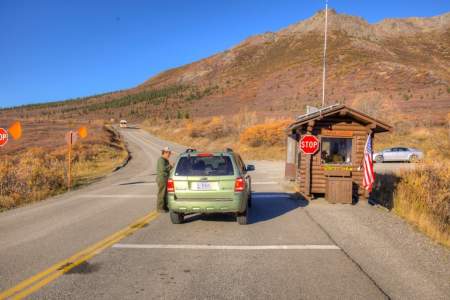
It’s 92 miles and about 5 hours from the park entrance to Kantishna, the end of the Park Road. Private vehicles aren’t permitted after Mile 15, so you’ll need to take either the hop-on, hop-off park shuttle bus or one of the tour buses. This road is only open in the summer months between May and early September. Dates vary depending on annual snowfall.
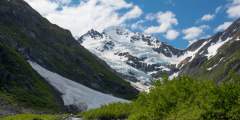
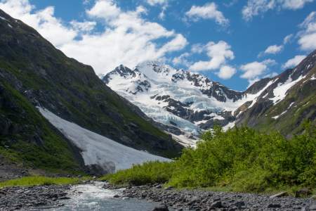
Portage Valley southeast of Anchorage at the head of Turnagain Arm offers so many potential adventures that you might have to tow a trailer loaded with gear to sample them all. What will you find here? Biking, hiking, picnicking, fishing, paddling, wildlife viewing, potential iceberg sightings — plus a natural history visitor center packed with interactive displays about the ecosystem of the valley and Prince William Sound. It’s like an outdoor ...more
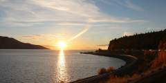
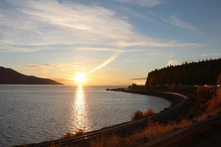
The Seward Highway hugs the dramatic shorelines of Turnagain Arm. One of the most beautiful stretches of highway in America
To enjoy a scenic drive just a few minutes from downtown Anchorage, head north to mile 6.1 on the Glenn Highway. From here, you can head up the steep and winding, Arctic Valley Road. The drive itself is only 45 minutes, but once you get there, you’ll want to spend more time photographing and exploring.
To explore the road less traveled, take the Old Glenn Highway to Palmer, a back road that feels like old Alaska. This 19-mile country road cuts through the heart of Alaska’s farmland and is a scenic, quiet alternative between Anchorage and Palmer. The road accesses state parks and recreation areas, petting zoos, and hiking trails and passes through picturesque terrain: pastoral countryside beneath the Chugach Mountains and Pioneer Peak. The… ...more
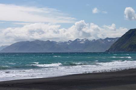
A 17 mile one-way jaunt from Chiniak Highway, this road was completed alongside the development of the Alaska Aerospace Corporation launch site, which is at the end of the road. In addition to accessing the private site, the paved road offers recreationalists and travelers access to great fishing beaches and rivers, surf spots, state parks, and scenic views of alpine passes and ocean. There’s also a private ranch here, where semi-domesticated ...more
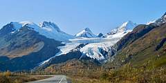
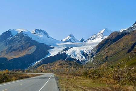
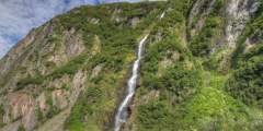
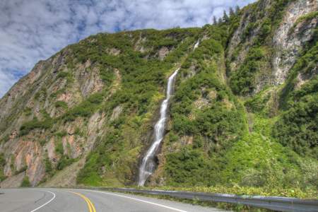
Where can you drive to see an amazing glacier, a museum with a saloon, and an old town site in a little over 30 minutes? The 32-mile trip from Valdez to Worthington Glacier is short, but worthwhile. The drive itself is beautiful, with this span of the Richardson Highway just alongside Lowe River.
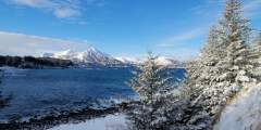
A curvy road following the shoreline south from town, this 42-mile highway will take you past the U.S. Coast Guard Station, salmon streams, long ocean inlets, and exposed surf beaches.
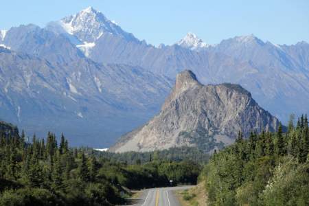
Driving north from Anchorage isn’t as instantly dramatic as going south, but within an hour you’re immersed in stop-and-shoot scenery. The Glenn Highway runs northeast to agricultural Palmer, then twists east along the Matanuska River Valley, sandwiched between coastal and interior mountains.
This 18-mile-long loop gravel road is the premier wildlife-viewing area on the Kenai Peninsula, and you’ll get spectacular views of lakes and glaciers. Don’t forget to stop and explore all the nature and wildlife around you!
Under an hour from Anchorage, this 22-mile drive takes you away from Alaska’s towns and cities, and into Chugach State Park. The road is smooth with twists and turns, and runs alongside Eklutna River, and the beautiful and glacial Eklutna Lake. You can also see Twin Peaks over the trees.
Driving north from Anchorage isn’t as instantly dramatic as going south, but within an hour you’re immersed in stop-and-shoot scenery. The Glenn Highway runs northeast to agricultural Palmer, and from there you can take a mountain road to scenic Hatcher Pass.
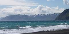
The shortest road out of town, Rezanof Drive becomes Monashka Bay Road and runs northwest of Kodiak for 12 miles. On this drive, you’ll get great views of the Specific coast, hiking trails, tide pools, a white-sand beach, and a museum.
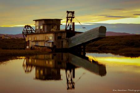
Nome — Council Road spans 72 miles (East) and takes 2 hours one-way without stops. For spectacular birding, sweeping coastal views, and the famous “Last Train to Nowhere,” explore the Nome — Council Road. Additional highlights include the Safety Roadhouse, which is the last stop on the Iditarod Sled Dog Race, and the small community of Council, which boasted a population of 15,000 in its heydey.
Heading southwest out of town and then curving towards the north, this relatively short road offers access to salmon streams, wildlife habitat, hiking, winter recreation, the Coast Guard golf course, and a protected bay that’s great for sea kayaking and beachcombing.
When locals want to see trees, they head north on The Nome — Taylor Road (also called Beam Rd. or Kougarok Rd.) The 85-mile gravel road runs north-south and takes 2 hours one-way without stops. The route winds past many old mining claims, the popular Salmon Lake, and offers a side trip to historic Pilgrim Hot Springs.
The Nome – Teller Road brings you within 55 miles of Russia, and is as close as you can drive to the Bering Strait Land Bridge. The road travels 73 miles northwest and takes about 2 hours one-way without stops. You end at Teller, an authentic Inupiat village of fewer than 300 people who survive on a subsistence lifestyle.
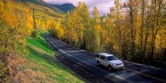
Off the Beaten Path
Take the road less traveled
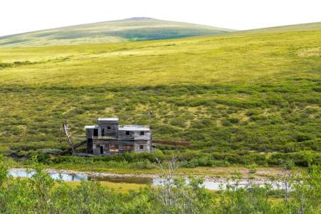
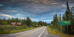
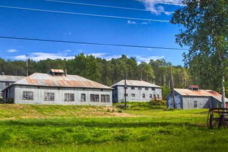
History Taylor Highway is a route through gold mining history. Gold was discovered here as early as 1881, and discoveries in 1887 and 1888 lead to interior Alaska’s first gold rush. Mining settlements like Jack Wade, Chicken, and Franklin were established practically overnight. Walking trails were quikly forged by men traveling between nearby Eagle and the new mining settlements. These paths eventually became wagon roads, and then Taylor… ...more
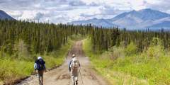
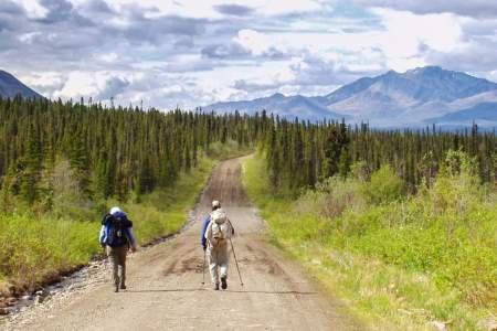
If you’ve seen the TV show Ice Road Truckers, then you’re familiar with the James W. Dalton Highway, a 414-mile stretch of gravel and dirt that runs from the town of Livengood up to Prudhoe Bay and through some of Alaska’s most remote wilderness.
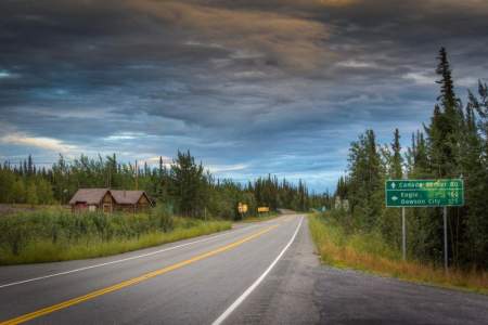
Taylor Highway (Hwy 5) is open seasonally from April to mid-October. Conditions of the road can range anywhere between good to poor and depend heavily on weather and maintenance. Keep in mind that there are very limited services or facilities available along the road past Eagle.
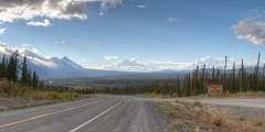
Paved and well-maintained (with some rough patches in winter), this 125 mile drive is a great way of seeing Alaska’s backcountry. While it is a beautiful drive year-round, locals have said their favorite time to take the Tok Cutoff is the fall and the spring, not only for the changes in flora, but for the start of migrating caribou!
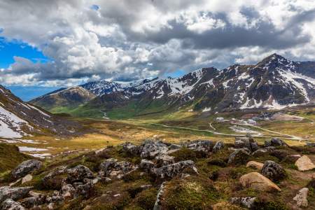
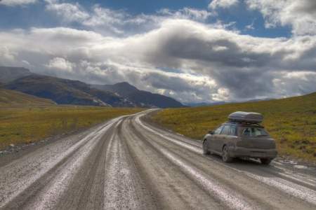
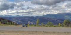
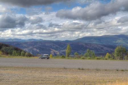
The name isn’t completely arbitrary – For most of the ride you drive along the peaks and crests of mountains and hills, leaving you a view of the valleys below. Though only open in the summer months, this 79 mile gravel-road has some spectacular views of the Alaska Range, and can take you on your way to Dawson City in the Yukon.
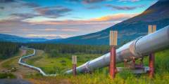
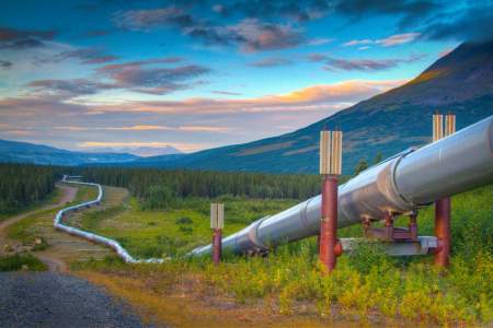
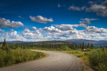
Open year-round, the Elliott Highway is paved until it meets the Dalton Highway at mile 73. But don’t let a little change in the road stop you from taking this amazing drive! Pass through the White Mountains and get the first good views of the Alaska Pipeline, and relax at the natural hot spring in Manley.
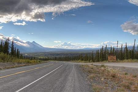
The Alaska Highway, sometimes known as the ALCAN (Alaska-Canada Highway), is the only way to drive up to Alaska from the lower 48s. While the trip in total from Dawson Creek, British Columbia to Delta Junction, Alaska is 1,387 miles, the drive from Port Alcan at the border is closer to 200 miles. This guide will give you good reason to make stops between the border and Delta Junction, where the Alaska Highway meets the Richardson Highway.
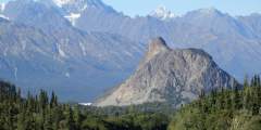
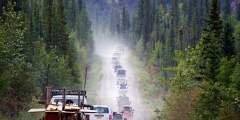
A little less than half of the 127 mile trip from Glennallen to McCarthy involves paved roadways, and the gravel surface of the McCarthy Road makes the trip slow going. However, if you’re prepared for any conditions (stop by the Chitina Ranger Stations, and be sure to bring a spare tire and jack!), the drive from Glennallen to McCarthy is well worth the effort. The drive is one of two access points to Wrangell-St.Elias National Park, and takes ...more
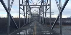
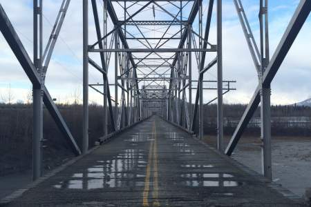
NOTE: The Copper River Highway is currently closed beyond mile 36, where there is a failed bridge. As of this time, the road does not go beyond that point. The 49.5 mile Copper River Highway leads from the town of Cordova to the Million Dollar Bridge. The Million Dollar Bridge was once used by the railroad to haul copper from Kennicott to the port of Cordova, and was added to the National Register of Historic Places in 2000. Aside from the ...more
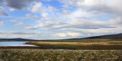
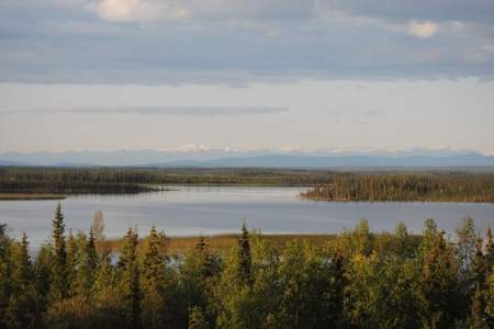
The skies of Interior Alaska are not something to miss, and the Steese Highway is an excellent way to experience them. In the summer, the sun hangs low in the sky for long periods of time and numerous small clouds come and go, creating a moving dance of light and shadow. You can drive to Eagle Summit (3,624 ft.) during summer solstice (June 21st) to see the sun crawl across the horizon. Or you can drive the Steese Highway in the winter and get a ...more
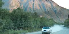
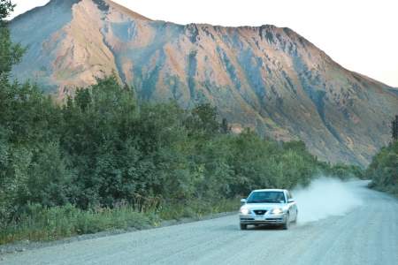
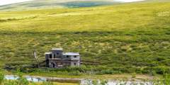
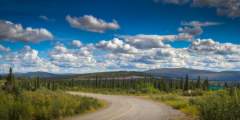
Drive down the 42-mile Nabesna Road for tremendous views to rival any road system in Alaska. The Wrangell, Mentasta and Nutzotin Mountains create a majestic panorama, characterized by some of the highest mountains in North America. Nabesna Road is one of two that allows access to Alaska’s largest national park, the Wrangell-St Elias National Park and Preserve. Services are limited and road conditions vary with the seasons, but there are plenty of ...more
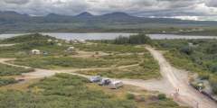
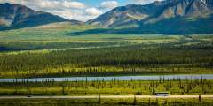
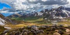
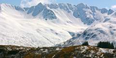
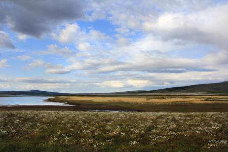
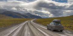
The Denali Highway, stretching 135 miles from Paxson to Cantwell, is certainly one of the most spectacular drives in the world. Much of the route lies above timberline, so the vistas go on forever. The mountains and glaciers of the Alaska Range form a majestic backdrop, with miles of rolling tundra punctuated by shallow lakes in between. There are a few along the way, and you can camp anywhere along the highway.