Nome Scenic Drives
No other place in Bush Alaska has a road system like Nome. Three gravel highways, each around 75 miles long, showcase dramatic and very different landscape. They wind through a wilderness of tundra, mountains, coastline, rivers, and valleys littered with abandoned gold dredges and railroads. This area is one of Alaska’s least-known treasures. If you’re in Nome during the summer (when the roads are passable), take three days and explore three ways!
Three Days - Three Ways, Exploring Nome's Road System
In half the time it would take you to drive from Anchorage to Denali, you can fly by jet to Nome, rent a car, and journey deep into a wilderness all your own.
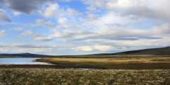
What you’ll find is some of Alaska’s most captivating landscapes—a wilderness that draws you in quickly and holds your attention. Up here, fewer than 150 miles from the Arctic Circle, there aren’t many trees, so you can see forever. The rivers are sparkling clear, not gray with glacial silt. It’s a perfect place to fish, view wildlife, mountain bike, camp, or enjoy historical artifacts.
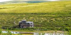
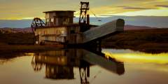
The sense of history on Nome’s roads is inescapable—and awesome. Thousands of years ago, of course, this was the Bering land bridge that served as the conduit from one continent to another. More recently was the last great Gold Rush in the American West, and you’ll see evidence all around: wooden railroad trestles, collapsing dredges, railroad cars, and other iron-cast mining relics.
The wilderness is some of Alaska’s most beautiful, with some 200 species of Arctic wildflowers, including hillsides endlessly carpeted with rare flowers like Kamchatka Rhododendron, Lapland Rosebay, and Siberian Iris. Get out, put your nose right down into the tundra and you’ll smell the rich, organic scent. Come in mid-August, and you can fill your car with berries—the berry-picking is some of Alaska’s best.
Wildlife, too, is a big part of any drive around Nome. The birding is world-famous: there are more than 180 species here, including Asiatic birds rarely seen in North America. And birds are everywhere—you don’t even have to get out of your car. But they’re not the only species in love with this area: also be on the lookout for bear, moose, reindeer, and musk oxen.
Tips
- There are limited car rental options in Nome, so you should make arrangements in advance.
- Guided tours are available – and recommended – to learn about natural and historical points of interest along the way.
- Don’t have time for all three roads? Each one has its own unique attractions. View our detailed pages on each road to help you decide.
Show Map
Scenic Drives
The Nome – Teller Road brings you within 55 miles of Russia, and is as close as you can drive to the Bering Strait Land Bridge. The road travels 73 miles northwest and takes about 2 hours one-way without stops. You end at Teller, an authentic Inupiat village of fewer than 300 people who survive on a subsistence lifestyle.
When locals want to see trees, they head north on The Nome — Taylor Road (also called Beam Rd. or Kougarok Rd.) The 85-mile gravel road runs north-south and takes 2 hours one-way without stops. The route winds past many old mining claims, the popular Salmon Lake, and offers a side trip to historic Pilgrim Hot Springs.
Nome — Council Road spans 72 miles (East) and takes 2 hours one-way without stops. For spectacular birding, sweeping coastal views, and the famous “Last Train to Nowhere,” explore the Nome — Council Road. Additional highlights include the Safety Roadhouse, which is the last stop on the Iditarod Sled Dog Race, and the small community of Council, which boasted a population of 15,000 in its heydey.


